TopoQuest Logo
Do you find TopoQuest useful?
Help keep TopoQuest running and adding new maps/features by donating!
Bitcoin:  19c7KJd3qBynnjoSw5npx9KScwjBe4ifkT
Litecoin:  LXs6TkuXGGXo1vDsWCkWVdjQX94eUKd6ui
Home View Maps Find Maps Find Places Resources & Links


Craig, Montana Topographic Map

USGS Map Title: Craig, MT
USGS Map MRC: 47111A8
DRG (GeoTIFF) Download: o47111a8.tif


Neighboring USGS Topographic Map Quads:


  Coburn Mountain, MT  
47112B1
 

  Mid Canon, MT  
47111B8
 

  Hardy, MT  
47111B7
 

  Wolf Creek, MT  
47112A1
 

  Craig, MT  
47111A8
 

  The Sawteeth, MT  
47111A7
 

  Sheep Creek, MT  
46112H1
 

  Beartooth Mountain, MT  
46111H8
 

  Candle Mountain, MT  
46111H7


Map MRC Location:

N48°
W112°
N48°
W111°
H8 H7 H6 H5 H4 H3 H2 H1
G8 G7 G6 G5 G4 G3 G2 G1
F8 F7 F6 F5 F4 F3 F2 F1
E8 E7 E6 E5 E4 E3 E2 E1
D8 D7 D6 D5 D4 D3 D2 D1
C8 C7 C6 C5 C4 C3 C2 C1
B8 B7 B6 B5 B4 B3 B2 B1
A8 A7 A6 A5 A4 A3 A2 A1
N47°
W112°
N47°
W111°

Craig, MT USGS 1:24K Topographic Map Preview:
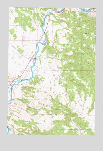
Craig, MT USGS Topographic Map
Click on map above to begin viewing in our Map Viewer.

This topographic map contains these locations and features:
Feature Name Type Latitude Longitude GNIS ID View Map
Billings SloughStreamN47.0533°W111.9808°800455View Map
Bray GulchValleyN47.0352°W111.9928°800494View Map
Brewer HillSummitN47.0749°W111.9719°800495View Map
CraigLocaleN47.0744°W111.9633°1789207View Map
CraigPopulated PlaceN47.0744°W111.9633°800644View Map
Craig BridgeBridgeN47.0744°W111.9614°1789447View Map
Craig CemeteryCemeteryN47.0777°W111.9689°1789422View Map
Craig Census Designated PlaceCensusN47.0741°W111.9651°2583802View Map
Craig Elementary SchoolSchoolN47.0736°W111.9667°1789396View Map
Craig Fishing Access SiteLocaleN47.0688°W111.9600°1744371View Map
Craig Post Office (historical)Post OfficeN47.0744°W111.9633°1789208View Map
Dearborn (historical)LocaleN47.1244°W111.8953°1762394View Map
Dog CreekStreamN47.0644°W111.9675°800705View Map
Eagle RockSummitN47.1238°W111.8778°770971View Map
Interchange 234CrossingN47.0752°W111.9667°1789666View Map
Missouri River Ranch AirportAirportN47.0623°W111.9715°2770366View Map
North Fork Stickney CreekStreamN47.0886°W111.9250°801242View Map
South Fork Stickney CreekStreamN47.0883°W111.9253°801497View Map
Spite Hill Fishing Access SiteLocaleN47.1211°W111.9372°1744356View Map
Stickney CreekStreamN47.1102°W111.9486°801542View Map
Stickney Creek Fishing Access SiteLocaleN47.1083°W111.9469°1744359View Map
Tunnel Number 3TunnelN47.1088°W111.9508°801625View Map
Wegner CreekStreamN47.0780°W111.9608°801662View Map
Wegner Creek BridgeBridgeN47.0763°W111.9550°1789445View Map
Wolf Creek - Craig Fire Service Area Station 2BuildingN47.0734°W111.9664°2546675View Map

Note: Coordinates in the location and feature list above are referenced to NAD83 datum.


Copyright (C) 2008-2024 Ryan Niemi / Sunset Dynamics ... All Rights Reserved