TopoQuest Logo
Do you find TopoQuest useful?
Help keep TopoQuest running and adding new maps/features by donating!
Bitcoin:  19c7KJd3qBynnjoSw5npx9KScwjBe4ifkT
Litecoin:  LXs6TkuXGGXo1vDsWCkWVdjQX94eUKd6ui
Home View Maps Find Maps Find Places Resources & Links


Craigmont, Idaho Topographic Map

USGS Map Title: Craigmont, ID
USGS Map MRC: 46116B4
DRG (GeoTIFF) Download: o46116b4.tif


Neighboring USGS Topographic Map Quads:


  Reubens, ID  
46116C5
 

  Fletcher, ID  
46116C4
 

  Mohler, ID  
46116C3
 

  Winchester East, ID  
46116B5
 

  Craigmont, ID  
46116B4
 

  Cottonwood NE, ID  
46116B3
 

  Westlake, ID  
46116A5
 

  Keuterville, ID  
46116A4
 

  Cottonwood, ID  
46116A3


Map MRC Location:

N47°
W117°
N47°
W116°
H8 H7 H6 H5 H4 H3 H2 H1
G8 G7 G6 G5 G4 G3 G2 G1
F8 F7 F6 F5 F4 F3 F2 F1
E8 E7 E6 E5 E4 E3 E2 E1
D8 D7 D6 D5 D4 D3 D2 D1
C8 C7 C6 C5 C4 C3 C2 C1
B8 B7 B6 B5 B4 B3 B2 B1
A8 A7 A6 A5 A4 A3 A2 A1
N46°
W117°
N46°
W116°

Craigmont, ID USGS 1:24K Topographic Map Preview:
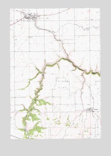
Craigmont, ID USGS Topographic Map
Click on map above to begin viewing in our Map Viewer.

This topographic map contains these locations and features:
Feature Name Type Latitude Longitude GNIS ID View Map
City of CraigmontCivilN46.2422°W116.4728°2410256View Map
City of FerdinandCivilN46.1519°W116.3900°2410495View Map
CraigmontPopulated PlaceN46.2413°W116.4671°399839View Map
Craigmont Municipal AirportAirportN46.2478°W116.4809°400803View Map
Craigmont Post OfficePost OfficeN46.2409°W116.4759°2766809View Map
Craigmont Volunteer Fire DepartmentBuildingN46.2414°W116.4772°2618942View Map
Dublin SidingLocaleN46.2321°W116.4035°399468View Map
FerdinandPopulated PlaceN46.1524°W116.3893°396483View Map
Ferdinand Post OfficePost OfficeN46.1523°W116.3895°2766814View Map
Ferdinand Rural City Fire DepartmentBuildingN46.1526°W116.3886°2619306View Map
Highland Junior-Senior High SchoolSchoolN46.2441°W116.4718°401371View Map
Highland SchoolSchoolN46.2441°W116.4719°401372View Map
Icicle FlatFlatN46.1768°W116.4290°373197View Map
Ilo (historical)Populated PlaceN46.2382°W116.4976°399585View Map
Lewis CountyCivilN46.2370°W116.4263°395622View Map
Saint Maurus CemeteryCemeteryN46.1579°W116.3901°374868View Map
Saint Maurus SchoolSchoolN46.1532°W116.3915°374869View Map
VollmerPopulated PlaceN46.2427°W116.4663°399737View Map
Willow CreekStreamN46.1279°W116.4749°375925View Map

Note: Coordinates in the location and feature list above are referenced to NAD83 datum.


Copyright (C) 2008-2024 Ryan Niemi / Sunset Dynamics ... All Rights Reserved