TopoQuest Logo
Do you find TopoQuest useful?
Help keep TopoQuest running and adding new maps/features by donating!
Bitcoin:  19c7KJd3qBynnjoSw5npx9KScwjBe4ifkT
Litecoin:  LXs6TkuXGGXo1vDsWCkWVdjQX94eUKd6ui
Home View Maps Find Maps Find Places Resources & Links


Craigsville, Virginia Topographic Map

USGS Map Title: Craigsville, VA
USGS Map MRC: 38079A4
DRG (GeoTIFF) Download: o38079a4.tif


Neighboring USGS Topographic Map Quads:


  Williamsville, VA  
38079B5
 

  Deerfield, VA  
38079B4
 

  Elliott Knob, VA  
38079B3
 

  Green Valley, VA  
38079A5
 

  Craigsville, VA  
38079A4
 

  Augusta Springs, VA  
38079A3
 

  Millboro, VA  
37079H5
 

  Goshen, VA  
37079H4
 

  Brownsburg, VA  
37079H3


Map MRC Location:

N39°
W80°
N39°
W79°
H8 H7 H6 H5 H4 H3 H2 H1
G8 G7 G6 G5 G4 G3 G2 G1
F8 F7 F6 F5 F4 F3 F2 F1
E8 E7 E6 E5 E4 E3 E2 E1
D8 D7 D6 D5 D4 D3 D2 D1
C8 C7 C6 C5 C4 C3 C2 C1
B8 B7 B6 B5 B4 B3 B2 B1
A8 A7 A6 A5 A4 A3 A2 A1
N38°
W80°
N38°
W79°

Craigsville, VA USGS 1:24K Topographic Map Preview:
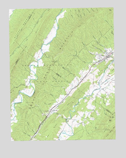
Craigsville, VA USGS Topographic Map
Click on map above to begin viewing in our Map Viewer.

This topographic map contains these locations and features:
Feature Name Type Latitude Longitude GNIS ID View Map
Allen CreekStreamN38.0126°W79.4278°1481282View Map
Archer KnobSummitN38.1226°W79.3764°1481336View Map
Beason HollowValleyN38.0070°W79.4699°1481558View Map
Bells ValleyPopulated PlaceN38.0276°W79.4487°1492546View Map
Black Oak HillSummitN38.0424°W79.4206°1492582View Map
Byrd GapGapN38.0204°W79.3795°1482201View Map
Byrd KnobSummitN38.0179°W79.3828°1492689View Map
Byrd Spring CreekStreamN38.0479°W79.3928°1482203View Map
Casta Line Trout FarmsLocaleN38.0367°W79.3803°2676184View Map
Cove RunStreamN38.0204°W79.4320°1482746View Map
CraigsvillePopulated PlaceN38.0787°W79.3831°1492819View Map
Craigsville - Augusta Springs First Aid Crew Rescue 16BuildingN38.0778°W79.3839°2075592View Map
Craigsville Elementary SchoolSchoolN38.0822°W79.3807°1739596View Map
Craigsville Memorial CemeteryCemeteryN38.0787°W79.3859°1739597View Map
Craigsville Post OfficePost OfficeN38.0777°W79.3851°1739598View Map
Craigsville Volunteer Fire Department Company 8BuildingN38.0823°W79.3799°2075606View Map
Davidson CreekStreamN38.0385°W79.4356°1482929View Map
Elephant CreekStreamN38.0337°W79.4417°1483258View Map
Estaline ValleyValleyN38.0495°W79.3916°1483317View Map
Farrow HollowValleyN38.0252°W79.4537°1483382View Map
Glover RunStreamN38.0257°W79.4075°1483678View Map
Grassy RunStreamN38.0751°W79.3750°1483758View Map
Halfmoon GapGapN38.0090°W79.3792°1483893View Map
Holmes School (historical)SchoolN38.0201°W79.4095°1805988View Map
Ingram DraftValleyN38.0529°W79.4805°1484342View Map
Kirtz HollowValleyN38.0345°W79.4483°1484618View Map
Lebanon ChurchChurchN38.0429°W79.4312°1484753View Map
Little River ChurchChurchN38.0537°W79.3923°1484968View Map
North Mountain TrailTrailN38.0571°W79.4567°1485911View Map
Ramsey DraftValleyN38.0588°W79.4209°1486499View Map
Ramsey GapGapN38.0748°W79.4473°1486502View Map
Sideling HillSummitN38.0723°W79.4934°1493593View Map
Smith CreekStreamN38.0493°W79.3920°1487342View Map
Snead HollowValleyN38.0032°W79.4748°1487369View Map
Staples HollowValleyN38.0861°W79.3856°1487521View Map
Stuples HollowValleyN38.0746°W79.3879°1487675View Map
Sulphur Spring HollowValleyN38.0837°W79.3899°1487720View Map
Taylor HollowValleyN38.0873°W79.3804°1487796View Map
Toma RunStreamN38.0190°W79.4220°1487943View Map
Town of CraigsvilleCivilN38.0841°W79.3843°2390815View Map
Walker Mountain TrailTrailN38.1087°W79.4820°1488162View Map
Wallace DraftValleyN38.0737°W79.3935°1488166View Map
Wilson BridgeBridgeN38.0190°W79.4323°1488409View Map

Note: Coordinates in the location and feature list above are referenced to NAD83 datum.


Copyright (C) 2008-2024 Ryan Niemi / Sunset Dynamics ... All Rights Reserved