TopoQuest Logo
Do you find TopoQuest useful?
Help keep TopoQuest running and adding new maps/features by donating!
Bitcoin:  19c7KJd3qBynnjoSw5npx9KScwjBe4ifkT
Litecoin:  LXs6TkuXGGXo1vDsWCkWVdjQX94eUKd6ui
Home View Maps Find Maps Find Places Resources & Links


Crazy Peak, Montana Topographic Map

USGS Map Title: Crazy Peak, MT
USGS Map MRC: 46110A3
DRG (GeoTIFF) Download: o46110a3.tif


Neighboring USGS Topographic Map Quads:


  Virginia Peak, MT  
46110B4
 

  Loco Mountain, MT  
46110B3
 

  Rein Lake, MT  
46110B2
 

  Campfire Lake, MT  
46110A4
 

  Crazy Peak, MT  
46110A3
 

  Amelong Creek, MT  
46110A2
 

  Ibex Mountain, MT  
45110H4
 

  Fairview Peak, MT  
45110H3
 

  Raspberry Butte, MT  
45110H2


Map MRC Location:

N47°
W111°
N47°
W110°
H8 H7 H6 H5 H4 H3 H2 H1
G8 G7 G6 G5 G4 G3 G2 G1
F8 F7 F6 F5 F4 F3 F2 F1
E8 E7 E6 E5 E4 E3 E2 E1
D8 D7 D6 D5 D4 D3 D2 D1
C8 C7 C6 C5 C4 C3 C2 C1
B8 B7 B6 B5 B4 B3 B2 B1
A8 A7 A6 A5 A4 A3 A2 A1
N46°
W111°
N46°
W110°

Crazy Peak, MT USGS 1:24K Topographic Map Preview:
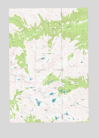
Crazy Peak, MT USGS Topographic Map
Click on map above to begin viewing in our Map Viewer.

This topographic map contains these locations and features:
Feature Name Type Latitude Longitude GNIS ID View Map
Big Timber PeakSummitN46.0244°W110.2616°779891View Map
Blue LakeLakeN46.0331°W110.2893°780152View Map
Cascade LakeLakeN46.0654°W110.2618°781001View Map
Cave LakeLakeN46.0700°W110.3226°781074View Map
Comanche CreekStreamN46.1016°W110.3121°781532View Map
Conical PeakSummitN46.0555°W110.3316°781571View Map
Cottonwood LakeLakeN46.0382°W110.3413°781738View Map
Coyote CreekStreamN46.1024°W110.2952°781811View Map
Crazy LakeLakeN46.0090°W110.2854°781864View Map
Crazy PeakSummitN46.0180°W110.2766°781868View Map
Dead Horse CreekStreamN46.0874°W110.3708°782136View Map
Diamond LakeLakeN46.0603°W110.3675°782358View Map
Druckmiller LakeLakeN46.0312°W110.3095°782541View Map
Eagle CreekStreamN46.0399°W110.2555°782751View Map
Eagle ParkParkN46.1097°W110.2632°782763View Map
Glacier LakeLakeN46.0474°W110.3423°783967View Map
Granite LakeLakeN46.0344°W110.2935°784170View Map
Granite Mountain MineMineN46.0374°W110.2930°804969View Map
Granite Mountain ShaftMineN46.0408°W110.2994°804970View Map
Granite PeakSummitN46.0374°W110.3044°784178View Map
Grasshopper GlacierGlacierN46.0349°W110.3324°784209View Map
Hidden LakeLakeN46.0207°W110.2696°784831View Map
Iddings PeakSummitN46.0136°W110.3169°785218View Map
Lone LakeLakeN46.0469°W110.3616°786479View Map
Lost LakeLakeN46.0041°W110.2826°786611View Map
Middle Fork Sweet Grass CreekStreamN46.0897°W110.3552°787309View Map
Milly CreekStreamN46.1033°W110.2844°787443View Map
North Fork Sweet Grass CreekStreamN46.0977°W110.3346°788258View Map
Oasis LakesLakeN46.0511°W110.3107°788376View Map
Pear LakeLakeN46.0241°W110.3057°788729View Map
Rock LakeReservoirN46.0198°W110.3308°789708View Map
Smeller LakeLakeN46.0045°W110.3023°790706View Map
South Fork Sweet Grass CreekStreamN46.0980°W110.3346°791065View Map
Stemwinder MineMineN46.0433°W110.2952°804972View Map
Thunder LakeLakeN46.0337°W110.2862°792144View Map
Thunder RapidsRapidsN46.0349°W110.2830°792149View Map
Twin LakesLakeN46.0452°W110.3085°792516View Map
Upper Stemwinder MineMineN46.0416°W110.3008°804971View Map
Wilsall PeakSummitN46.0269°W110.3461°2612063View Map

Note: Coordinates in the location and feature list above are referenced to NAD83 datum.


Copyright (C) 2008-2025 Ryan Niemi / Sunset Dynamics ... All Rights Reserved