TopoQuest Logo
Do you find TopoQuest useful?
Help keep TopoQuest running and adding new maps/features by donating!
Bitcoin:  19c7KJd3qBynnjoSw5npx9KScwjBe4ifkT
Litecoin:  LXs6TkuXGGXo1vDsWCkWVdjQX94eUKd6ui
Home View Maps Find Maps Find Places Resources & Links


Creighton, South Dakota Topographic Map

USGS Map Title: Creighton, SD
USGS Map MRC: 44102C2
DRG (GeoTIFF) Download: o44102c2.tif


Neighboring USGS Topographic Map Quads:


  Dalzell NE, SD  
44102D3
 

  Pedro NW, SD  
44102D2
 

  Pedro, SD  
44102D1
 

  Dalzell SE, SD  
44102C3
 

  Creighton, SD  
44102C2
 

  Pedro SE, SD  
44102C1
 

  Wasta NE, SD  
44102B3
 

  Rainy Creek, SD  
44102B2
 

  Horse Tooth, SD  
44102B1


Map MRC Location:

N45°
W103°
N45°
W102°
H8 H7 H6 H5 H4 H3 H2 H1
G8 G7 G6 G5 G4 G3 G2 G1
F8 F7 F6 F5 F4 F3 F2 F1
E8 E7 E6 E5 E4 E3 E2 E1
D8 D7 D6 D5 D4 D3 D2 D1
C8 C7 C6 C5 C4 C3 C2 C1
B8 B7 B6 B5 B4 B3 B2 B1
A8 A7 A6 A5 A4 A3 A2 A1
N44°
W103°
N44°
W102°

Creighton, SD USGS 1:24K Topographic Map Preview:
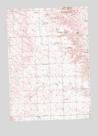
Creighton, SD USGS Topographic Map
Click on map above to begin viewing in our Map Viewer.

This topographic map contains these locations and features:
Feature Name Type Latitude Longitude GNIS ID View Map
CreightonPopulated PlaceN44.2550°W102.2079°1260993View Map
Creighton (historical)LocaleN44.2550°W102.1665°1264127View Map
Creighton CemeteryCemeteryN44.2552°W102.1975°1254540View Map
Crouch RanchLocaleN44.2842°W102.1377°1254555View Map
Dale RanchLocaleN44.3594°W102.1315°1254592View Map
Emmanuel ChurchChurchN44.2817°W102.1682°1254939View Map
Emmanuel Lutheran CemeteryCemeteryN44.2834°W102.1683°1265089View Map
Erwin Eisenbraun DamDamN44.2917°W102.1904°1259901View Map
Fourmile DrawValleyN44.3216°W102.1288°1255131View Map
Hammann LakeReservoirN44.3569°W102.1939°1255407View Map
Hammann SchoolSchoolN44.3697°W102.2021°1255408View Map
Johnson RanchLocaleN44.3669°W102.1927°1255864View Map
Lewis DamDamN44.2617°W102.1788°1259891View Map
North Creighton SchoolSchoolN44.3122°W102.1896°1256741View Map
Peno Grazing Association DamDamN44.3150°W102.1371°1259914View Map
Schroeder RanchLocaleN44.3355°W102.1765°1257990View Map
Selvin Johnson DamDamN44.3567°W102.1904°1259861View Map
South Creighton SchoolSchoolN44.2725°W102.1677°1258178View Map
Three Tree DrawValleyN44.3363°W102.1332°1258540View Map
Township of Rainy CreekCivilN44.2903°W102.1779°1268750View Map
Township of Rainy Creek/CheyenneCivilN44.3541°W102.1979°1729758View Map
Veryl Schroeder 1 DamDamN44.3367°W102.1821°1259900View Map
Veryl Schroeder 2 DamDamN44.3333°W102.1854°1259899View Map

Note: Coordinates in the location and feature list above are referenced to NAD83 datum.


Copyright (C) 2008-2025 Ryan Niemi / Sunset Dynamics ... All Rights Reserved