TopoQuest Logo
Do you find TopoQuest useful?
Help keep TopoQuest running and adding new maps/features by donating!
Bitcoin:  19c7KJd3qBynnjoSw5npx9KScwjBe4ifkT
Litecoin:  LXs6TkuXGGXo1vDsWCkWVdjQX94eUKd6ui
Home View Maps Find Maps Find Places Resources & Links


Cresco SW, Iowa Topographic Map

USGS Map Title: Cresco SW, IA
USGS Map MRC: 43092C2
DRG (GeoTIFF) Download: o43092c2.tif


Neighboring USGS Topographic Map Quads:


  Lime Springs, IA  
43092D3
 

  Cresco NW, IA  
43092D2
 

  Cresco NE, IA  
43092D1
 

  Lourdes, IA  
43092C3
 

  Cresco SW, IA  
43092C2
 

  Cresco SE, IA  
43092C1
 

  Jerico, IA  
43092B3
 

  Saude, IA  
43092B2
 

  Protivin, IA  
43092B1


Map MRC Location:

N44°
W93°
N44°
W92°
H8 H7 H6 H5 H4 H3 H2 H1
G8 G7 G6 G5 G4 G3 G2 G1
F8 F7 F6 F5 F4 F3 F2 F1
E8 E7 E6 E5 E4 E3 E2 E1
D8 D7 D6 D5 D4 D3 D2 D1
C8 C7 C6 C5 C4 C3 C2 C1
B8 B7 B6 B5 B4 B3 B2 B1
A8 A7 A6 A5 A4 A3 A2 A1
N43°
W93°
N43°
W92°

Cresco SW, IA USGS 1:24K Topographic Map Preview:
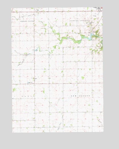
Cresco SW, IA USGS Topographic Map
Click on map above to begin viewing in our Map Viewer.

This topographic map contains these locations and features:
Feature Name Type Latitude Longitude GNIS ID View Map
Country ClubLocaleN43.3472°W92.1432°1948681View Map
Ellen Church FieldAirportN43.3679°W92.1329°466758View Map
Holy Cross CemeteryCemeteryN43.3048°W92.2196°457576View Map
Holy Cross ChurchChurchN43.3041°W92.2199°457578View Map
Howard Center Post Office (historical)Post OfficeN43.3714°W92.2199°466431View Map
Murray Wildlife AreaParkN43.3444°W92.1391°1948692View Map
North Branch Turkey RiverStreamN43.3414°W92.1818°459563View Map
Pond Valley Post Office (historical)Post OfficeN43.2569°W92.2079°1948721View Map
SchleyPopulated PlaceN43.3033°W92.2191°461465View Map
Schley Post Office (historical)Post OfficeN43.3033°W92.2182°1948720View Map
South Branch Turkey RiverStreamN43.3283°W92.2266°461768View Map
Thomson Marsh Wildlife Management AreaParkN43.3041°W92.1529°1948682View Map
Township of New OregonCivilN43.2741°W92.1399°468435View Map
Turkey Bend Wildlife AreaParkN43.3458°W92.1468°1948693View Map
Turkey River Wildlife AreaParkN43.3666°W92.2127°1948690View Map
Vernon SpringsPopulated PlaceN43.3500°W92.1382°464784View Map
Vernon Springs County ParkParkN43.3458°W92.1363°1825164View Map
Vernon Springs Post Office (historical)Post OfficeN43.3500°W92.1382°1948718View Map
West Branch Turkey RiverStreamN43.3675°W92.2135°462824View Map

Note: Coordinates in the location and feature list above are referenced to NAD83 datum.


Copyright (C) 2008-2024 Ryan Niemi / Sunset Dynamics ... All Rights Reserved