TopoQuest Logo
Do you find TopoQuest useful?
Help keep TopoQuest running and adding new maps/features by donating!
Bitcoin:  19c7KJd3qBynnjoSw5npx9KScwjBe4ifkT
Litecoin:  LXs6TkuXGGXo1vDsWCkWVdjQX94eUKd6ui
Home View Maps Find Maps Find Places Resources & Links


Creston, Ohio Topographic Map

USGS Map Title: Creston, OH
USGS Map MRC: 40081H8
DRG (GeoTIFF) Download: o40081h8.tif


Neighboring USGS Topographic Map Quads:


  Lodi, OH  
41082A1
 

  Westfield Center, OH  
41081A8
 

  Seville, OH  
41081A7
 

  West Salem, OH  
40082H1
 

  Creston, OH  
40081H8
 

  Rittman, OH  
40081H7
 

  New Pittsburg, OH  
40082G1
 

  Wooster, OH  
40081G8
 

  Orrville, OH  
40081G7


Map MRC Location:

N41°
W82°
N41°
W81°
H8 H7 H6 H5 H4 H3 H2 H1
G8 G7 G6 G5 G4 G3 G2 G1
F8 F7 F6 F5 F4 F3 F2 F1
E8 E7 E6 E5 E4 E3 E2 E1
D8 D7 D6 D5 D4 D3 D2 D1
C8 C7 C6 C5 C4 C3 C2 C1
B8 B7 B6 B5 B4 B3 B2 B1
A8 A7 A6 A5 A4 A3 A2 A1
N40°
W82°
N40°
W81°

Creston, OH USGS 1:24K Topographic Map Preview:
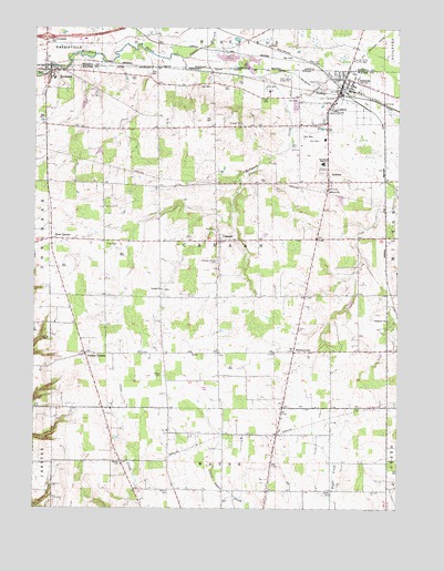
Creston, OH USGS Topographic Map
Click on map above to begin viewing in our Map Viewer.

This topographic map contains these locations and features:
Feature Name Type Latitude Longitude GNIS ID View Map
Barton CemeteryCemeteryN40.8798°W81.9524°1037662View Map
Beech Grove CemeteryCemeteryN40.9239°W81.8782°1730941View Map
Blue Ridge FarmsLocaleN40.8858°W81.9789°2705620View Map
BurbankPopulated PlaceN40.9887°W81.9949°1056738View Map
Burbank Elementary SchoolSchoolN40.9867°W81.9935°1054833View Map
Camel CreekStreamN40.9920°W81.9496°1038653View Map
CanaanPopulated PlaceN40.9448°W81.9365°1060922View Map
Canaan Bend CemeteryCemeteryN40.9750°W81.9285°1038784View Map
Canaan CemeteryCemeteryN40.9319°W81.9560°1730942View Map
Canaan Center CemeteryCemeteryN40.9395°W81.9371°1038786View Map
Canaan Lutheran ChurchChurchN40.9320°W81.9560°1038787View Map
Canaan Township Fire Department Station 1 HeadquartersBuildingN40.9773°W81.8992°2549383View Map
Canaan Township Fire Department Station 2BuildingN40.9878°W81.9943°2549384View Map
Cantendo AcresLocaleN40.9197°W81.9328°2628460View Map
Chippewa Church of the BrethrenChurchN40.9239°W81.8788°1039075View Map
Chippewa Watershed Conservation District Structure ReservoirReservoirN40.9401°W81.8849°1078892View Map
Chippewa Watershed Conservation District Structure ReservoirReservoirN40.9283°W81.8916°1078893View Map
Circle J FarmsLocaleN40.8903°W81.9733°2709585View Map
Colvin Family FarmLocaleN40.9103°W81.8964°2710500View Map
CrestonPopulated PlaceN40.9870°W81.8938°1061007View Map
Creston Middle SchoolSchoolN40.9808°W81.8962°1054831View Map
Creston Post OfficePost OfficeN40.9834°W81.8956°2775386View Map
Cupps CemeteryCemeteryN40.9095°W81.9560°1039540View Map
Ewing CemeteryCemeteryN40.9195°W81.9968°1040290View Map
Gerber FarmLocaleN40.9267°W81.9089°2710498View Map
Geyer CemeteryCemeteryN40.8795°W81.8982°1040845View Map
Gill FarmsLocaleN40.9142°W81.9253°2710496View Map
Golden CornersPopulated PlaceN40.9151°W81.9818°1040934View Map
HermanvillePopulated PlaceN40.9159°W81.9107°1041499View Map
Hoistington FarmsLocaleN40.9306°W81.9378°2710501View Map
Indian Head VillagePopulated PlaceN40.9803°W81.9106°2557753View Map
Interchange 204CrossingN40.9976°W81.9963°1058914View Map
JacksonPopulated PlaceN40.9603°W81.8993°1042020View Map
Jackson CemeteryCemeteryN40.9581°W81.8999°1730945View Map
Jackson Presbyterian ChurchChurchN40.9578°W81.8999°1042029View Map
Killbuck DitchCanalN40.9823°W81.8976°1042258View Map
Maple Mound CemeteryCemeteryN40.9853°W81.9015°1042968View Map
McLaughlin FarmsLocaleN40.9847°W81.9572°2710499View Map
Moonstruck FarmLocaleN40.9194°W81.9111°2706163View Map
Quailcrest FarmLocaleN40.8983°W81.9922°2652230View Map
School Number 11 (historical)SchoolN40.9151°W81.9363°1069524View Map
School Number 2 (historical)SchoolN40.9745°W81.9388°1069531View Map
School Number 3 (historical)SchoolN40.8870°W81.9693°1069530View Map
School Number 5 (historical)SchoolN40.9442°W81.9754°1069529View Map
School Number 8 (historical)SchoolN40.9601°W81.8993°1069532View Map
Shoemaker CemeteryCemeteryN40.9295°W81.9052°1730949View Map
Township of CanaanCivilN40.9457°W81.9370°1087149View Map
Township of Creston Village (historical)CivilN40.9913°W81.8853°2397788View Map
Twin Castle FarmsLocaleN40.8769°W81.9486°2709586View Map
Village of BurbankCivilN40.9864°W81.9948°2397495View Map
Village of CrestonCivilN40.9763°W81.9000°2398646View Map
Wayne Presbyterian CemeteryCemeteryN40.8867°W81.9699°1730950View Map
Wayne Presbyterian ChurchChurchN40.8864°W81.9696°1058106View Map
West CanaanPopulated PlaceN40.9451°W81.9938°1061734View Map

Note: Coordinates in the location and feature list above are referenced to NAD83 datum.


Copyright (C) 2008-2025 Ryan Niemi / Sunset Dynamics ... All Rights Reserved