TopoQuest Logo
Do you find TopoQuest useful?
Help keep TopoQuest running and adding new maps/features by donating!
Bitcoin:  19c7KJd3qBynnjoSw5npx9KScwjBe4ifkT
Litecoin:  LXs6TkuXGGXo1vDsWCkWVdjQX94eUKd6ui
Home View Maps Find Maps Find Places Resources & Links


Creston, Montana Topographic Map

USGS Map Title: Creston, MT
USGS Map MRC: 48114B2
DRG (GeoTIFF) Download: o48114b2.tif


Neighboring USGS Topographic Map Quads:


  Rose Crossing, MT  
48114C3
 

  Columbia Falls South, MT  
48114C2
 

  Doris Mountain, MT  
48114C1
 

  Kalispell, MT  
48114B3
 

  Creston, MT  
48114B2
 

  Hash Mountain, MT  
48114B1
 

  Lion Mountain, MT  
48114A3
 

  Somers, MT  
48114A2
 

  Bigfork, MT  
48114A1


Map MRC Location:

N49°
W115°
N49°
W114°
H8 H7 H6 H5 H4 H3 H2 H1
G8 G7 G6 G5 G4 G3 G2 G1
F8 F7 F6 F5 F4 F3 F2 F1
E8 E7 E6 E5 E4 E3 E2 E1
D8 D7 D6 D5 D4 D3 D2 D1
C8 C7 C6 C5 C4 C3 C2 C1
B8 B7 B6 B5 B4 B3 B2 B1
A8 A7 A6 A5 A4 A3 A2 A1
N48°
W115°
N48°
W114°

Creston, MT USGS 1:24K Topographic Map Preview:
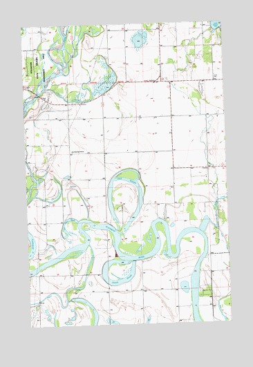
Creston, MT USGS Topographic Map
Click on map above to begin viewing in our Map Viewer.

This topographic map contains these locations and features:
Feature Name Type Latitude Longitude GNIS ID View Map
27N20W03CD__01 WellWellN48.1263°W114.1287°826491View Map
27N20W04AAAA01 WellWellN48.1383°W114.1393°826607View Map
27N20W04DD__01 WellWellN48.1263°W114.1396°826492View Map
27N20W05AA__01 WellWellN48.1372°W114.1612°826591View Map
27N20W05AB__01 WellWellN48.1372°W114.1668°826592View Map
27N20W05BB__01 WellWellN48.1372°W114.1776°826593View Map
27N20W05DA__01 WellWellN48.1300°W114.1612°826521View Map
27N20W05DD__01 WellWellN48.1263°W114.1612°826493View Map
27N20W06AB__01 WellWellN48.1372°W114.1885°826594View Map
27N20W06AC__01 WellWellN48.1336°W114.1885°826559View Map
27N20W06AC__02 WellWellN48.1336°W114.1885°826560View Map
27N20W06BB__01 WellWellN48.1372°W114.1993°826595View Map
27N21W01BA__01 WellWellN48.1383°W114.2157°826608View Map
27N21W01DD__01 WellWellN48.1272°W114.2051°826502View Map
27N21W03DA__01 WellWellN48.1308°W114.2479°826537View Map
28N20W03BB__01 WellWellN48.2238°W114.1340°1634241View Map
28N20W03CD__01 WellWellN48.2130°W114.1287°1634159View Map
28N20W03CD__02 WellWellN48.2130°W114.1287°1634160View Map
28N20W04AB__01 WellWellN48.2238°W114.1448°1634242View Map
28N20W04BB__01 WellWellN48.2238°W114.1557°1634243View Map
28N20W05DC__01 WellWellN48.2130°W114.1662°1634161View Map
28N20W06BA__01 WellWellN48.2238°W114.1932°1634244View Map
28N20W06BC__01 WellWellN48.2202°W114.1985°1634214View Map
28N20W06DD__01 WellWellN48.2130°W114.1823°1634162View Map
28N20W07AA__01 WellWellN48.2094°W114.1823°1634132View Map
28N20W07DC__01 WellWellN48.1986°W114.1879°1634040View Map
28N20W08AD__01 WellWellN48.2058°W114.1610°1634102View Map
28N20W08BB__01 WellWellN48.2094°W114.1771°1634131View Map
28N20W08CD__01 WellWellN48.1986°W114.1718°1634039View Map
28N20W08DA__01 WellWellN48.2022°W114.1610°1634072View Map
28N20W09AA__01 WellWellN48.2094°W114.1396°1634129View Map
28N20W09BB__01 WellWellN48.2094°W114.1557°1634130View Map
28N20W09DBBC01 WellWellN48.2027°W114.1473°1634086View Map
28N20W09DDDA01 WellWellN48.1983°W114.1379°1634032View Map
28N20W10BC__01 WellWellN48.2058°W114.1340°1634101View Map
28N20W15BC__01 WellWellN48.1913°W114.1340°1633989View Map
28N20W15BD__01 WellWellN48.1913°W114.1287°1633988View Map
28N20W15CB__01 WellWellN48.1877°W114.1340°1633962View Map
28N20W15CB__02 WellWellN48.1877°W114.1340°1633963View Map
28N20W15CB__03 WellWellN48.1877°W114.1340°1633964View Map
28N20W15CB__04 WellWellN48.1877°W114.1340°1633965View Map
28N20W15CBD_01 WellWellN48.1861°W114.1329°1633948View Map
28N20W15CBD_02 WellWellN48.1861°W114.1329°1633949View Map
28N20W16AA__01 WellWellN48.1950°W114.1396°1634008View Map
28N20W16AA__02 WellWellN48.1950°W114.1396°1634009View Map
28N20W16AD__01 WellWellN48.1913°W114.1396°1633990View Map
28N20W16CAAA01 WellWellN48.1877°W114.1501°1633966View Map
28N20W16CC__01 WellWellN48.1841°W114.1557°1633927View Map
28N20W16DD__01 WellWellN48.1841°W114.1396°1633926View Map
28N20W18BD__01 WellWellN48.1913°W114.1932°1633991View Map
28N20W18BD__02 WellWellN48.1913°W114.1932°1633992View Map
28N20W18CC__01 WellWellN48.1841°W114.1985°1633928View Map
28N20W20CB__01 WellWellN48.1736°W114.1771°1633838View Map
28N20W20DC__01 WellWellN48.1700°W114.1662°1633806View Map
28N20W22BC__01 WellWellN48.1772°W114.1340°1633861View Map
28N20W30DB__01 WellWellN48.1591°W114.1879°826844View Map
28N20W31AD__01 WellWellN48.1483°W114.1823°826721View Map
28N20W32DA__01 WellWellN48.1447°W114.1610°826685View Map
28N20W34BB__01 WellWellN48.1519°W114.1340°826762View Map
28N20W34CA__01 WellWellN48.1447°W114.1287°826684View Map
28N20W34CC__01 WellWellN48.1411°W114.1340°826640View Map
28N21W01CA__01 WellWellN48.2169°W114.2151°1634190View Map
28N21W01CB__01 WellWellN48.2169°W114.2207°1634191View Map
28N21W01CB__02 WellWellN48.2169°W114.2207°1634192View Map
28N21W01CB__03 WellWellN48.2169°W114.2207°1634193View Map
28N21W01DD__01 WellWellN48.2133°W114.2046°1634168View Map
28N21W02AD__01 WellWellN48.2205°W114.2260°1634220View Map
28N21W02ADDC01 WellWellN48.2188°W114.2257°1634210View Map
28N21W02BDCC01 WellWellN48.2188°W114.2387°1634211View Map
28N21W02CA__01 WellWellN48.2169°W114.2368°1634194View Map
28N21W02CD__01 WellWellN48.2133°W114.2368°1634170View Map
28N21W02CD__02 WellWellN48.2133°W114.2368°1634171View Map
28N21W02DD__01 WellWellN48.2133°W114.2260°1634169View Map
28N21W11BAAA01 WellWellN48.2108°W114.2348°1634147View Map
28N21W11CB__01 WellWellN48.2025°W114.2421°1634081View Map
28N21W11CB__02 WellWellN48.2025°W114.2421°1634082View Map
28N21W11DB__01 WellWellN48.2025°W114.2312°1634080View Map
28N21W12AB__01 WellWellN48.2097°W114.2098°1634135View Map
28N21W12AC__01 WellWellN48.2061°W114.2098°1634106View Map
28N21W12CB__01 WellWellN48.2025°W114.2207°1634079View Map
28N21W12CCCC01 WellWellN48.1969°W114.2221°1634025View Map
28N21W12DA__01 WellWellN48.2025°W114.2046°1634078View Map
28N21W13AB__01 WellWellN48.1952°W114.2098°1634014View Map
28N21W13AD__01 WellWellN48.1916°W114.2046°1633993View Map
28N21W13BABB01 WellWellN48.1963°W114.2168°1634019View Map
28N21W13CA__01 WellWellN48.1880°W114.2151°1633967View Map
28N21W13CC__01 WellWellN48.1844°W114.2207°1633933View Map
28N21W14DD__01 WellWellN48.1844°W114.2260°1633934View Map
28N21W15AA__01 WellWellN48.1952°W114.2473°1634015View Map
28N21W15DA__01 WellWellN48.1880°W114.2473°1633968View Map
28N21W23CA__01 WellWellN48.1733°W114.2368°1633831View Map
28N21W23DA__01 WellWellN48.1733°W114.2260°1633830View Map
28N21W26BABA01 WellWellN48.1675°W114.2379°1633794View Map
28N21W35BC__01 WellWellN48.1480°W114.2421°826713View Map
28N21W35BCCD01 WellWellN48.1466°W114.2426°826709View Map
28N21W35CB__01 WellWellN48.1444°W114.2421°826675View Map
28N21W35CC__01 WellWellN48.1408°W114.2421°826626View Map
28N21W36DD__01 WellWellN48.1408°W114.2046°826625View Map
29N20W27BB__01 WellWellN48.2491°W114.1351°1634404View Map
29N20W27CBBB01 WellWellN48.2464°W114.1532°1634391View Map
29N20W27DA__01 WellWellN48.2455°W114.1512°1634383View Map
29N20W28BD__01 WellWellN48.2455°W114.1351°1634382View Map
29N20W28CA__01 WellWellN48.2491°W114.1676°1634405View Map
29N20W29AC__01 WellWellN48.2455°W114.1676°1634384View Map
29N20W29AC__02 WellWellN48.2491°W114.1837°1634406View Map
29N20W29ACCD01 WellWellN48.2475°W114.1843°1634398View Map
29N20W29BD__01 WellWellN48.2494°W114.1890°1634410View Map
29N20W29CD__01 WellWellN48.2491°W114.1893°1634407View Map
29N20W30DA__01 WellWellN48.2419°W114.1893°1634366View Map
29N20W31ABCA01 WellWellN48.2383°W114.2051°1634339View Map
29N20W31AD__01 WellWellN48.2455°W114.2001°1634385View Map
29N20W32ADCD01 WellWellN48.2333°W114.1793°1634313View Map
29N20W32BD__01 WellWellN48.2347°W114.2001°1634322View Map
29N20W32BD__02 WellWellN48.2347°W114.1893°1634321View Map
29N20W32DD__01 WellWellN48.2347°W114.1893°1634320View Map
29N20W33CA__01 WellWellN48.2275°W114.1785°1634269View Map
29N20W33CADC01 WellWellN48.2300°W114.1665°1634299View Map
29N20W33CD__01 WellWellN48.2311°W114.1676°1634301View Map
29N20W33DC__01 WellWellN48.2275°W114.1676°1634268View Map
29N20W35CD__01 WellWellN48.2275°W114.1621°1634267View Map
29N21W35BB__01 WellWellN48.2383°W114.2407°1634340View Map
29N21W36DD__01 WellWellN48.2275°W114.2026°1634270View Map
Ashley CreekStreamN48.1588°W114.2126°779170View Map
Ashley Creek BridgeBridgeN48.1352°W114.2448°1795949View Map
Church SloughLakeN48.1426°W114.1950°781267View Map
CrestonPopulated PlaceN48.1894°W114.1373°781889View Map
Creston Fire DepartmentBuildingN48.2168°W114.2153°1796113View Map
Creston Fire DepartmentBuildingN48.1891°W114.1377°1796114View Map
Creston Fire Department Lake Blaine StationBuildingN48.2259°W114.1378°1796138View Map
Creston Post Office (historical)Post OfficeN48.1894°W114.1373°1796048View Map
Creston SchoolSchoolN48.1897°W114.1380°1796284View Map
Egan Post Office (historical)Post OfficeN48.1722°W114.1898°1796038View Map
Egan School (historical)SchoolN48.1855°W114.2229°783001View Map
Egan SloughLakeN48.1654°W114.1895°783002View Map
Fair - Mont - Egan SchoolSchoolN48.1972°W114.2219°793944View Map
Fairview School (historical)SchoolN48.2466°W114.1868°783273View Map
Foster Mobile Home ParkPopulated PlaceN48.2263°W114.1315°1796139View Map
Half Moon SloughGutN48.1691°W114.2257°784467View Map
Hodgeson School (historical)SchoolN48.1391°W114.1798°784911View Map
JessupPopulated PlaceN48.2111°W114.1282°798861View Map
Jessup Post Office (historical)Post OfficeN48.2111°W114.1282°1796011View Map
McWenneger SloughLakeN48.2259°W114.2002°787124View Map
Mill CreekStreamN48.1627°W114.1423°787368View Map
Montford Post Office (historical)Post OfficeN48.2138°W114.2204°1795986View Map
Montford School (historical)SchoolN48.2113°W114.2071°787580View Map
Mountain Crossroads Golf CourseLocaleN48.2333°W114.1593°1795942View Map
Patrick CreekStreamN48.1322°W114.2415°788687View Map
Ramsdell Post (historical)LocaleN48.1722°W114.1898°1796245View Map
Reeds SloughLakeN48.1265°W114.2003°2081037View Map
Sanders AirportAirportN48.1257°W114.2406°806459View Map
Shaws SloughGutN48.2186°W114.2232°790302View Map
Sheldon Post Office (historical)Post OfficeN48.2472°W114.1982°1795965View Map
Weaver AirportAirportN48.2462°W114.2445°806455View Map
Wounded Buck Ranch AirportAirportN48.1270°W114.1698°2650673View Map

Note: Coordinates in the location and feature list above are referenced to NAD83 datum.


Copyright (C) 2008-2024 Ryan Niemi / Sunset Dynamics ... All Rights Reserved