TopoQuest Logo
Do you find TopoQuest useful?
Help keep TopoQuest running and adding new maps/features by donating!
Bitcoin:  19c7KJd3qBynnjoSw5npx9KScwjBe4ifkT
Litecoin:  LXs6TkuXGGXo1vDsWCkWVdjQX94eUKd6ui
Home View Maps Find Maps Find Places Resources & Links


Creston West, Iowa Topographic Map

USGS Map Title: Creston West, IA
USGS Map MRC: 41094A4
DRG (GeoTIFF) Download: o41094a4.tif


Neighboring USGS Topographic Map Quads:


  Nevinville, IA  
41094B5
 

  Orient, IA  
41094B4
 

  Zion, IA  
41094B3
 

  Prescott, IA  
41094A5
 

  Creston West, IA  
41094A4
 

  Creston East, IA  
41094A3
 

  Lenox, IA  
40094H5
 

  Kent, IA  
40094H4
 

  Shannon City, IA  
40094H3


Map MRC Location:

N42°
W95°
N42°
W94°
H8 H7 H6 H5 H4 H3 H2 H1
G8 G7 G6 G5 G4 G3 G2 G1
F8 F7 F6 F5 F4 F3 F2 F1
E8 E7 E6 E5 E4 E3 E2 E1
D8 D7 D6 D5 D4 D3 D2 D1
C8 C7 C6 C5 C4 C3 C2 C1
B8 B7 B6 B5 B4 B3 B2 B1
A8 A7 A6 A5 A4 A3 A2 A1
N41°
W95°
N41°
W94°

Creston West, IA USGS 1:24K Topographic Map Preview:
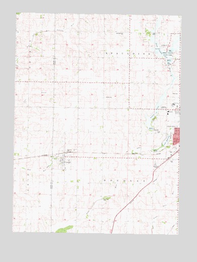
Creston West, IA USGS Topographic Map
Click on map above to begin viewing in our Map Viewer.

This topographic map contains these locations and features:
Feature Name Type Latitude Longitude GNIS ID View Map
Calvary CemeteryCemeteryN41.0583°W94.3911°1822992View Map
City of CromwellCivilN41.0403°W94.4617°2393677View Map
Country Court Mobile Home ParkPopulated PlaceN41.0472°W94.3800°1969471View Map
Cozy Camper CampgroundsLocaleN41.0500°W94.3858°1969470View Map
Crestmoor Country ClubLocaleN41.0722°W94.3863°1822994View Map
Creston Nursing Rehabilitation CenterHospitalN41.0689°W94.3841°1969482View Map
CromwellPopulated PlaceN41.0394°W94.4619°455725View Map
CromwellLocaleN41.0455°W94.4614°1969540View Map
Cromwell Congregational ChurchChurchN41.0403°W94.4622°1969542View Map
Cromwell HeliportAirportN41.0389°W94.4669°466763View Map
Cromwell Post OfficePost OfficeN41.0394°W94.4619°1969541View Map
Frank Phillips Visitors Information CenterBuildingN41.0458°W94.3794°1969472View Map
Graceland CollegeSchoolN41.0744°W94.3808°1969509View Map
Greater Community HospitalHospitalN41.0700°W94.3841°1969478View Map
Greater Community Hospital HeliportAirportN41.0722°W94.3944°466761View Map
Greater Regional Medical CenterHospitalN41.0700°W94.3839°1969479View Map
Green Valley LakeReservoirN41.1030°W94.3884°457111View Map
Green Valley Lake DamDamN41.0967°W94.3836°463527View Map
Green Valley State ParkParkN41.1144°W94.3830°457113View Map
Internal Medicine ConsultantsHospitalN41.0700°W94.3841°1969480View Map
Kingdom Hall of Jehovahs WitnessesChurchN41.0694°W94.3863°1969495View Map
KITR-FM (Creston)TowerN41.0378°W94.3941°463691View Map
KITR-FM (Creston)TowerN41.0947°W94.3752°467309View Map
KSIB-AM (Creston)TowerN41.0378°W94.3941°467253View Map
Lake McKinleyReservoirN41.0508°W94.3872°1822989View Map
Lytles Grove CemeteryCemeteryN41.0197°W94.4321°1822990View Map
Maple Hill CemeteryCemeteryN41.0472°W94.4611°1822991View Map
McKinley ParkParkN41.0586°W94.3825°1822988View Map
Mercer FieldAirportN41.0777°W94.4324°466760View Map
Mitchell MarshParkN41.0903°W94.3808°1969460View Map
Pine Valley Golf CourseLocaleN41.0389°W94.3933°1969510View Map
Platt Post Office (historical)Post OfficeN41.0055°W94.4600°1969522View Map
Southwest Foot and Ankle CenterHospitalN41.0700°W94.3841°1969481View Map
Southwestern Community College - Creston CampusSchoolN41.0733°W94.3809°1822993View Map
SpauldingLocaleN41.1236°W94.4094°463552View Map
Spaulding Center CemeteryCemeteryN41.1145°W94.4187°1822995View Map
Summit LakeReservoirN41.0652°W94.3975°462081View Map
Summit Lake Wildlife Management AreaParkN41.0708°W94.3933°1969459View Map
Township of DouglasCivilN41.0256°W94.4178°467737View Map
Township of SpauldingCivilN41.1151°W94.4145°468731View Map
Union County Historical Village and MuseumLocaleN41.0508°W94.3783°1969468View Map
Wallace Ultralight AirportAirportN41.0555°W94.3947°466762View Map

Note: Coordinates in the location and feature list above are referenced to NAD83 datum.


Copyright (C) 2008-2024 Ryan Niemi / Sunset Dynamics ... All Rights Reserved