TopoQuest Logo
Do you find TopoQuest useful?
Help keep TopoQuest running and adding new maps/features by donating!
Bitcoin:  19c7KJd3qBynnjoSw5npx9KScwjBe4ifkT
Litecoin:  LXs6TkuXGGXo1vDsWCkWVdjQX94eUKd6ui
Home View Maps Find Maps Find Places Resources & Links


Crooked River Point, Idaho Topographic Map

USGS Map Title: Crooked River Point, ID
USGS Map MRC: 44116G6
DRG (GeoTIFF) Download: o44116g6.tif


Neighboring USGS Topographic Map Quads:


  Oxbow, OR  
44116H7
 

  Rocky Comfort Flat, ID  
44116H6
 

  Weasel Gulch, ID  
44116H5
 

  Cuddy Mountain, ID  
44116G7
 

  Crooked River Point, ID  
44116G6
 

  Peck Mountain, ID  
44116G5
 

  Advent Gulch, ID  
44116F7
 

  Rush Peak, ID  
44116F6
 

  Goodrich, ID  
44116F5


Map MRC Location:

N45°
W117°
N45°
W116°
H8 H7 H6 H5 H4 H3 H2 H1
G8 G7 G6 G5 G4 G3 G2 G1
F8 F7 F6 F5 F4 F3 F2 F1
E8 E7 E6 E5 E4 E3 E2 E1
D8 D7 D6 D5 D4 D3 D2 D1
C8 C7 C6 C5 C4 C3 C2 C1
B8 B7 B6 B5 B4 B3 B2 B1
A8 A7 A6 A5 A4 A3 A2 A1
N44°
W117°
N44°
W116°

Crooked River Point, ID USGS 1:24K Topographic Map Preview:
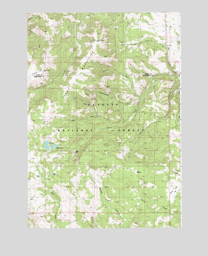
Crooked River Point, ID USGS Topographic Map
Click on map above to begin viewing in our Map Viewer.

This topographic map contains these locations and features:
Feature Name Type Latitude Longitude GNIS ID View Map
Buck ParkLocaleN44.7813°W116.7415°378386View Map
Buck park Guard StationLocaleN44.7735°W116.7413°394463View Map
Crooked River PointSummitN44.8588°W116.6946°380094View Map
Cuddy MineMineN44.8093°W116.7385°380154View Map
Cuddy MountainsRangeN44.8229°W116.7321°380156View Map
Devils SlideCliffN44.7932°W116.7140°380547View Map
Grouse CreekStreamN44.8263°W116.6582°382710View Map
Hornet Creek-Lower DamDamN44.7982°W116.7260°398855View Map
Hornet Creek-Upper DamDamN44.7977°W116.7329°398737View Map
Hornet Ranger StationLocaleN44.8402°W116.6299°383345View Map
Hornet ReservoirReservoirN44.7980°W116.7340°397794View Map
Johnson Creek ParkLocaleN44.7665°W116.6321°383992View Map
Lower Hornet ReservoirReservoirN44.7976°W116.7282°395659View Map
North CreekStreamN44.8143°W116.6935°387631View Map
Olive CreekStreamN44.8357°W116.6288°387948View Map
Olive MeadowsFlatN44.7829°W116.6585°394871View Map
Placer CreekStreamN44.8079°W116.6807°388579View Map
Pyramid PointSummitN44.7818°W116.6265°388949View Map
Rush LakeLakeN44.7816°W116.7304°389733View Map
Summers PointRidgeN44.8371°W116.7454°396008View Map
West Mill CreekStreamN44.8540°W116.6357°393233View Map

Note: Coordinates in the location and feature list above are referenced to NAD83 datum.


Copyright (C) 2008-2025 Ryan Niemi / Sunset Dynamics ... All Rights Reserved