TopoQuest Logo
Do you find TopoQuest useful?
Help keep TopoQuest running and adding new maps/features by donating!
Bitcoin:  19c7KJd3qBynnjoSw5npx9KScwjBe4ifkT
Litecoin:  LXs6TkuXGGXo1vDsWCkWVdjQX94eUKd6ui
Home View Maps Find Maps Find Places Resources & Links


Crooks, South Dakota Topographic Map

USGS Map Title: Crooks, SD
USGS Map MRC: 43096F7
DRG (GeoTIFF) Download: o43096f7.tif


Neighboring USGS Topographic Map Quads:


  Colton, SD  
43096G8
 

  Colton SE, SD  
43096G7
 

  Dell Rapids, SD  
43096G6
 

  Hartford North, SD  
43096F8
 

  Crooks, SD  
43096F7
 

  Renner, SD  
43096F6
 

  Hartford South, SD  
43096E8
 

  Sioux Falls West, SD  
43096E7
 

  Sioux Falls East, SD  
43096E6


Map MRC Location:

N44°
W97°
N44°
W96°
H8 H7 H6 H5 H4 H3 H2 H1
G8 G7 G6 G5 G4 G3 G2 G1
F8 F7 F6 F5 F4 F3 F2 F1
E8 E7 E6 E5 E4 E3 E2 E1
D8 D7 D6 D5 D4 D3 D2 D1
C8 C7 C6 C5 C4 C3 C2 C1
B8 B7 B6 B5 B4 B3 B2 B1
A8 A7 A6 A5 A4 A3 A2 A1
N43°
W97°
N43°
W96°

Crooks, SD USGS 1:24K Topographic Map Preview:
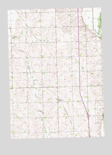
Crooks, SD USGS Topographic Map
Click on map above to begin viewing in our Map Viewer.

This topographic map contains these locations and features:
Feature Name Type Latitude Longitude GNIS ID View Map
Benton ChurchChurchN43.6600°W96.8542°1253852View Map
Benton Lutheran CemeteryCemeteryN43.6603°W96.8544°2779254View Map
City of CrooksCivilN43.6594°W96.8092°1267341View Map
CrooksPopulated PlaceN43.6647°W96.8109°1265631View Map
Crooks Branch LibraryBuildingN43.6672°W96.8105°2723447View Map
Crooks City HallBuildingN43.6540°W96.8123°2724704View Map
Crooks Post OfficePost OfficeN43.6621°W96.8105°2709781View Map
Crooks Volunteer Fire DepartmentBuildingN43.6600°W96.8134°2580943View Map
Interchange 86CrossingN43.6453°W96.7714°2725678View Map
Johnsons AdditionPopulated PlaceN43.6586°W96.8089°1264928View Map
LyonsPopulated PlaceN43.7230°W96.8678°1256287View Map
Lyons CemeteryCemeteryN43.6890°W96.8567°1256288View Map
Lyons Post OfficePost OfficeN43.7229°W96.8688°2710526View Map
Lyons Volunteer Fire DepartmentBuildingN43.7203°W96.8706°2581003View Map
Minnehaha CountyCivilN43.6742°W96.7914°1265772View Map
MorefieldPopulated PlaceN43.6889°W96.7708°2571590View Map
New Hope (historical)LocaleN43.6733°W96.8131°1263267View Map
Renberg Elementary SchoolSchoolN43.6460°W96.7596°2729613View Map
Township of BentonCivilN43.6322°W96.8344°1267932View Map
Township of LyonsCivilN43.7176°W96.8310°1267940View Map
West Nidaros ChurchChurchN43.7028°W96.7912°1258908View Map
West Nidaros Lutheran Church CemeteryCemeteryN43.7027°W96.7926°2779269View Map
West Point (historical)LocaleN43.7061°W96.8267°1263268View Map

Note: Coordinates in the location and feature list above are referenced to NAD83 datum.


Copyright (C) 2008-2024 Ryan Niemi / Sunset Dynamics ... All Rights Reserved