TopoQuest Logo
Do you find TopoQuest useful?
Help keep TopoQuest running and adding new maps/features by donating!
Bitcoin:  19c7KJd3qBynnjoSw5npx9KScwjBe4ifkT
Litecoin:  LXs6TkuXGGXo1vDsWCkWVdjQX94eUKd6ui
Home View Maps Find Maps Find Places Resources & Links


Crosby Springs, New Mexico Topographic Map

USGS Map Title: Crosby Springs, NM
USGS Map MRC: 34107B8
DRG (GeoTIFF) Download: o34107b8.tif


Neighboring USGS Topographic Map Quads:


  Red Flats, NM  
34108C1
 

  Madre Mountain, NM  
34107C8
 

  Cal Ship Mesa, NM  
34107C7
 

  Cox Peak, NM  
34108B1
 

  Crosby Springs, NM  
34107B8
 

  Datil, NM  
34107B7
 

  Log Canyon, NM  
34108A1
 

  Sugarloaf Mountain, NM  
34107A8
 

  Anderson Peak, NM  
34107A7


Map MRC Location:

N35°
W108°
N35°
W107°
H8 H7 H6 H5 H4 H3 H2 H1
G8 G7 G6 G5 G4 G3 G2 G1
F8 F7 F6 F5 F4 F3 F2 F1
E8 E7 E6 E5 E4 E3 E2 E1
D8 D7 D6 D5 D4 D3 D2 D1
C8 C7 C6 C5 C4 C3 C2 C1
B8 B7 B6 B5 B4 B3 B2 B1
A8 A7 A6 A5 A4 A3 A2 A1
N34°
W108°
N34°
W107°

Crosby Springs, NM USGS 1:24K Topographic Map Preview:
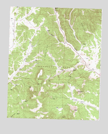
Crosby Springs, NM USGS Topographic Map
Click on map above to begin viewing in our Map Viewer.

This topographic map contains these locations and features:
Feature Name Type Latitude Longitude GNIS ID View Map
Anderson MountainSummitN34.1359°W107.9092°903157View Map
Baldwin CabinLocaleN34.1817°W107.8837°903515View Map
Baldwin Forest Service StationLocaleN34.1820°W107.8831°937077View Map
Baldwincab Water WellWellN34.1828°W107.8801°919781View Map
Buck Water WellWellN34.2206°W107.8851°918853View Map
Buck WindmillLocaleN34.2203°W107.8851°913541View Map
Crosby MountainsRidgeN34.1803°W107.9548°905520View Map
Crosby SpringsSpringN34.1484°W107.9381°905521View Map
Deep TankReservoirN34.2204°W107.9823°913545View Map
Driveway TankReservoirN34.1630°W107.8789°913753View Map
East Sugarloaf MountainSummitN34.1567°W107.9031°905990View Map
Flying V 1A Water WellWellN34.1801°W107.9853°919633View Map
Flying V 1B Water WellWellN34.1801°W107.9853°919634View Map
Flying V 2 Water WellWellN34.2064°W107.9695°919765View Map
Flying V Number 1 WindmillLocaleN34.1801°W107.9853°906319View Map
Flying V Number 2 WindmillLocaleN34.2062°W107.9695°906320View Map
Flying V SpringSpringN34.1625°W107.9900°906321View Map
Government TankReservoirN34.1634°W107.9596°906668View Map
Harveys WellWellN34.1892°W107.9045°906862View Map
Hidden SpringSpringN34.1603°W107.9715°906957View Map
Hidden TankReservoirN34.1276°W107.9304°913755View Map
Hidden TankReservoirN34.1381°W107.9311°906960View Map
Home Water WellWellN34.1814°W107.9117°919716View Map
Homestead Census Designated PlaceCensusN34.1489°W107.8820°2584113View Map
Jonnies WellWellN34.1453°W107.8992°907437View Map
Lower TankReservoirN34.1944°W107.9759°913543View Map
Pine ParkLocaleN34.1814°W107.8862°909673View Map
Pine Park TankReservoirN34.1730°W107.9144°909674View Map
Pine SpringSpringN34.1675°W107.9911°913754View Map
Pipe SpringSpringN34.1569°W107.9964°909735View Map
Rene SpringSpringN34.1672°W107.9454°910124View Map
Road SpringSpringN34.1900°W107.9640°910336View Map
Rock Cliff TankReservoirN34.1271°W107.9246°910361View Map
Sawmill WellWellN34.1473°W107.9078°910854View Map
Slaughter CanyonValleyN34.2101°W107.9184°911129View Map
Slaughter SpringSpringN34.2242°W107.9481°911131View Map
Stewart WellWellN34.1942°W107.8945°911418View Map
Sugarloaf SpringSpringN34.1299°W107.9868°911465View Map
Sweeten WindmillReservoirN34.1426°W107.8895°913756View Map
Swingle CanyonValleyN34.1862°W107.8887°911508View Map
Swingle SpringSpringN34.1805°W107.9119°911509View Map
Thompson CanyonValleyN34.1987°W107.9026°911660View Map
Thompson SpringSpringN34.2101°W107.8994°911668View Map
Turkey Park SpringSpringN34.1442°W107.9770°911882View Map
Turkey SpringSpringN34.2075°W107.9586°913546View Map
Upper TankReservoirN34.2007°W107.9707°913542View Map
Vega WellWellN34.1859°W107.8887°912085View Map
White House SpringSpringN34.2493°W107.9396°912302View Map
White House WellWellN34.2476°W107.9384°912303View Map
Whitehouse Water WellWellN34.2467°W107.9395°919672View Map
Z Slash WellWellN34.2364°W107.9987°912539View Map

Note: Coordinates in the location and feature list above are referenced to NAD83 datum.


Copyright (C) 2008-2024 Ryan Niemi / Sunset Dynamics ... All Rights Reserved