TopoQuest Logo
Do you find TopoQuest useful?
Help keep TopoQuest running and adding new maps/features by donating!
Bitcoin:  19c7KJd3qBynnjoSw5npx9KScwjBe4ifkT
Litecoin:  LXs6TkuXGGXo1vDsWCkWVdjQX94eUKd6ui
Home View Maps Find Maps Find Places Resources & Links


Croton, Iowa Topographic Map

USGS Map Title: Croton, IA
USGS Map MRC: 40091E6
DRG (GeoTIFF) Download: o40091e6.tif


Neighboring USGS Topographic Map Quads:


  Bonaparte, IA  
40091F7
 

  Farmington, IA  
40091F6
 

  Donnellson, IA  
40091F5
 

  Anson, MO  
40091E7
 

  Croton, IA  
40091E6
 

  Argyle, IA  
40091E5
 

  Medill, MO  
40091D7
 

  Kahoka, MO  
40091D6
 

  Wayland, MO  
40091D5


Map MRC Location:

N41°
W92°
N41°
W91°
H8 H7 H6 H5 H4 H3 H2 H1
G8 G7 G6 G5 G4 G3 G2 G1
F8 F7 F6 F5 F4 F3 F2 F1
E8 E7 E6 E5 E4 E3 E2 E1
D8 D7 D6 D5 D4 D3 D2 D1
C8 C7 C6 C5 C4 C3 C2 C1
B8 B7 B6 B5 B4 B3 B2 B1
A8 A7 A6 A5 A4 A3 A2 A1
N40°
W92°
N40°
W91°

Croton, IA USGS 1:24K Topographic Map Preview:
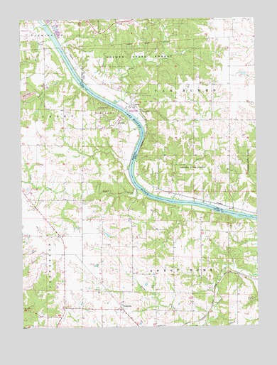
Croton, IA USGS Topographic Map
Click on map above to begin viewing in our Map Viewer.

This topographic map contains these locations and features:
Feature Name Type Latitude Longitude GNIS ID View Map
Amos Glover Historical MarkerParkN40.5911°W91.6813°1981374View Map
AthensPopulated PlaceN40.5825°W91.6985°740640View Map
Athens State ParkParkN40.5878°W91.7066°742719View Map
Brick Church (historical)ChurchN40.5361°W91.7457°731707View Map
Cedar College SchoolSchoolN40.5509°W91.7274°731704View Map
Cedar CreekStreamN40.5559°W91.6885°715589View Map
Cook CemeteryCemeteryN40.6056°W91.6279°1981372View Map
Crooked CreekStreamN40.5842°W91.6885°455726View Map
CrotonPopulated PlaceN40.5903°W91.6907°455735View Map
Croton (historical)LocaleN40.5903°W91.6907°1981103View Map
Croton CemeteryCemeteryN40.5912°W91.6814°1981375View Map
Croton Civil War Memorial ParkParkN40.5884°W91.6927°1981373View Map
Croton Post Office (historical)Post OfficeN40.5903°W91.6907°1981104View Map
DumasPopulated PlaceN40.5212°W91.6354°731706View Map
Grants CreekStreamN40.5517°W91.6702°457073View Map
Grover College School (historical)SchoolN40.5748°W91.7418°731703View Map
Highland School (historical)SchoolN40.5378°W91.7479°731705View Map
Johnson CemeteryCemeteryN40.5611°W91.6502°1981371View Map
Lick CreekStreamN40.5909°W91.6999°458337View Map
Little Rollins CreekStreamN40.6172°W91.7334°458499View Map
Northrup CemeteryCemeteryN40.5000°W91.6790°723515View Map
PeaksvillePopulated PlaceN40.5070°W91.6971°724145View Map
Peaksville CemeteryCemeteryN40.5150°W91.7082°724146View Map
Pioneer CemeteryCemeteryN40.6223°W91.6668°1981370View Map
Prairie Presbyterian ChurchChurchN40.5089°W91.6974°731708View Map
Rollins CreekStreamN40.6017°W91.7216°735823View Map
Salubria CemeteryCemeteryN40.6167°W91.7252°1980993View Map
Shaffer CemeteryCemeteryN40.5309°W91.7454°726255View Map
Shimek State ForestForestN40.6100°W91.6821°461581View Map
Shimek State Forest Wildlife Management Area - Croton UnitParkN40.5617°W91.6257°1981598View Map
Shimek State Forest Wildlife Management Area - Lick Creek UnitParkN40.6014°W91.6863°1981596View Map
Township of Sweet HomeCivilN40.5092°W91.6668°766499View Map
Township of Van BurenCivilN40.5972°W91.6537°468857View Map
Walker CemeteryCemeteryN40.5161°W91.6824°728262View Map

Note: Coordinates in the location and feature list above are referenced to NAD83 datum.


Copyright (C) 2008-2024 Ryan Niemi / Sunset Dynamics ... All Rights Reserved