TopoQuest Logo
Do you find TopoQuest useful?
Help keep TopoQuest running and adding new maps/features by donating!
Bitcoin:  19c7KJd3qBynnjoSw5npx9KScwjBe4ifkT
Litecoin:  LXs6TkuXGGXo1vDsWCkWVdjQX94eUKd6ui
Home View Maps Find Maps Find Places Resources & Links


Crystal Lake, Iowa Topographic Map

USGS Map Title: Crystal Lake, IA
USGS Map MRC: 43093B7
DRG (GeoTIFF) Download: o43093b7.tif


Neighboring USGS Topographic Map Quads:


  Buffalo Center SW, IA  
43093C8
 

  Thompson, IA  
43093C7
 

  Forest City, IA  
43093C6
 

  Woden, IA  
43093B8
 

  Crystal Lake, IA  
43093B7
 

  Hayfield, IA  
43093B6
 

  Wesley, IA  
43093A8
 

  Britt, IA  
43093A7
 

  Duncan, IA  
43093A6


Map MRC Location:

N44°
W94°
N44°
W93°
H8 H7 H6 H5 H4 H3 H2 H1
G8 G7 G6 G5 G4 G3 G2 G1
F8 F7 F6 F5 F4 F3 F2 F1
E8 E7 E6 E5 E4 E3 E2 E1
D8 D7 D6 D5 D4 D3 D2 D1
C8 C7 C6 C5 C4 C3 C2 C1
B8 B7 B6 B5 B4 B3 B2 B1
A8 A7 A6 A5 A4 A3 A2 A1
N43°
W94°
N43°
W93°

Crystal Lake, IA USGS 1:24K Topographic Map Preview:
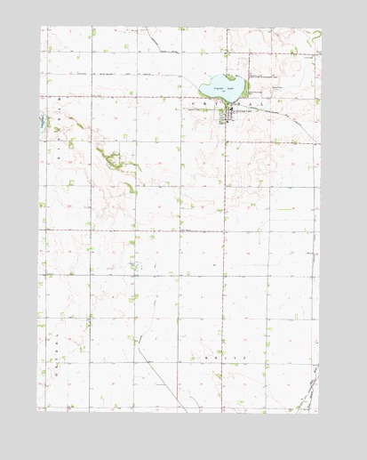
Crystal Lake, IA USGS Topographic Map
Click on map above to begin viewing in our Map Viewer.

This topographic map contains these locations and features:
Feature Name Type Latitude Longitude GNIS ID View Map
Calvary Lutheran ChurchChurchN43.2236°W93.7913°1926026View Map
City of Crystal LakeCivilN43.2230°W93.7927°2393686View Map
Crystal Hills Wildlife Management AreaParkN43.2250°W93.7627°1925998View Map
Crystal LakeLakeN43.2303°W93.7932°455747View Map
Crystal LakePopulated PlaceN43.2233°W93.7924°455748View Map
Crystal Lake ParkParkN43.2255°W93.7924°463935View Map
Crystal Lake Post OfficePost OfficeN43.2233°W93.7924°1926024View Map
Crystal Lake State Game Mgt AreaParkN43.2352°W93.7849°455751View Map
Crystal Lake Volunteer Fire DepartmentBuildingN43.2245°W93.7897°1926025View Map
Crystal Township CemeteryCemeteryN43.2233°W93.8035°1926029View Map
Crystallake (historical)LocaleN43.2250°W93.7894°1926023View Map
Drainage Ditch Number 1CanalN43.1308°W93.8144°465751View Map
Drainage Ditch Number 114CanalN43.1961°W93.7527°465763View Map
Ellsworth College ParkParkN43.2283°W93.7841°456327View Map
Gladfelter Marsh Wildlife Management AreaParkN43.2027°W93.7752°1925997View Map
Lake GeorgeLakeN43.2188°W93.8742°456876View Map
South 80 FieldAirportN43.1908°W93.7708°466764View Map
Township of BrittCivilN43.1263°W93.7929°467489View Map
Township of CrystalCivilN43.2124°W93.7929°467668View Map
United Methodist ChurchChurchN43.2230°W93.7924°1926027View Map
Upper Flat ChurchChurchN43.1841°W93.8119°462493View Map
Woden - Crystal Lake Elementary SchoolSchoolN43.2194°W93.7916°1926009View Map
Woden-Crystal Junior-Senior High SchoolSchoolN43.2194°W93.7919°1926028View Map

Note: Coordinates in the location and feature list above are referenced to NAD83 datum.


Copyright (C) 2008-2024 Ryan Niemi / Sunset Dynamics ... All Rights Reserved