TopoQuest Logo
Do you find TopoQuest useful?
Help keep TopoQuest running and adding new maps/features by donating!
Bitcoin:  19c7KJd3qBynnjoSw5npx9KScwjBe4ifkT
Litecoin:  LXs6TkuXGGXo1vDsWCkWVdjQX94eUKd6ui
Home View Maps Find Maps Find Places Resources & Links


Cundiyo, New Mexico Topographic Map

USGS Map Title: Cundiyo, NM
USGS Map MRC: 35105H8
DRG (GeoTIFF) Download: o35105h8.tif


Neighboring USGS Topographic Map Quads:


  San Juan Pueblo, NM  
36106A1
 

  Chimayo, NM  
36105A8
 

  Truchas, NM  
36105A7
 

  Espanola, NM  
35106H1
 

  Cundiyo, NM  
35105H8
 

  Sierra Mosca, NM  
35105H7
 

  Horcado Ranch, NM  
35106G1
 

  Tesuque, NM  
35105G8
 

  Aspen Basin, NM  
35105G7


Map MRC Location:

N36°
W106°
N36°
W105°
H8 H7 H6 H5 H4 H3 H2 H1
G8 G7 G6 G5 G4 G3 G2 G1
F8 F7 F6 F5 F4 F3 F2 F1
E8 E7 E6 E5 E4 E3 E2 E1
D8 D7 D6 D5 D4 D3 D2 D1
C8 C7 C6 C5 C4 C3 C2 C1
B8 B7 B6 B5 B4 B3 B2 B1
A8 A7 A6 A5 A4 A3 A2 A1
N35°
W106°
N35°
W105°

Cundiyo, NM USGS 1:24K Topographic Map Preview:
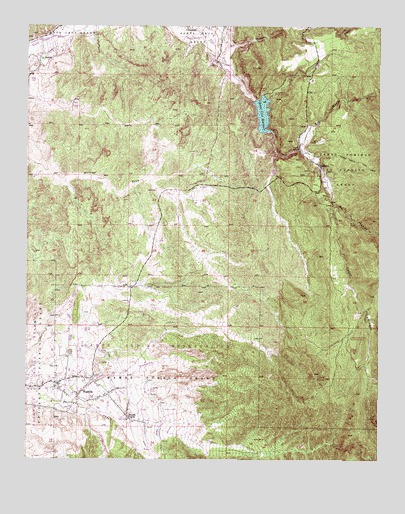
Cundiyo, NM USGS Topographic Map
Click on map above to begin viewing in our Map Viewer.

This topographic map contains these locations and features:
Feature Name Type Latitude Longitude GNIS ID View Map
10170 Water WellWellN35.9145°W105.9400°922851View Map
10183 Water WellWellN35.8911°W105.9720°922783View Map
10184 Water WellWellN35.8989°W105.9886°926664View Map
10186 Water WellWellN35.8942°W105.9839°926671View Map
10194 Water WellWellN35.9967°W105.9853°922861View Map
10257 Water WellWellN35.9672°W105.9045°922857View Map
Arroyo de la Caņada AnchaArroyoN35.9961°W105.9420°918027View Map
Arroyo de la MoradaArroyoN35.9975°W105.9892°918028View Map
Arroyo de los GuardunosArroyoN35.8922°W105.9834°918033View Map
Arryo Seco Water WellWellN35.9500°W105.9320°926662View Map
BLM Recreation SiteLocaleN35.9803°W105.9164°913464View Map
Boy Scouts of America Chimayo Rest CampLocaleN35.9109°W105.8906°927264View Map
Camp Frank Rand Boy Scout CampLocaleN35.9106°W105.8864°916001View Map
Caņada AnchaValleyN35.8778°W105.9581°918102View Map
Caņon ChimayoValleyN35.9484°W105.8920°918116View Map
Capilla de Santo Domingo ChurchChurchN35.9600°W105.8972°916004View Map
Cerro PiņonSummitN35.8986°W105.8984°918146View Map
Chimayo Boy Scout CampLocaleN35.9045°W105.8847°913463View Map
Chimayo Census Designated PlaceCensusN35.9976°W105.9363°2408026View Map
CundiyoMineN35.9356°W105.8850°916859View Map
CundiyoPopulated PlaceN35.9592°W105.8964°928719View Map
Cundiyo CemeteryCemeteryN35.9592°W105.8964°931217View Map
Cundiyo Census Designated PlaceCensusN35.9563°W105.8970°2408633View Map
Cundiyo Post Office (historical)Post OfficeN35.9592°W105.8964°938155View Map
El Buen Pastor ChurchChurchN35.9997°W105.9311°916019View Map
El Santuario Church National Historic LandmarkChurchN35.9895°W105.9314°916022View Map
EscondilloPopulated PlaceN35.9528°W105.8909°901973View Map
EWCH 2 Water WellWellN35.8789°W105.9164°922776View Map
Gilliland ClaimsMineN35.9639°W105.9375°916833View Map
Hubbard ProspectMineN35.9828°W105.9170°917951View Map
John Hyson SchoolSchoolN35.9997°W105.9306°916033View Map
Kel Fed 1 Water WellWellN35.9842°W105.9984°926652View Map
KIOT-FM (Espanola)TowerN35.8986°W105.8984°938645View Map
KIOT-FM (Espanola)TowerN35.9003°W105.8950°938646View Map
La CajaValleyN35.9700°W105.9117°918215View Map
La Capilla de Nacimiento del Niņo Dios ChurchChurchN35.9917°W105.9953°916035View Map
La PueblaPopulated PlaceN35.9892°W105.9964°918224View Map
La Puebla Census Designated PlaceCensusN35.9890°W105.9988°2408513View Map
La Puebla DitchCanalN35.9934°W105.9903°916036View Map
MarionMineN35.9867°W105.9211°916828View Map
NambePopulated PlaceN35.8934°W105.9825°918262View Map
Nambe Census Designated PlaceCensusN35.8984°W105.9667°2584160View Map
Nambe ECW1 Water WellWellN35.9145°W105.9850°922852View Map
Nambe Indian SchoolSchoolN35.8850°W105.9581°909012View Map
Nambe Post Office (historical)Post OfficeN35.8934°W105.9825°938175View Map
Nambe PuebloPopulated PlaceN35.8875°W105.9650°928762View Map
Nambe PuebloCivilN35.8757°W105.9350°918263View Map
Nambe Pueblo GrantCivilN35.8914°W105.9509°918264View Map
Northlake CampgroundLocaleN35.9795°W105.9150°916048View Map
Overlook CampgroundLocaleN35.9636°W105.9184°916050View Map
PotreroPopulated PlaceN35.9897°W105.9336°918471View Map
Potrero DitchCanalN35.9920°W105.9364°916055View Map
Pueblo of Nambe Historical MarkerParkN35.8875°W105.9650°932370View Map
Reservoir DitchCanalN35.9925°W105.9278°916058View Map
RG-14204 Water WellWellN35.8889°W105.9772°926680View Map
RG-16849 Water WellWellN35.9864°W105.9292°926654View Map
RG-18448 Water WellWellN35.8959°W105.9672°926674View Map
RG-20351 Water WellWellN35.9047°W105.9900°926668View Map
RG-2182 Water WellWellN35.8909°W105.9950°922781View Map
RG-22935 Water WellWellN35.9850°W105.9964°926653View Map
RG-23784 Water WellWellN35.9967°W105.9939°922862View Map
RG-25071 Water WellWellN35.9245°W105.9831°926658View Map
RG-26557 Water WellWellN35.9992°W105.9306°922863View Map
RG-9327 Water WellWellN35.8911°W105.9720°922782View Map
Rio Chiquito Census Designated PlaceCensusN35.9984°W105.8868°2409170View Map
Rio FrijolesStreamN35.9650°W105.9042°910237View Map
Rio MedioStreamN35.9650°W105.9047°918318View Map
Rio QuemadoStreamN35.9914°W105.9322°918323View Map
Sacred Heart ChurchChurchN35.8967°W105.9892°916060View Map
Saint Dominic ChurchChurchN35.9592°W105.8964°902419View Map
San Antonio de la Ladera ChurchChurchN35.9917°W105.9370°916063View Map
San Francisco de Assisi ChurchChurchN35.8867°W105.9656°916064View Map
Santa Cruz Debris Basin Number 101 DamDamN35.9600°W105.9122°923851View Map
Santa Cruz GrantCivilN35.9986°W105.9859°910779View Map
Santa Cruz LakeReservoirN35.9834°W105.9172°924034View Map
Santa Cruz Reservoir DamDamN35.9834°W105.9172°924033View Map
Santa Fe County Volunteer Fire Chimayo DistrictBuildingN35.9829°W105.9326°2657750View Map
Santa Fe County Volunteer Fire Department la Puebla District Station 1BuildingN35.9866°W105.9998°2658188View Map
Santa Fe County Volunteer Fire Department Pojoaque District Station 2BuildingN35.9044°W105.9755°2657815View Map
Santo Domingo De Cundiyo GrantCivilN35.9603°W105.8884°910797View Map
Santo Niņo ChurchChurchN35.9897°W105.9328°916070View Map
Sierra Mosca TrailTrailN35.9611°W105.8834°918366View Map

Note: Coordinates in the location and feature list above are referenced to NAD83 datum.


Copyright (C) 2008-2024 Ryan Niemi / Sunset Dynamics ... All Rights Reserved