TopoQuest Logo
Do you find TopoQuest useful?
Help keep TopoQuest running and adding new maps/features by donating!
Bitcoin:  19c7KJd3qBynnjoSw5npx9KScwjBe4ifkT
Litecoin:  LXs6TkuXGGXo1vDsWCkWVdjQX94eUKd6ui
Home View Maps Find Maps Find Places Resources & Links


Curtis Station, Mississippi Topographic Map

USGS Map Title: Curtis Station, MS
USGS Map MRC: 34090C2
DRG (GeoTIFF) Download: o34090c2.tif


Neighboring USGS Topographic Map Quads:


  Falcon, MS  
34090D3
 

  Crenshaw South, MS  
34090D2
 

  Pleasant Grove, MS  
34090D1
 

  Marks, MS  
34090C3
 

  Curtis Station, MS  
34090C2
 

  Asa, MS  
34090C1
 

  Lambert, MS  
34090B3
 

  Crowder, MS  
34090B2
 

  Tocowa, MS  
34090B1


Map MRC Location:

N35°
W91°
N35°
W90°
H8 H7 H6 H5 H4 H3 H2 H1
G8 G7 G6 G5 G4 G3 G2 G1
F8 F7 F6 F5 F4 F3 F2 F1
E8 E7 E6 E5 E4 E3 E2 E1
D8 D7 D6 D5 D4 D3 D2 D1
C8 C7 C6 C5 C4 C3 C2 C1
B8 B7 B6 B5 B4 B3 B2 B1
A8 A7 A6 A5 A4 A3 A2 A1
N34°
W91°
N34°
W90°

Curtis Station, MS USGS 1:24K Topographic Map Preview:
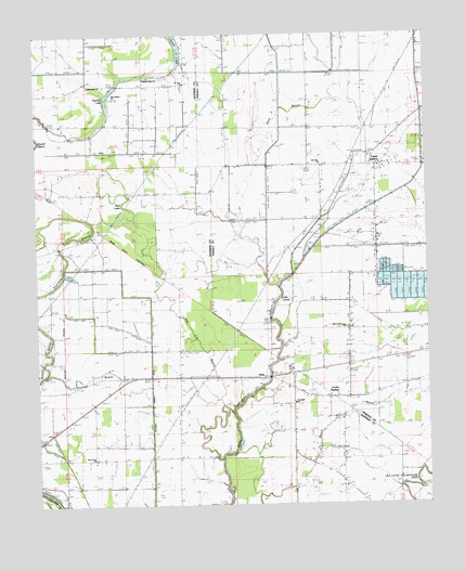
Curtis Station, MS USGS Topographic Map
Click on map above to begin viewing in our Map Viewer.

This topographic map contains these locations and features:
Feature Name Type Latitude Longitude GNIS ID View Map
Ash Log BayouGutN34.3048°W90.2106°666391View Map
Beech BayouStreamN34.2637°W90.1870°666754View Map
Blue HoleLakeN34.3109°W90.2391°1700688View Map
BoboPopulated PlaceN34.2843°W90.1759°667356View Map
Curtis StationPopulated PlaceN34.3401°W90.1393°669032View Map
Goodwill ChurchChurchN34.2773°W90.1681°670511View Map
Lake CarrierLakeN34.3079°W90.1726°668093View Map
Lake Carrier (historical)LocaleN34.3065°W90.1734°707419View Map
Lake Carrier SchoolSchoolN34.2793°W90.1543°672250View Map
Locke StationPopulated PlaceN34.2787°W90.1556°685692View Map
Locke Station ChurchChurchN34.2782°W90.1559°672742View Map
Lower Tallahatchie River Y-10-35 DamDamN34.2734°W90.1651°682547View Map
M and M Fish Farm Lake DamDamN34.3084°W90.1334°682572View Map
McDonald Grove ChurchChurchN34.2962°W90.1509°673336View Map
Mount Olive ChurchChurchN34.3407°W90.1584°674162View Map
Mount Olive School (historical)SchoolN34.3404°W90.1593°685700View Map
New Bethel ChurchChurchN34.3593°W90.2254°674589View Map
New Bethel School (historical)SchoolN34.3584°W90.2240°683758View Map
New Home ChurchChurchN34.2618°W90.2323°674651View Map
Onemile BayouStreamN34.2848°W90.2476°675288View Map
Pilgrims Rest ChurchChurchN34.2626°W90.2423°675782View Map
Pilgrims Rest ChurchChurchN34.3634°W90.2151°675783View Map
Queen ChapelChurchN34.2846°W90.2040°676429View Map
Quitman Panola DitchCanalN34.2679°W90.2140°676440View Map
Red LakeLakeN34.3296°W90.2226°683768View Map
RiverviewPopulated PlaceN34.2837°W90.2490°692180View Map
Riverview ChurchChurchN34.2834°W90.2493°676690View Map
Riverview School (historical)SchoolN34.2840°W90.2490°1700690View Map
Round Hole (historical)LakeN34.3282°W90.2356°1700691View Map
Saint John ChurchChurchN34.3621°W90.2023°677067View Map
Sanctified ChurchChurchN34.3621°W90.2326°677321View Map
Sand BayouGutN34.3493°W90.1754°677323View Map
Shelton Grove ChurchChurchN34.2621°W90.1690°677645View Map
South LakeLakeN34.3710°W90.2039°678004View Map
Squirrel LakeLakeN34.3617°W90.2237°678198View Map
Supervisor District 3CivilN34.2686°W90.2250°712048View Map
Viney RoughFlatN34.3659°W90.1379°679224View Map
Wesley ChapelChurchN34.3601°W90.2109°679454View Map

Note: Coordinates in the location and feature list above are referenced to NAD83 datum.


Copyright (C) 2008-2025 Ryan Niemi / Sunset Dynamics ... All Rights Reserved