TopoQuest Logo
Do you find TopoQuest useful?
Help keep TopoQuest running and adding new maps/features by donating!
Bitcoin:  19c7KJd3qBynnjoSw5npx9KScwjBe4ifkT
Litecoin:  LXs6TkuXGGXo1vDsWCkWVdjQX94eUKd6ui
Home View Maps Find Maps Find Places Resources & Links


Antelope Butte, Montana Topographic Map

USGS Map Title: Antelope Butte, MT
USGS Map MRC: 47111D4
DRG (GeoTIFF) Download: o47111d4.tif


Neighboring USGS Topographic Map Quads:


  Vaughn, MT  
47111E5
 

  Manchester, MT  
47111E4
 

  Northwest Great Falls, MT  
47111E3
 

  Ulm, MT  
47111D5
 

  Antelope Butte, MT  
47111D4
 

  Southwest Great Falls, MT  
47111D3
 

  Nelson Island, MT  
47111C5
 

  Truly, MT  
47111C4
 

  Eden, MT  
47111C3


Map MRC Location:

N48°
W112°
N48°
W111°
H8 H7 H6 H5 H4 H3 H2 H1
G8 G7 G6 G5 G4 G3 G2 G1
F8 F7 F6 F5 F4 F3 F2 F1
E8 E7 E6 E5 E4 E3 E2 E1
D8 D7 D6 D5 D4 D3 D2 D1
C8 C7 C6 C5 C4 C3 C2 C1
B8 B7 B6 B5 B4 B3 B2 B1
A8 A7 A6 A5 A4 A3 A2 A1
N47°
W112°
N47°
W111°

Antelope Butte, MT USGS 1:24K Topographic Map Preview:
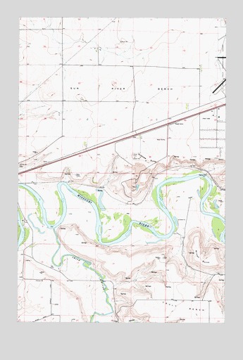
Antelope Butte, MT USGS Topographic Map
Click on map above to begin viewing in our Map Viewer.

This topographic map contains these locations and features:
Feature Name Type Latitude Longitude GNIS ID View Map
19N02E01BCBC01 WellWellN47.4311°W111.4319°822867View Map
19N02E08DDDD01 WellWellN47.4077°W111.4966°822723View Map
19N02E21D___01 WellWellN47.3816°W111.4805°822561View Map
19N02E23C___01 WellWellN47.3816°W111.4486°822560View Map
19N03E05BABA01 WellWellN47.4352°W111.3833°822903View Map
20N02E13____01 WellWellN47.4872°W111.4214°823347View Map
20N02E15____01 WellWellN47.4872°W111.4641°823348View Map
20N02E15A___01 WellWellN47.4908°W111.4589°823367View Map
20N02E15D___01 WellWellN47.4836°W111.4589°823324View Map
20N02E21____01 WellWellN47.4727°W111.4852°823246View Map
20N02E22____01 WellWellN47.4727°W111.4641°823245View Map
20N02E22C___01 WellWellN47.4691°W111.4694°823202View Map
20N02E22C___02 WellWellN47.4691°W111.4694°823203View Map
20N02E22C___03 WellWellN47.4691°W111.4694°823204View Map
20N02E22C___04 WellWellN47.4691°W111.4694°823205View Map
20N02E22D___01 WellWellN47.4691°W111.4589°823201View Map
20N02E23A___01 WellWellN47.4763°W111.4375°823272View Map
20N02E23C___01 WellWellN47.4691°W111.4480°823200View Map
20N02E24B___01 WellWellN47.4763°W111.4269°823271View Map
20N02E25C___01 WellWellN47.4544°W111.4269°823049View Map
20N02E28____01 WellWellN47.4583°W111.4852°823101View Map
20N02E28____02 WellWellN47.4583°W111.4852°823102View Map
20N02E28A___01 WellWellN47.4619°W111.4800°823136View Map
20N02E33B___01 WellWellN47.4472°W111.4905°822978View Map
20N02E33B___02 WellWellN47.4472°W111.4905°822979View Map
20N02E34A___01 WellWellN47.4472°W111.4589°822977View Map
20N02E35D___01 WellWellN47.4400°W111.4375°822940View Map
20N03E08DCBB01 WellWellN47.4975°W111.3800°823400View Map
20N03E17C___01 WellWellN47.4838°W111.3841°823325View Map
20N03E29ACBA01 WellWellN47.4605°W111.3794°823125View Map
20N03E29ADCC01 WellWellN47.4583°W111.3755°823100View Map
20N03E30A___01 WellWellN47.4619°W111.3947°823135View Map
20N03E32DBAB01 WellWellN47.4425°W111.3769°822955View Map
20N04E16CCBA02 WellWellN47.4825°W111.4044°823314View Map
Antelope ButteSummitN47.4427°W111.4266°801993View Map
Bair AirportAirportN47.4076°W111.4895°806544View Map
Buchanan Ranch Airport (historical)AirportN47.4300°W111.4608°806428View Map
Ferguson School (historical)SchoolN47.3786°W111.4958°1761902View Map
Great Falls DivisionCivilN47.4581°W111.4494°1940634View Map
Lord CouleeValleyN47.3783°W111.4439°773674View Map
Lower Smith River Fishing Access SiteLocaleN47.3938°W111.4489°1744337View Map
Smith Farms AirportAirportN47.4008°W111.4695°806433View Map
Smith RiverStreamN47.4136°W111.4786°790736View Map
Sun River BenchBenchN47.4713°W111.4319°802209View Map
Sun River Bench School (historical)SchoolN47.4797°W111.4314°1761913View Map
Sun River Historical Marker (historical)ParkN47.4561°W111.4091°1761791View Map
Ulm Bridge Fishing Access SiteLocaleN47.4077°W111.4977°1744335View Map
Wilson ButteSummitN47.3994°W111.3819°802240View Map

Note: Coordinates in the location and feature list above are referenced to NAD83 datum.


Copyright (C) 2008-2025 Ryan Niemi / Sunset Dynamics ... All Rights Reserved