TopoQuest Logo
Do you find TopoQuest useful?
Help keep TopoQuest running and adding new maps/features by donating!
Bitcoin:  19c7KJd3qBynnjoSw5npx9KScwjBe4ifkT
Litecoin:  LXs6TkuXGGXo1vDsWCkWVdjQX94eUKd6ui
Home View Maps Find Maps Find Places Resources & Links


Custer, Idaho Topographic Map

USGS Map Title: Custer, ID
USGS Map MRC: 44114D6
DRG (GeoTIFF) Download: o44114d6.tif


Neighboring USGS Topographic Map Quads:


  Casto, ID  
44114E7
 

  Sherman Peak, ID  
44114E6
 

  Challis Creek Lakes, ID  
44114E5
 

  Mount Jordan, ID  
44114D7
 

  Custer, ID  
44114D6
 

  Elevenmile Creek, ID  
44114D5
 

  East Basin Creek, ID  
44114C7
 

  Sunbeam, ID  
44114C6
 

  Thompson Creek, ID  
44114C5


Map MRC Location:

N45°
W115°
N45°
W114°
H8 H7 H6 H5 H4 H3 H2 H1
G8 G7 G6 G5 G4 G3 G2 G1
F8 F7 F6 F5 F4 F3 F2 F1
E8 E7 E6 E5 E4 E3 E2 E1
D8 D7 D6 D5 D4 D3 D2 D1
C8 C7 C6 C5 C4 C3 C2 C1
B8 B7 B6 B5 B4 B3 B2 B1
A8 A7 A6 A5 A4 A3 A2 A1
N44°
W115°
N44°
W114°

Custer, ID USGS 1:24K Topographic Map Preview:
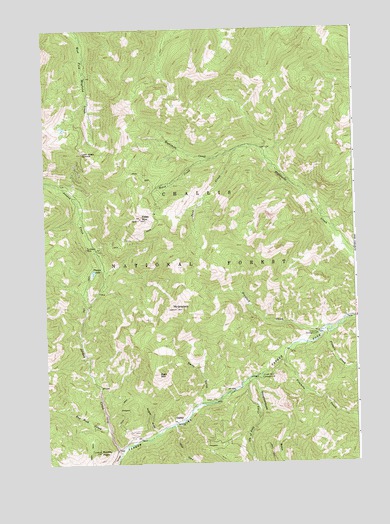
Custer, ID USGS Topographic Map
Click on map above to begin viewing in our Map Viewer.

This topographic map contains these locations and features:
Feature Name Type Latitude Longitude GNIS ID View Map
Adair CreekStreamN44.3857°W114.7001°376468View Map
Bald MountainSummitN44.4007°W114.7048°376883View Map
CusterPopulated PlaceN44.3874°W114.6959°396356View Map
Custer MuseumBuildingN44.3874°W114.6962°394339View Map
Custer Number 1 CampgroundLocaleN44.3994°W114.6637°380192View Map
Estes CreekStreamN44.4635°W114.6801°381495View Map
Estes MountainSummitN44.4457°W114.7117°381496View Map
Fivemile CreekStreamN44.4046°W114.6548°381804View Map
Fourth of July CreekStreamN44.3966°W114.6720°381972View Map
Greylock CampgroundLocaleN44.4119°W114.6415°382676View Map
Greylock CreekStreamN44.4127°W114.6401°399901View Map
Jordan CreekStreamN44.3782°W114.7212°384022View Map
Loon Creek SummitSummitN44.4646°W114.7345°386126View Map
Mount GreylockSummitN44.4199°W114.6973°382679View Map
Park CreekStreamN44.4666°W114.6687°388207View Map
Pinyon LakeLakeN44.4301°W114.7309°388548View Map
Puzzler GulchValleyN44.3838°W114.7076°388939View Map
Red Rock CreekStreamN44.3846°W114.7248°389233View Map
Rookie PointSummitN44.3785°W114.7290°389591View Map
Sixmile CreekStreamN44.4130°W114.6379°390497View Map
Slaughterhouse GulchValleyN44.3982°W114.6670°390584View Map
State of IdahoCivilN44.3891°W114.6594°1779783View Map
Sunbeam MineMineN44.4371°W114.7331°391647View Map
Swift GulchValleyN44.3930°W114.6873°391780View Map
Yankee Fork DredgeLocaleN44.3782°W114.7242°394338View Map

Note: Coordinates in the location and feature list above are referenced to NAD83 datum.


Copyright (C) 2008-2025 Ryan Niemi / Sunset Dynamics ... All Rights Reserved