TopoQuest Logo
Do you find TopoQuest useful?
Help keep TopoQuest running and adding new maps/features by donating!
Bitcoin:  19c7KJd3qBynnjoSw5npx9KScwjBe4ifkT
Litecoin:  LXs6TkuXGGXo1vDsWCkWVdjQX94eUKd6ui
Home View Maps Find Maps Find Places Resources & Links


Cuzco, Indiana Topographic Map

USGS Map Title: Cuzco, IN
USGS Map MRC: 38086D6
DRG (GeoTIFF) Download: o38086d6.tif


Neighboring USGS Topographic Map Quads:


  Rusk, IN  
38086E7
 

  Hillham, IN  
38086E6
 

  French Lick, IN  
38086E5
 

  Dubois, IN  
38086D7
 

  Cuzco, IN  
38086D6
 

  Greenbrier, IN  
38086D5
 

  Saint Anthony, IN  
38086C7
 

  Birdseye, IN  
38086C6
 

  Taswell, IN  
38086C5


Map MRC Location:

N39°
W87°
N39°
W86°
H8 H7 H6 H5 H4 H3 H2 H1
G8 G7 G6 G5 G4 G3 G2 G1
F8 F7 F6 F5 F4 F3 F2 F1
E8 E7 E6 E5 E4 E3 E2 E1
D8 D7 D6 D5 D4 D3 D2 D1
C8 C7 C6 C5 C4 C3 C2 C1
B8 B7 B6 B5 B4 B3 B2 B1
A8 A7 A6 A5 A4 A3 A2 A1
N38°
W87°
N38°
W86°

Cuzco, IN USGS 1:24K Topographic Map Preview:
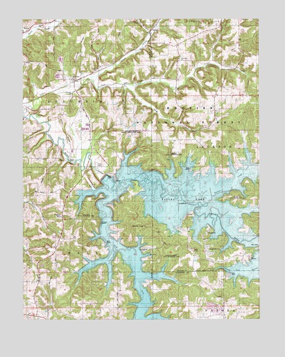
Cuzco, IN USGS Topographic Map
Click on map above to begin viewing in our Map Viewer.

This topographic map contains these locations and features:
Feature Name Type Latitude Longitude GNIS ID View Map
Bender SchoolSchoolN38.4245°W86.7458°450672View Map
Cane CreekStreamN38.4756°W86.7147°450752View Map
Cane Creek ChurchChurchN38.4837°W86.6669°450753View Map
Cane Creek SchoolSchoolN38.4814°W86.6680°450754View Map
CuzcoPopulated PlaceN38.4751°W86.7228°450826View Map
Dillon CreekStreamN38.4595°W86.7489°450851View Map
EllsworthPopulated PlaceN38.4278°W86.7183°450890View Map
Jackson State Recreation AreaParkN38.4437°W86.6708°451708View Map
Lick ForkStreamN38.4289°W86.7008°451661View Map
Lick Fork State Recreation AreaParkN38.4187°W86.7167°451709View Map
Lost RidgeRidgeN38.4537°W86.7278°451174View Map
Newton-Stewart State Recreation AreaParkN38.4014°W86.6722°451711View Map
NortonPopulated PlaceN38.4945°W86.6830°451284View Map
Painter CreekStreamN38.4237°W86.6528°451662View Map
Patoka LakeReservoirN38.4109°W86.6373°451715View Map
Patoka Lake DamDamN38.4348°W86.7069°451807View Map
Persimmon RidgeRidgeN38.4881°W86.7180°451328View Map
Ritter CreekStreamN38.3764°W86.6872°451397View Map
Southern Indiana Purdue Agriculture CenterSchoolN38.4528°W86.6917°451710View Map
Swift CemeteryCemeteryN38.4231°W86.6280°451533View Map
Township of ColumbiaCivilN38.4822°W86.7376°453238View Map
Township of HallCivilN38.3946°W86.7372°453362View Map
Township of JacksonCivilN38.4461°W86.6260°453458View Map

Note: Coordinates in the location and feature list above are referenced to NAD83 datum.


Copyright (C) 2008-2024 Ryan Niemi / Sunset Dynamics ... All Rights Reserved