TopoQuest Logo
Do you find TopoQuest useful?
Help keep TopoQuest running and adding new maps/features by donating!
Bitcoin:  19c7KJd3qBynnjoSw5npx9KScwjBe4ifkT
Litecoin:  LXs6TkuXGGXo1vDsWCkWVdjQX94eUKd6ui
Home View Maps Find Maps Find Places Resources & Links


Daggett, California Topographic Map

USGS Map Title: Daggett, CA
USGS Map MRC: 34116G8
DRG (GeoTIFF) Download: o34116g8.tif


Neighboring USGS Topographic Map Quads:


  Barstow, CA  
34117H1
 

  Nebo, CA  
34116H8
 

  Yermo, CA  
34116H7
 

  Barstow SE, CA  
34117G1
 

  Daggett, CA  
34116G8
 

  Minneola, CA  
34116G7
 

  Stoddard Well, CA  
34117F1
 

  West Ord Mountain, CA  
34116F8
 

  Ord Mountain, CA  
34116F7


Map MRC Location:

N35°
W117°
N35°
W116°
H8 H7 H6 H5 H4 H3 H2 H1
G8 G7 G6 G5 G4 G3 G2 G1
F8 F7 F6 F5 F4 F3 F2 F1
E8 E7 E6 E5 E4 E3 E2 E1
D8 D7 D6 D5 D4 D3 D2 D1
C8 C7 C6 C5 C4 C3 C2 C1
B8 B7 B6 B5 B4 B3 B2 B1
A8 A7 A6 A5 A4 A3 A2 A1
N34°
W117°
N34°
W116°

Daggett, CA USGS 1:24K Topographic Map Preview:
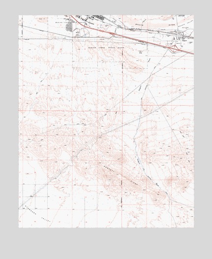
Daggett, CA USGS Topographic Map
Click on map above to begin viewing in our Map Viewer.

This topographic map contains these locations and features:
Feature Name Type Latitude Longitude GNIS ID View Map
Barstow Service Center HeliportAirportN34.8750°W116.9975°1653257View Map
Calico Continuation High SchoolSchoolN34.8611°W116.8900°1839717View Map
DaggettPopulated PlaceN34.8633°W116.8881°241219View Map
Daggett Community Services District Station 1BuildingN34.8624°W116.8850°2665111View Map
Daggett Community Services District Station 2BuildingN34.8656°W116.8858°2664525View Map
Daggett Middle SchoolSchoolN34.8605°W116.8900°1839725View Map
Daggett Pioneer CemeteryCemeteryN34.8586°W116.8800°241220View Map
Daggett Post OfficePost OfficeN34.8621°W116.8860°1839726View Map
Daggett RidgeRidgeN34.7811°W116.9286°241221View Map
Daggett WashStreamN34.8675°W116.9009°241222View Map
Desert View Housing AreaPopulated PlaceN34.8683°W116.9648°1839727View Map
Eniwetok Housing AreaPopulated PlaceN34.8717°W116.9631°1839729View Map
Marine Corps Logistics Base BarstowMilitaryN34.8547°W116.9401°2512485View Map
Marine Corps Logistics Base Fire Station Nebo AnnexBuildingN34.8736°W116.9509°2665094View Map
McKinley Elementary SchoolSchoolN34.8725°W116.9653°245708View Map
Nebo Center Census Designated Place (historical)CensusN34.8727°W116.9536°2408909View Map
Ord Mountain HeliportAirportN34.8750°W116.9975°1653256View Map
Silver Valley Adult SchoolSchoolN34.8611°W116.8900°1839767View Map

Note: Coordinates in the location and feature list above are referenced to NAD83 datum.


Copyright (C) 2008-2024 Ryan Niemi / Sunset Dynamics ... All Rights Reserved