TopoQuest Logo
Do you find TopoQuest useful?
Help keep TopoQuest running and adding new maps/features by donating!
Bitcoin:  19c7KJd3qBynnjoSw5npx9KScwjBe4ifkT
Litecoin:  LXs6TkuXGGXo1vDsWCkWVdjQX94eUKd6ui
Home View Maps Find Maps Find Places Resources & Links


Danner, Oregon Topographic Map

USGS Map Title: Danner, OR
USGS Map MRC: 42117H3
DRG (GeoTIFF) Download: o42117h3.tif


Neighboring USGS Topographic Map Quads:


  Jordan Craters South, OR  
43117A4
 

  Cow Lakes, OR  
43117A3
 

  Downey Canyon, OR  
43117A2
 

  Threemile Hill, OR  
42117H4
 

  Danner, OR  
42117H3
 

  Antelope Reservoir, OR  
42117H2
 

  Dry Creek Rim, OR  
42117G4
 

  Little Grassy Mountain, OR  
42117G3
 

  Juniper Ridge, OR  
42117G2


Map MRC Location:

N43°
W118°
N43°
W117°
H8 H7 H6 H5 H4 H3 H2 H1
G8 G7 G6 G5 G4 G3 G2 G1
F8 F7 F6 F5 F4 F3 F2 F1
E8 E7 E6 E5 E4 E3 E2 E1
D8 D7 D6 D5 D4 D3 D2 D1
C8 C7 C6 C5 C4 C3 C2 C1
B8 B7 B6 B5 B4 B3 B2 B1
A8 A7 A6 A5 A4 A3 A2 A1
N42°
W118°
N42°
W117°

Danner, OR USGS 1:24K Topographic Map Preview:
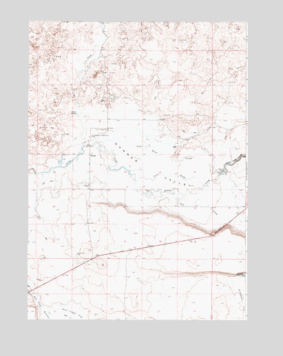
Danner, OR USGS Topographic Map
Click on map above to begin viewing in our Map Viewer.

This topographic map contains these locations and features:
Feature Name Type Latitude Longitude GNIS ID View Map
Barrick and Shannon RanchLocaleN42.9443°W117.3526°1638426View Map
Castle SloughStreamN42.9332°W117.3140°1118670View Map
Cow CreekStreamN42.9474°W117.3438°1119425View Map
DannerPopulated PlaceN42.9443°W117.3401°1136202View Map
Danner Post Office (historical)Post OfficeN42.9443°W117.3401°1165129View Map
Danner ValleyValleyN42.9360°W117.3704°1119683View Map
Fort Dobie (historical)LocaleN42.9485°W117.3399°1129609View Map
Goose RanchLocaleN42.9477°W117.2901°1121245View Map
Goose Ranch SloughStreamN42.9488°W117.3351°1121246View Map
Hard Up PointCapeN42.9377°W117.2629°1121590View Map
Jack CreekStreamN42.9257°W117.3032°1122323View Map
Jack Creek HillSlopeN42.9138°W117.2649°1160349View Map
Jean Baptiste Charbonneau GraveCemeteryN42.9520°W117.3392°1122390View Map
Jordan Creek CanyonValleyN42.9332°W117.2696°1122529View Map
North Antelope CanalCanalN42.9304°W117.2593°1130455View Map
Palmer DamDamN42.9293°W117.3051°1160350View Map
Parks SpringSpringN42.9615°W117.3476°1125196View Map
Rock Creek DamDamN42.8856°W117.3720°1133662View Map
Rock Creek ReservoirReservoirN42.8772°W117.3571°1126184View Map
Skinner (historical)LocaleN42.9513°W117.2890°1129610View Map
Skinner DamDamN42.9364°W117.2656°1127028View Map
Skinner Ranch AirportAirportN42.9505°W117.2850°2646025View Map
South Antelope CanalCanalN42.9177°W117.2854°1130454View Map

Note: Coordinates in the location and feature list above are referenced to NAD83 datum.


Copyright (C) 2008-2025 Ryan Niemi / Sunset Dynamics ... All Rights Reserved