TopoQuest Logo
Do you find TopoQuest useful?
Help keep TopoQuest running and adding new maps/features by donating!
Bitcoin:  19c7KJd3qBynnjoSw5npx9KScwjBe4ifkT
Litecoin:  LXs6TkuXGGXo1vDsWCkWVdjQX94eUKd6ui
Home View Maps Find Maps Find Places Resources & Links


Dayton, Oregon Topographic Map

USGS Map Title: Dayton, OR
USGS Map MRC: 45123B1
DRG (GeoTIFF) Download: o45123b1.tif


Neighboring USGS Topographic Map Quads:


  Carlton, OR  
45123C2
 

  Dundee, OR  
45123C1
 

  Newberg, OR  
45122C8
 

  McMinnville, OR  
45123B2
 

  Dayton, OR  
45123B1
 

  Saint Paul, OR  
45122B8
 

  Amity, OR  
45123A2
 

  Mission Bottom, OR  
45123A1
 

  Gervais, OR  
45122A8


Map MRC Location:

N46°
W124°
N46°
W123°
H8 H7 H6 H5 H4 H3 H2 H1
G8 G7 G6 G5 G4 G3 G2 G1
F8 F7 F6 F5 F4 F3 F2 F1
E8 E7 E6 E5 E4 E3 E2 E1
D8 D7 D6 D5 D4 D3 D2 D1
C8 C7 C6 C5 C4 C3 C2 C1
B8 B7 B6 B5 B4 B3 B2 B1
A8 A7 A6 A5 A4 A3 A2 A1
N45°
W124°
N45°
W123°

Dayton, OR USGS 1:24K Topographic Map Preview:
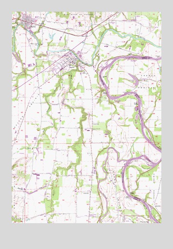
Dayton, OR USGS Topographic Map
Click on map above to begin viewing in our Map Viewer.

This topographic map contains these locations and features:
Feature Name Type Latitude Longitude GNIS ID View Map
11th Street ParkParkN45.2146°W123.0901°2058238View Map
Alderman ParkParkN45.2226°W123.0707°1157897View Map
Alderman ParkParkN45.2228°W123.0704°2058239View Map
Allison BarBarN45.1340°W123.0137°1116882View Map
Bible Baptist ChurchChurchN45.2453°W123.1122°2508985View Map
Brentano BarBarN45.2246°W123.0270°1118055View Map
Brookside CemeteryCemeteryN45.2184°W123.0734°1158070View Map
Candiani BarBarN45.2101°W123.0515°1118558View Map
Carey BendBendN45.2201°W123.0407°1118602View Map
Church of Jesus Christ of Latter Day SaintsChurchN45.2197°W123.0850°2508983View Map
City of DaytonCivilN45.2198°W123.0781°2410299View Map
City of LafayetteCivilN45.2462°W123.1115°2411593View Map
Coffee ChuteChannelN45.1898°W123.0195°1157966View Map
Coffee IslandIslandN45.1898°W123.0179°1119079View Map
Coffee Island BarBarN45.1907°W123.0204°1157965View Map
Cole and Forrester DamDamN45.2332°W123.0929°1131581View Map
Commons ParkParkN45.2435°W123.1162°2058244View Map
Connor LakeLakeN45.2158°W123.0026°1130145View Map
Courthouse Square ParkParkN45.2212°W123.0765°2058240View Map
Crawford (historical)LocaleN45.2443°W123.0443°1166742View Map
Crawford Post Office (historical)Post OfficeN45.2443°W123.0443°1165103View Map
DaytonPopulated PlaceN45.2207°W123.0762°1166639View Map
Dayton Boat LandingLocaleN45.2217°W123.0703°2668311View Map
Dayton Boat LandingParkN45.2216°W123.0703°2058241View Map
Dayton City HallBuildingN45.2197°W123.0769°2661192View Map
Dayton Fire DistrictBuildingN45.2167°W123.0822°2576514View Map
Dayton Grade SchoolSchoolN45.2183°W123.0772°1157898View Map
Dayton High SchoolSchoolN45.2162°W123.0848°2496444View Map
Dayton Junior High SchoolSchoolN45.2162°W123.0848°2496445View Map
Dayton Landing County ParkParkN45.2312°W123.0526°1157899View Map
Dayton Municipal CourthouseBuildingN45.2196°W123.0774°2661470View Map
Dayton Post OfficePost OfficeN45.2185°W123.0793°1165133View Map
Dayton Public WorksBuildingN45.2197°W123.0769°2661491View Map
Dayton Sewage Treatment LagoonsLocaleN45.2248°W123.0700°2660705View Map
Dayton StationLocaleN45.2354°W123.0679°1119726View Map
Dayton Water Treatment PlantLocaleN45.2123°W123.0914°2660787View Map
Duke BarBarN45.1440°W123.0320°1120206View Map
Duke LandingLocaleN45.1407°W123.0282°1157973View Map
Durettes LandingLocaleN45.1429°W123.0287°1157974View Map
Evers LakeLakeN45.2219°W123.1224°1130144View Map
FairfieldPopulated PlaceN45.1346°W123.0062°1157980View Map
Fairfield BarBarN45.1385°W123.0151°1120559View Map
Fairfield Post Office (historical)Post OfficeN45.1346°W123.0062°1165237View Map
Feasters RocksBarN45.1687°W123.0026°1157981View Map
Five IslandsIslandN45.1762°W123.0120°1120803View Map
Five Islands BarBarN45.1837°W123.0179°1120802View Map
Fort Yamhill State ParkParkN45.2212°W123.0762°1157894View Map
Four CornersLocaleN45.1262°W123.0373°1638763View Map
Grand IslandIslandN45.1271°W123.0379°1158263View Map
Grand Island JunctionLocaleN45.1287°W123.0615°1158072View Map
Grand Island School (historical)SchoolN45.1296°W123.0309°1121285View Map
Hawn CreekStreamN45.2407°W123.1229°1157993View Map
Henry CreekStreamN45.2365°W123.1084°1121760View Map
Historic Lafayette Research Library and MuseumBuildingN45.2461°W123.1124°2661402View Map
Holdridge CreekStreamN45.1473°W123.0920°1121902View Map
Horseshoe LakeReservoirN45.2110°W123.0241°1122044View Map
Independent Order of Odd Fellows CemeteryCemeteryN45.2140°W123.0654°1638251View Map
Jackson BendBendN45.1565°W123.0148°1122350View Map
Joel Perkins ParkParkN45.2451°W123.1123°2058245View Map
Kunz ReservoirReservoirN45.2487°W123.0966°1158082View Map
LafayettePopulated PlaceN45.2443°W123.1148°1157999View Map
Lafayette AirstripAirportN45.2441°W123.1243°1163616View Map
Lafayette City HallBuildingN45.2440°W123.1132°2661471View Map
Lafayette Community ChurchChurchN45.2439°W123.1147°2508984View Map
Lafayette Fire DepartmentBuildingN45.2439°W123.1132°2576484View Map
Lafayette Locks County ParkParkN45.2307°W123.1045°1129348View Map
Lafayette Municipal CourthouseBuildingN45.2440°W123.1132°2661113View Map
Lafayette Post OfficePost OfficeN45.2436°W123.1135°1165504View Map
Lafayette Public WorksBuildingN45.2397°W123.1132°2661487View Map
Lafayette Sewage Treatment PlantLocaleN45.2384°W123.1105°2660660View Map
Lambert BendBendN45.1615°W123.0248°1122923View Map
Lambert SloughStreamN45.1615°W123.0307°1122926View Map
Legion FieldParkN45.2229°W123.0776°2058242View Map
Lippin Cotts GulchValleyN45.2012°W123.0720°1162078View Map
Lower Lambert BarBarN45.1604°W123.0132°1123569View Map
Mary Gilkey City Public LibraryBuildingN45.2197°W123.0769°2661193View Map
Meadowbrook LakeLakeN45.1884°W123.0232°1130147View Map
Michael ReservoirReservoirN45.1745°W123.0430°1130152View Map
Miller CreekStreamN45.2329°W123.0529°1159034View Map
Millican CreekStreamN45.2423°W123.1215°1124214View Map
Mission BarBarN45.2229°W123.0037°1158378View Map
Mount Hood Post Office (historical)Post OfficeN45.1276°W123.1179°1165671View Map
O'Dell CemeteryCemeteryN45.1465°W123.0959°1158071View Map
Oaklawn (historical)LocaleN45.2373°W123.0818°1166737View Map
Palmer CreekStreamN45.2215°W123.0712°1158020View Map
Pioneer Evangelical ChurchChurchN45.2214°W123.0783°2508969View Map
PleasantdaleLocaleN45.1843°W123.0595°1158021View Map
Riverwood Golf CourseLocaleN45.2390°W123.0212°1163769View Map
Saint Clair Post Office (historical)Post OfficeN45.2421°W123.0007°1164652View Map
San Salvador AccessParkN45.2221°W123.0234°1162079View Map
San Salvador Access Boat RampLocaleN45.2224°W123.0273°2699786View Map
San Salvador BeachBeachN45.2218°W123.0270°1126547View Map
Schuetze ReservoirReservoirN45.2428°W123.1016°1158069View Map
Scottys PondLakeN45.1409°W123.1235°1130207View Map
Snaggy Bend BarBarN45.1276°W123.0059°1158035View Map
Stockhoff ReservoirReservoirN45.1683°W123.1048°1130148View Map
Stringer DamDamN45.1448°W123.1045°1131595View Map
Stringer ReservoirReservoirN45.1425°W123.1099°1130149View Map
Terry ParkParkN45.2407°W123.1140°1157895View Map
UnionvalePopulated PlaceN45.1432°W123.0607°1128424View Map
Upper Lambert BarBarN45.1590°W123.0329°1128459View Map
Warner CreekStreamN45.1596°W123.0720°1130151View Map
Wascher Elementary SchoolSchoolN45.2467°W123.1064°1157896View Map
Webfoot Grange HallBuildingN45.1801°W123.0876°1639209View Map
West Fork Palmer CreekStreamN45.2146°W123.0790°1128862View Map
Weston (historical)LocaleN45.1943°W123.0318°1130146View Map
Weston BarBarN45.2012°W123.0243°1128920View Map
Weston BendBendN45.2032°W123.0268°1128921View Map
Weston LandingLocaleN45.2018°W123.0473°1158054View Map
Whites LandingLocaleN45.1257°W123.0120°1158058View Map
Willamette Post Office (historical)Post OfficeN45.1665°W123.0179°1164785View Map
Woods LandingLocaleN45.1951°W123.0198°1158064View Map
Woods ReservoirReservoirN45.2345°W123.0926°1130143View Map

Note: Coordinates in the location and feature list above are referenced to NAD83 datum.


Copyright (C) 2008-2025 Ryan Niemi / Sunset Dynamics ... All Rights Reserved