TopoQuest Logo
Do you find TopoQuest useful?
Help keep TopoQuest running and adding new maps/features by donating!
Bitcoin:  19c7KJd3qBynnjoSw5npx9KScwjBe4ifkT
Litecoin:  LXs6TkuXGGXo1vDsWCkWVdjQX94eUKd6ui
Home View Maps Find Maps Find Places Resources & Links


Dayton, Washington Topographic Map

USGS Map Title: Dayton, WA
USGS Map MRC: 46117C8
DRG (GeoTIFF) Download: o46117c8.tif


Neighboring USGS Topographic Map Quads:


  Kellogg Creek, WA  
46118D1
 

  Tucannon, WA  
46117D8
 

  Turner, WA  
46117D7
 

  Huntsville, WA  
46118C1
 

  Dayton, WA  
46117C8
 

  Cahill Mountain, WA  
46117C7
 

  Coppei, WA  
46118B1
 

  Robinette Mountain, WA  
46117B8
 

  Eckler Mountain, WA  
46117B7


Map MRC Location:

N47°
W118°
N47°
W117°
H8 H7 H6 H5 H4 H3 H2 H1
G8 G7 G6 G5 G4 G3 G2 G1
F8 F7 F6 F5 F4 F3 F2 F1
E8 E7 E6 E5 E4 E3 E2 E1
D8 D7 D6 D5 D4 D3 D2 D1
C8 C7 C6 C5 C4 C3 C2 C1
B8 B7 B6 B5 B4 B3 B2 B1
A8 A7 A6 A5 A4 A3 A2 A1
N46°
W118°
N46°
W117°

Dayton, WA USGS 1:24K Topographic Map Preview:
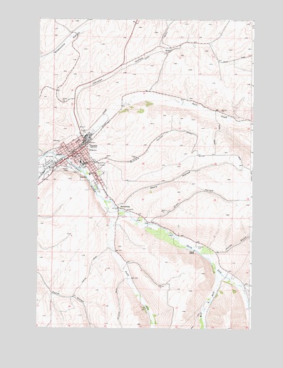
Dayton, WA USGS Topographic Map
Click on map above to begin viewing in our Map Viewer.

This topographic map contains these locations and features:
Feature Name Type Latitude Longitude GNIS ID View Map
BaileysburgPopulated PlaceN46.2990°W117.9527°1510802View Map
City of DaytonCivilN46.3168°W117.9769°2410301View Map
Columbia CountyCivilN46.2975°W117.9078°1513273View Map
Columbia County CourthouseBuildingN46.3213°W117.9794°1514912View Map
Columbia County Fire District 3BuildingN46.3182°W117.9847°2619720View Map
Columbia County Sheriff's OfficeBuildingN46.3212°W117.9785°2722048View Map
Crall HollowValleyN46.2929°W117.9333°1504245View Map
Davis HollowValleyN46.2999°W117.9516°1504342View Map
DaytonPopulated PlaceN46.3238°W117.9724°1504356View Map
Dayton and Columbia County FairgroundsLocaleN46.3165°W117.9941°1514530View Map
Dayton Elementary SchoolSchoolN46.3173°W117.9754°1514531View Map
Dayton General HospitalHospitalN46.3121°W117.9703°1514532View Map
Dayton High SchoolSchoolN46.3162°W117.9743°1507418View Map
Dayton Post OfficePost OfficeN46.3194°W117.9785°2769169View Map
Dayton Railroad DepotBuildingN46.3215°W117.9866°1514911View Map
Hatley GulchValleyN46.2801°W117.8963°1505419View Map
Johnson HollowValleyN46.3288°W117.9760°1505846View Map
KZHR-FM (Dayton)TowerN46.3204°W117.9805°1534340View Map
Mustard HollowValleyN46.3168°W117.9660°1506910View Map
North Fork Touchet RiverStreamN46.3013°W117.9585°1507069View Map
Patit CreekStreamN46.3199°W117.9844°1507326View Map
Rodgers GulchValleyN46.2679°W117.8813°1507893View Map
RonanPopulated PlaceN46.3638°W117.9224°1511269View Map
South Fork Touchet RiverStreamN46.3013°W117.9585°1508546View Map
Thorn Lookout TowerTowerN46.3004°W117.8758°1533242View Map
Touchet Valley Golf CourseLocaleN46.3193°W117.9930°1514499View Map
Wolf ForkStreamN46.2740°W117.8958°1509603View Map

Note: Coordinates in the location and feature list above are referenced to NAD83 datum.


Copyright (C) 2008-2024 Ryan Niemi / Sunset Dynamics ... All Rights Reserved