TopoQuest Logo
Do you find TopoQuest useful?
Help keep TopoQuest running and adding new maps/features by donating!
Bitcoin:  19c7KJd3qBynnjoSw5npx9KScwjBe4ifkT
Litecoin:  LXs6TkuXGGXo1vDsWCkWVdjQX94eUKd6ui
Home View Maps Find Maps Find Places Resources & Links


Deckers, Colorado Topographic Map

USGS Map Title: Deckers, CO
USGS Map MRC: 39105C2
DRG (GeoTIFF) Download: o39105c2.tif


Neighboring USGS Topographic Map Quads:


  Pine, CO  
39105D3
 

  Platte Canyon, CO  
39105D2
 

  Kassler, CO  
39105D1
 

  Green Mountain, CO  
39105C3
 

  Deckers, CO  
39105C2
 

  Devils Head, CO  
39105C1
 

  Cheesman Lake, CO  
39105B3
 

  Westcreek, CO  
39105B2
 

  Dakan Mountain, CO  
39105B1


Map MRC Location:

N40°
W106°
N40°
W105°
H8 H7 H6 H5 H4 H3 H2 H1
G8 G7 G6 G5 G4 G3 G2 G1
F8 F7 F6 F5 F4 F3 F2 F1
E8 E7 E6 E5 E4 E3 E2 E1
D8 D7 D6 D5 D4 D3 D2 D1
C8 C7 C6 C5 C4 C3 C2 C1
B8 B7 B6 B5 B4 B3 B2 B1
A8 A7 A6 A5 A4 A3 A2 A1
N39°
W106°
N39°
W105°

Deckers, CO USGS 1:24K Topographic Map Preview:
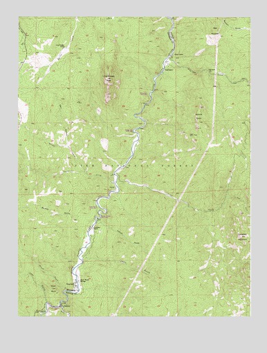
Deckers, CO USGS Topographic Map
Click on map above to begin viewing in our Map Viewer.

This topographic map contains these locations and features:
Feature Name Type Latitude Longitude GNIS ID View Map
Bear MountainSummitN39.3689°W105.1444°183560View Map
Big Bertha Pegmatite MineMineN39.3344°W105.2172°1703789View Map
Bridge Crossing Picnic AreaLocaleN39.2914°W105.2061°196938View Map
Brush CreekStreamN39.2605°W105.2244°183517View Map
Campbell MountainSummitN39.2833°W105.1303°183539View Map
DeckersPopulated PlaceN39.2547°W105.2269°204730View Map
Deckers Post Office (historical)Post OfficeN39.2547°W105.2269°2026932View Map
Deep CreekStreamN39.2997°W105.1383°183551View Map
Dell GulchValleyN39.3209°W105.2237°183554View Map
Gunbarrel CreekStreamN39.3061°W105.1975°183525View Map
Hatch GulchValleyN39.2895°W105.2069°183540View Map
Horse CreekStreamN39.2547°W105.2272°183563View Map
Jenny GulchValleyN39.2746°W105.2141°183542View Map
Kelsey CreekStreamN39.3094°W105.2133°183526View Map
Lazy GulchValleyN39.2556°W105.2342°183516View Map
Lone Rock CampgroundLocaleN39.2517°W105.2347°183546View Map
Long Scraggy PeakSummitN39.3492°W105.2019°183555View Map
Long Scraggy RanchLocaleN39.3619°W105.2264°183553View Map
Madonna Number One MineMineN39.3730°W105.1964°1703790View Map
Madonna Number Two MineMineN39.3742°W105.2005°1703791View Map
Mickey Number One MineMineN39.3672°W105.1944°1703792View Map
Miller Lode Number OneMineN39.2830°W105.1397°1703786View Map
NighthawkPopulated PlaceN39.3547°W105.1694°183557View Map
Nighthawk HillSummitN39.3530°W105.1455°183559View Map
Noddle HeadsSummitN39.3336°W105.1533°183550View Map
North Fork Volunteer Fire Department Station 1BuildingN39.3616°W105.2450°2368631View Map
North Fork Volunteer Fire Department Station 3BuildingN39.2640°W105.2198°2368644View Map
OxyokePopulated PlaceN39.3030°W105.1983°183547View Map
Pine CreekStreamN39.3578°W105.1697°183561View Map
Pine Creek MineMineN39.3553°W105.1514°1703787View Map
Platte River CampgroundLocaleN39.2939°W105.2044°183548View Map
Platte River Picnic AreaLocaleN39.2950°W105.2075°197373View Map
Ponderosa Pine CampgroundLocaleN39.3339°W105.1867°183556View Map
Saloon GulchValleyN39.2882°W105.2099°183518View Map
Scraggy View Picnic AreaLocaleN39.3275°W105.1878°196934View Map
Skull RockSummitN39.2617°W105.2317°183545View Map
Snow Water SpringsPopulated PlaceN39.2647°W105.2169°183543View Map
South Platte RiverStreamN39.2917°W105.2089°201759View Map
Sugar CreekStreamN39.3064°W105.1972°183549View Map
Swayback RanchLocaleN39.2872°W105.2097°183541View Map
Three Musketeers MineMineN39.2742°W105.1514°1703788View Map
Top of the World Picnic GroundLocaleN39.3714°W105.2383°183552View Map
TrumbullPopulated PlaceN39.2630°W105.2194°183544View Map
Twin CedarsPopulated PlaceN39.3597°W105.1672°183558View Map
Willow Bend Picnic AreaLocaleN39.3428°W105.1803°196935View Map

Note: Coordinates in the location and feature list above are referenced to NAD83 datum.


Copyright (C) 2008-2024 Ryan Niemi / Sunset Dynamics ... All Rights Reserved