TopoQuest Logo
Do you find TopoQuest useful?
Help keep TopoQuest running and adding new maps/features by donating!
Bitcoin:  19c7KJd3qBynnjoSw5npx9KScwjBe4ifkT
Litecoin:  LXs6TkuXGGXo1vDsWCkWVdjQX94eUKd6ui
Home View Maps Find Maps Find Places Resources & Links


Deep River, Iowa Topographic Map

USGS Map Title: Deep River, IA
USGS Map MRC: 41092E3
DRG (GeoTIFF) Download: o41092e3.tif


Neighboring USGS Topographic Map Quads:


  Brooklyn, IA  
41092F4
 

  Victor, IA  
41092F3
 

  Williamsburg NW, IA  
41092F2
 

  Barnes City, IA  
41092E4
 

  Deep River, IA  
41092E3
 

  Millersburg, IA  
41092E2
 

  Gibson, IA  
41092D4
 

  What Cheer, IA  
41092D3
 

  Keswick, IA  
41092D2


Map MRC Location:

N42°
W93°
N42°
W92°
H8 H7 H6 H5 H4 H3 H2 H1
G8 G7 G6 G5 G4 G3 G2 G1
F8 F7 F6 F5 F4 F3 F2 F1
E8 E7 E6 E5 E4 E3 E2 E1
D8 D7 D6 D5 D4 D3 D2 D1
C8 C7 C6 C5 C4 C3 C2 C1
B8 B7 B6 B5 B4 B3 B2 B1
A8 A7 A6 A5 A4 A3 A2 A1
N41°
W93°
N41°
W92°

Deep River, IA USGS 1:24K Topographic Map Preview:
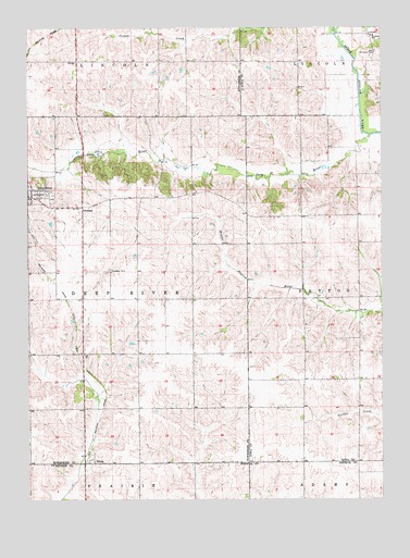
Deep River, IA USGS Topographic Map
Click on map above to begin viewing in our Map Viewer.

This topographic map contains these locations and features:
Feature Name Type Latitude Longitude GNIS ID View Map
Calvary Lutheran ChurchChurchN41.5825°W92.3735°1997362View Map
Church of the NazareneChurchN41.5797°W92.3710°1997361View Map
City of Deep RiverCivilN41.5812°W92.3732°2394485View Map
Deep RiverPopulated PlaceN41.5803°W92.3749°455847View Map
Deep RiverStreamN41.5964°W92.2538°455848View Map
Deep River CemeteryCemeteryN41.5797°W92.3664°1997449View Map
Deep River Post OfficePost OfficeN41.5803°W92.3735°1997359View Map
Deep River Timber ReserveParkN41.5931°W92.3460°1997257View Map
Deep River United ChurchChurchN41.5806°W92.3749°1997363View Map
DresdenPopulated PlaceN41.5778°W92.3557°464521View Map
Dresden CemeteryCemeteryN41.5608°W92.3459°456010View Map
German Methodist Episcopal CemeteryCemeteryN41.5750°W92.2668°2047409View Map
HedgeLocaleN41.5750°W92.2788°466096View Map
Hedge Post Office (historical)Post OfficeN41.5750°W92.2585°1999744View Map
Saint Johns CemeteryCemeteryN41.6183°W92.2523°461016View Map
Saint Johns SchoolSchoolN41.6228°W92.2530°461078View Map
TiltonPopulated PlaceN41.5097°W92.3524°462243View Map
Tilton Evangelical Methodist ChurchChurchN41.5097°W92.3538°1997464View Map
Tilton Post Office (historical)Post OfficeN41.5097°W92.3524°1997273View Map
Township of Deep RiverCivilN41.5556°W92.3550°467692View Map

Note: Coordinates in the location and feature list above are referenced to NAD83 datum.


Copyright (C) 2008-2024 Ryan Niemi / Sunset Dynamics ... All Rights Reserved