TopoQuest Logo
Do you find TopoQuest useful?
Help keep TopoQuest running and adding new maps/features by donating!
Bitcoin:  19c7KJd3qBynnjoSw5npx9KScwjBe4ifkT
Litecoin:  LXs6TkuXGGXo1vDsWCkWVdjQX94eUKd6ui
Home View Maps Find Maps Find Places Resources & Links


Deer Creek, Minnesota Topographic Map

USGS Map Title: Deer Creek, MN
USGS Map MRC: 46095D3
DRG (GeoTIFF) Download: o46095d3.tif


Neighboring USGS Topographic Map Quads:


  New York Mills West, MN  
46095E4
 

  New York Mills East, MN  
46095E3
 

  Sebeka SW, MN  
46095E2
 

  Heinola, MN  
46095D4
 

  Deer Creek, MN  
46095D3
 

  Wadena, MN  
46095D2
 

  Henning, MN  
46095C4
 

  Henning SE, MN  
46095C3
 

  Wrightstown, MN  
46095C2


Map MRC Location:

N47°
W96°
N47°
W95°
H8 H7 H6 H5 H4 H3 H2 H1
G8 G7 G6 G5 G4 G3 G2 G1
F8 F7 F6 F5 F4 F3 F2 F1
E8 E7 E6 E5 E4 E3 E2 E1
D8 D7 D6 D5 D4 D3 D2 D1
C8 C7 C6 C5 C4 C3 C2 C1
B8 B7 B6 B5 B4 B3 B2 B1
A8 A7 A6 A5 A4 A3 A2 A1
N46°
W96°
N46°
W95°

Deer Creek, MN USGS 1:24K Topographic Map Preview:
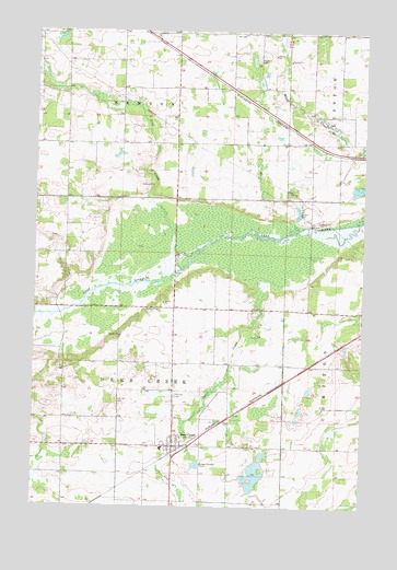
Deer Creek, MN USGS Topographic Map
Click on map above to begin viewing in our Map Viewer.

This topographic map contains these locations and features:
Feature Name Type Latitude Longitude GNIS ID View Map
City of Deer CreekCivilN46.3909°W95.3217°2394488View Map
Deer CreekPopulated PlaceN46.3911°W95.3214°642707View Map
Deer CreekStreamN46.4350°W95.2895°642708View Map
Deer Creek (historical)LocaleN46.3897°W95.3194°2073102View Map
Deer Creek Fire and RescueBuildingN46.3913°W95.3196°2666709View Map
Deer Creek Mobile Home ParkPopulated PlaceN46.3911°W95.3211°2073101View Map
Deer Creek Post Office (historical)Post OfficeN46.3911°W95.3211°2073099View Map
Dopelius (historical)LocaleN46.4792°W95.2861°2073021View Map
Dopelius Post Office (historical)Post OfficeN46.4792°W95.2861°2073023View Map
Fairview CemeteryCemeteryN46.4044°W95.3211°643513View Map
Finn CreekStreamN46.4372°W95.3198°643634View Map
Finn Creek MuseumBuildingN46.4561°W95.3694°2072793View Map
Oak Hill CemeteryCemeteryN46.4027°W95.3431°648821View Map
Salem Evangelical Church Cemetery (historical)CemeteryN46.4111°W95.3250°2072708View Map
South Bluff CreekStreamN46.4502°W95.2506°652271View Map
Topelius (historical)Populated PlaceN46.4792°W95.2861°2073022View Map
Topelius CemeteryCemeteryN46.4925°W95.2909°653237View Map
Township of Deer CreekCivilN46.4153°W95.3465°663942View Map
Township of NewtonCivilN46.4985°W95.3427°665115View Map
Trinity Lutheran ChurchChurchN46.3911°W95.3211°2073100View Map
United Methodist ChurchChurchN46.3911°W95.3211°2073098View Map

Note: Coordinates in the location and feature list above are referenced to NAD83 datum.


Copyright (C) 2008-2025 Ryan Niemi / Sunset Dynamics ... All Rights Reserved