TopoQuest Logo
Do you find TopoQuest useful?
Help keep TopoQuest running and adding new maps/features by donating!
Bitcoin:  19c7KJd3qBynnjoSw5npx9KScwjBe4ifkT
Litecoin:  LXs6TkuXGGXo1vDsWCkWVdjQX94eUKd6ui
Home View Maps Find Maps Find Places Resources & Links


Anthony, Kansas Topographic Map

USGS Map Title: Anthony, KS
USGS Map MRC: 37098B1
DRG (GeoTIFF) Download: o37098b1.tif


Neighboring USGS Topographic Map Quads:


  Crystal Springs, KS  
37098C2
 

  Harper, KS  
37098C1
 

  Danville, KS  
37097C8
 

  Attica, KS  
37098B2
 

  Anthony, KS  
37098B1
 

  Bluff City NW, KS  
37097B8
 

  Waldron, KS  
37098A2
 

  Spring, KS  
37098A1
 

  Bluff City West, KS  
37097A8


Map MRC Location:

N38°
W99°
N38°
W98°
H8 H7 H6 H5 H4 H3 H2 H1
G8 G7 G6 G5 G4 G3 G2 G1
F8 F7 F6 F5 F4 F3 F2 F1
E8 E7 E6 E5 E4 E3 E2 E1
D8 D7 D6 D5 D4 D3 D2 D1
C8 C7 C6 C5 C4 C3 C2 C1
B8 B7 B6 B5 B4 B3 B2 B1
A8 A7 A6 A5 A4 A3 A2 A1
N37°
W99°
N37°
W98°

Anthony, KS USGS 1:24K Topographic Map Preview:
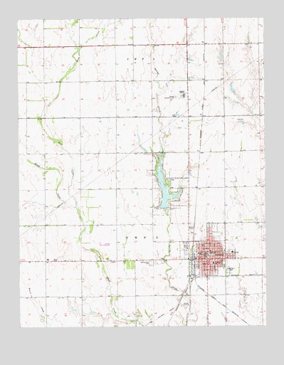
Anthony, KS USGS Topographic Map
Click on map above to begin viewing in our Map Viewer.

This topographic map contains these locations and features:
Feature Name Type Latitude Longitude GNIS ID View Map
AnthonyPopulated PlaceN37.1534°W98.0312°470518View Map
Anthony Chamber of CommerceBuildingN37.1525°W98.0325°2692652View Map
Anthony Christian ChurchChurchN37.1631°W98.0404°1992468View Map
Anthony Church of ChristChurchN37.1514°W98.0292°1992463View Map
Anthony City DamDamN37.1734°W98.0503°479935View Map
Anthony City HallBuildingN37.1513°W98.0317°2693036View Map
Anthony Country ClubLocaleN37.1716°W98.0549°2694546View Map
Anthony Downs RacesLocaleN37.1623°W98.0254°2692653View Map
Anthony Elementary SchoolSchoolN37.1507°W98.0269°2497370View Map
Anthony Elementary SchoolSchoolN37.1508°W98.0271°470516View Map
Anthony Fire StationBuildingN37.1514°W98.0317°2111103View Map
Anthony Medical CenterHospitalN37.1549°W98.0173°2499147View Map
Anthony Medical Center HeliportAirportN37.1557°W98.0176°2624881View Map
Anthony Municipal AirportAirportN37.1545°W98.0777°470519View Map
Anthony Municipal HallBuildingN37.1519°W98.0291°2693035View Map
Anthony Municipal LakeReservoirN37.1800°W98.0514°479934View Map
Anthony Police DepartmentBuildingN37.1509°W98.0317°2503805View Map
Anthony Post OfficePost OfficeN37.1535°W98.0312°1992462View Map
Anthony Public LibraryBuildingN37.1525°W98.0234°1992473View Map
Anthony United Methodist ChurchChurchN37.1538°W98.0312°1992470View Map
Anthony Wastewater Treatment PlantLocaleN37.1358°W98.0409°2692002View Map
Assembly of God ChurchChurchN37.1557°W98.0213°2689300View Map
Central Baptist ChurchChurchN37.1462°W98.0311°2690706View Map
Chaparral High SchoolSchoolN37.2187°W98.0411°470512View Map
Church of the NazareneChurchN37.1499°W98.0299°1992466View Map
City of AnthonyCivilN37.1580°W98.0414°485540View Map
First Baptist ChurchChurchN37.1550°W98.0298°1992467View Map
First Church of GodChurchN37.1525°W98.0256°1992469View Map
First Congregational United Church of ChristChurchN37.1535°W98.0317°1992464View Map
First Pentecostal ChurchChurchN37.1593°W98.0345°1992465View Map
Forest Park CemeteryCemeteryN37.1476°W98.0191°470517View Map
Grace Episcopal ChurchChurchN37.1555°W98.0285°1992471View Map
Harper CountyCivilN37.1916°W98.0755°485004View Map
Harper County Court HouseBuildingN37.1539°W98.0295°1992474View Map
Harper County Emergency Medical ServicesBuildingN37.1527°W98.0298°2696550View Map
Harper County Health DepartmentBuildingN37.1531°W98.0298°2695016View Map
Harper County JailBuildingN37.1535°W98.0293°2504296View Map
Harper County Sheriff's OfficeBuildingN37.1535°W98.0292°2503790View Map
Kansas Highway Patrol Troop FBuildingN37.1535°W98.0294°2504219View Map
Lincoln Elementary SchoolSchoolN37.1547°W98.0345°470514View Map
Rush CreekStreamN37.1739°W98.0965°470504View Map
Sacred Heart ChurchChurchN37.1515°W98.0231°2690787View Map
Saint Mathew African Methodist Episcopal ChurchChurchN37.1497°W98.0356°1992472View Map
Spring Grove CemeteryCemeteryN37.1505°W98.0586°470513View Map
Sun Light Worship CenterChurchN37.1525°W98.0256°2690815View Map
Union Valley (historical)LocaleN37.1903°W98.0970°482319View Map
Washington Annex SchoolSchoolN37.1511°W98.0284°470515View Map

Note: Coordinates in the location and feature list above are referenced to NAD83 datum.


Copyright (C) 2008-2025 Ryan Niemi / Sunset Dynamics ... All Rights Reserved