TopoQuest Logo
Do you find TopoQuest useful?
Help keep TopoQuest running and adding new maps/features by donating!
Bitcoin:  19c7KJd3qBynnjoSw5npx9KScwjBe4ifkT
Litecoin:  LXs6TkuXGGXo1vDsWCkWVdjQX94eUKd6ui
Home View Maps Find Maps Find Places Resources & Links


Anthony Lakes, Oregon Topographic Map

USGS Map Title: Anthony Lakes, OR
USGS Map MRC: 44118H2
DRG (GeoTIFF) Download: o44118h2.tif


Neighboring USGS Topographic Map Quads:


  Limber Jim Creek, OR  
45118A3
 

  Anthony Butte, OR  
45118A2
 

  Tucker Flat, OR  
45118A1
 

  Crawfish Lake, OR  
44118H3
 

  Anthony Lakes, OR  
44118H2
 

  Rock Creek, OR  
44118H1
 

  Mount Ireland, OR  
44118G3
 

  Bourne, OR  
44118G2
 

  Elkhorn Peak, OR  
44118G1


Map MRC Location:

N45°
W119°
N45°
W118°
H8 H7 H6 H5 H4 H3 H2 H1
G8 G7 G6 G5 G4 G3 G2 G1
F8 F7 F6 F5 F4 F3 F2 F1
E8 E7 E6 E5 E4 E3 E2 E1
D8 D7 D6 D5 D4 D3 D2 D1
C8 C7 C6 C5 C4 C3 C2 C1
B8 B7 B6 B5 B4 B3 B2 B1
A8 A7 A6 A5 A4 A3 A2 A1
N44°
W119°
N44°
W118°

Anthony Lakes, OR USGS 1:24K Topographic Map Preview:
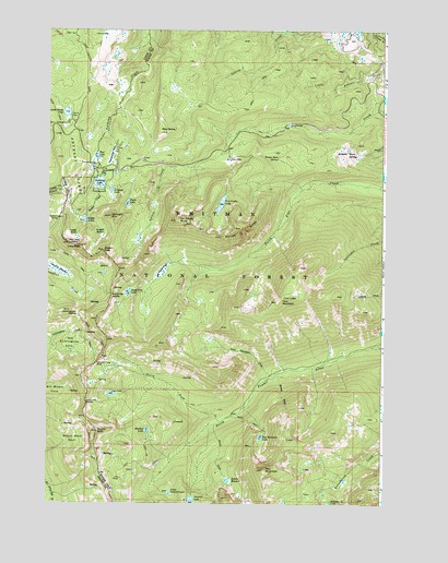
Anthony Lakes, OR USGS Topographic Map
Click on map above to begin viewing in our Map Viewer.

This topographic map contains these locations and features:
Feature Name Type Latitude Longitude GNIS ID View Map
Angell BasinBasinN44.9454°W118.2297°1116950View Map
Angell PeakSummitN44.9415°W118.2294°1116951View Map
Anthony LakeLakeN44.9596°W118.2314°1117008View Map
Anthony Lake CampgroundLocaleN44.9591°W118.2294°2700179View Map
Anthony LakesLakeN44.9596°W118.2314°1117009View Map
Anthony Lakes Forest Service StationLocaleN44.9632°W118.2336°1167256View Map
Anthony Lakes Shoreline Recreation SiteLocaleN44.9629°W118.2302°1167255View Map
Anthony Lakes Sno-ParkLocaleN44.9640°W118.2352°1131976View Map
Antone BurnAreaN44.9679°W118.1399°1116629View Map
Antone ButteSummitN44.9671°W118.1397°1136007View Map
Bear ButteSummitN44.9729°W118.2074°1117344View Map
Black LakeLakeN44.9541°W118.2207°1117761View Map
Bobier MeadowFlatN44.8813°W118.1822°1117890View Map
Bobier SlideValleyN44.9096°W118.1636°1117891View Map
Brown Bear SpringSpringN44.9665°W118.1653°1118121View Map
Crawfish MeadowFlatN44.9362°W118.2469°1140409View Map
Cunningham CoveBasinN44.9179°W118.2413°1119625View Map
Cunningham SaddleGapN44.9251°W118.2388°1119627View Map
Dutch FlatFlatN44.9365°W118.2066°1120231View Map
Dutch Flat LakeLakeN44.9306°W118.2203°1120234View Map
Dutch Flat SaddleGapN44.9296°W118.2266°1120235View Map
Floodwater FlatsFlatN44.9671°W118.2252°1120840View Map
Grande Ronde LakeLakeN44.9780°W118.2436°1121289View Map
Grande Ronde Lake Campground Boat RampLocaleN44.9774°W118.2423°2700344View Map
Grande Ronde Lake Recreation SiteLocaleN44.9754°W118.2436°1167258View Map
Gunsight MountainSummitN44.9507°W118.2272°1121490View Map
Hoffer ButteSummitN44.9462°W118.2391°1136383View Map
Hoffer LakesLakeN44.9494°W118.2361°1121866View Map
Horse CreekStreamN44.8957°W118.1872°1121993View Map
Killamacue DamDamN44.8752°W118.1462°1133574View Map
Lees PeakSummitN44.9429°W118.2377°1123029View Map
Lilypad LakeLakeN44.9575°W118.2269°1123084View Map
Little AlpsPopulated PlaceN44.9657°W118.1830°1136483View Map
Little Summit LakeSwampN44.8778°W118.2045°1123294View Map
Lost LakeLakeN44.9038°W118.2262°1123509View Map
Lost Lake SaddleGapN44.9013°W118.2352°1123513View Map
Loy MineMineN44.8818°W118.2222°1123600View Map
Meadow LakeLakeN44.8943°W118.2127°1124029View Map
Mount RuthSummitN44.8940°W118.2311°1126378View Map
Mount Ruth CoveBasinN44.8935°W118.2399°1124409View Map
Mud LakeLakeN44.9666°W118.2324°1124462View Map
Mud Lake Recreation SiteLocaleN44.9651°W118.2333°1167257View Map
Nip and Tuck PassGapN44.9118°W118.2316°1124694View Map
North Fork North Powder RiverStreamN44.8965°W118.1855°1124793View Map
Parker CreekStreamN44.9579°W118.2322°1125185View Map
Red MountainSummitN44.8838°W118.1691°1125889View Map
Red Mountain LakeLakeN44.8926°W118.1705°1125892View Map
Station SpringSpringN44.9596°W118.2358°1131973View Map
Summit LakeLakeN44.8753°W118.1960°1127716View Map
The Lakes LookoutSummitN44.9435°W118.2424°1127978View Map
The Lakes Lookout SpringSpringN44.9494°W118.2484°1127979View Map
Tumbledown CreekStreamN44.9582°W118.2327°1131975View Map
Tumbledown SpringSpringN44.9574°W118.2419°1131974View Map
Twin MountainSummitN44.9282°W118.1644°1128355View Map
Twin Mountain CreekStreamN44.9085°W118.1655°1128356View Map
Van Patten ButteSummitN44.9496°W118.2022°1128507View Map
Van Patten LakeLakeN44.9542°W118.1859°1128508View Map
Van Patten Lake DamDamN44.9568°W118.1843°1131374View Map
Van Patten RidgeRidgeN44.9476°W118.1799°1128509View Map

Note: Coordinates in the location and feature list above are referenced to NAD83 datum.


Copyright (C) 2008-2024 Ryan Niemi / Sunset Dynamics ... All Rights Reserved