TopoQuest Logo
Do you find TopoQuest useful?
Help keep TopoQuest running and adding new maps/features by donating!
Bitcoin:  19c7KJd3qBynnjoSw5npx9KScwjBe4ifkT
Litecoin:  LXs6TkuXGGXo1vDsWCkWVdjQX94eUKd6ui
Home View Maps Find Maps Find Places Resources & Links


Delta, Utah Topographic Map

USGS Map Title: Delta, UT
USGS Map MRC: 39112C5
DRG (GeoTIFF) Download: o39112c5.tif


Neighboring USGS Topographic Map Quads:


  Sutherland, UT  
39112D6
 

  Delta NE, UT  
39112D5
 

  Strong, UT  
39112D4
 

  Hinckley, UT  
39112C6
 

  Delta, UT  
39112C5
 

  Harding, UT  
39112C4
 

  Sunstone Knoll, UT  
39112B6
 

  Pahvant Butte North, UT  
39112B5
 

  McCornick, UT  
39112B4


Map MRC Location:

N40°
W113°
N40°
W112°
H8 H7 H6 H5 H4 H3 H2 H1
G8 G7 G6 G5 G4 G3 G2 G1
F8 F7 F6 F5 F4 F3 F2 F1
E8 E7 E6 E5 E4 E3 E2 E1
D8 D7 D6 D5 D4 D3 D2 D1
C8 C7 C6 C5 C4 C3 C2 C1
B8 B7 B6 B5 B4 B3 B2 B1
A8 A7 A6 A5 A4 A3 A2 A1
N39°
W113°
N39°
W112°

Delta, UT USGS 1:24K Topographic Map Preview:
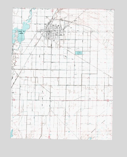
Delta, UT USGS Topographic Map
Click on map above to begin viewing in our Map Viewer.

This topographic map contains these locations and features:
Feature Name Type Latitude Longitude GNIS ID View Map
Canal CCanalN39.3633°W112.5611°1450277View Map
City of DeltaCivilN39.3540°W112.5723°2410320View Map
DeltaPopulated PlaceN39.3522°W112.5772°1427334View Map
Delta City CemeteryCemeteryN39.3645°W112.5659°1435404View Map
Delta Community Medical CenterHospitalN39.3501°W112.5611°1435405View Map
Delta Community Presbyterian ChurchChurchN39.3502°W112.5791°1455596View Map
Delta DivisionCivilN39.3429°W112.5426°1939357View Map
Delta Early Childhood CenterSchoolN39.3443°W112.5746°1435410View Map
Delta Fire DepartmentBuildingN39.3531°W112.5795°2627329View Map
Delta High SchoolSchoolN39.3584°W112.5758°1435407View Map
Delta Middle SchoolSchoolN39.3583°W112.5688°1435408View Map
Delta North Elementary SchoolSchoolN39.3535°W112.5720°1435409View Map
Delta Post OfficePost OfficeN39.3511°W112.5685°1455236View Map
Eliason Jensen DitchCanalN39.2927°W112.5877°1427793View Map
Grace Baptist ChurchChurchN39.3513°W112.5752°1436722View Map
Gunnison Bend DamDamN39.3400°W112.6141°1434737View Map
Gunnison Bend ReservoirReservoirN39.3502°W112.6178°1434736View Map
Jones DitchCanalN39.3558°W112.5508°1429235View Map
KNAK-AM (Delta)TowerN39.3366°W112.5566°1455733View Map
Lyman DitchCanalN39.3594°W112.5952°1430022View Map
Melville East CanalCanalN39.3436°W112.5774°1430219View Map
Melville West CanalCanalN39.3502°W112.5886°1430220View Map
Millard County Ambulance Service Delta StationBuildingN39.3513°W112.5789°2665411View Map
Millard County Sheriffs Office Delta SubstationBuildingN39.3535°W112.5785°2730412View Map
Oasis CanalCanalN39.3086°W112.6069°1430940View Map
Oasis CemeteryCemeteryN39.3063°W112.6083°1436063View Map
South Track CanalCanalN39.3158°W112.5494°1432766View Map
Stewart DitchCanalN39.3466°W112.5391°1432977View Map
Styler DitchCanalN39.2869°W112.6086°1433023View Map
Terry DitchCanalN39.3741°W112.5863°1433242View Map
The Church of Jesus Christ of Latter Day SaintsChurchN39.3494°W112.5813°1436887View Map
The Church of Jesus Christ of Latter Day SaintsChurchN39.3561°W112.5799°1436888View Map
The Church of Jesus Christ of Latter Day SaintsChurchN39.3536°W112.5744°1436889View Map
The Church of Jesus Christ of Latter Day SaintsChurchN39.3683°W112.5955°1437084View Map
Town DitchCanalN39.3025°W112.6224°1433613View Map
Water of Life Lutheran ChurchChurchN39.3511°W112.5852°1436795View Map

Note: Coordinates in the location and feature list above are referenced to NAD83 datum.


Copyright (C) 2008-2024 Ryan Niemi / Sunset Dynamics ... All Rights Reserved