TopoQuest Logo
Do you find TopoQuest useful?
Help keep TopoQuest running and adding new maps/features by donating!
Bitcoin:  19c7KJd3qBynnjoSw5npx9KScwjBe4ifkT
Litecoin:  LXs6TkuXGGXo1vDsWCkWVdjQX94eUKd6ui
Home View Maps Find Maps Find Places Resources & Links


Desert Well, Arizona Topographic Map

USGS Map Title: Desert Well, AZ
USGS Map MRC: 33111C5
DRG (GeoTIFF) Download: o33111c5.tif


Neighboring USGS Topographic Map Quads:


  Buckhorn, AZ  
33111D6
 

  Apache Junction, AZ  
33111D5
 

  Goldfield, AZ  
33111D4
 

  Higley, AZ  
33111C6
 

  Desert Well, AZ  
33111C5
 

  Superstition Mountains SW, AZ  
33111C4
 

  Chandler Heights, AZ  
33111B6
 

  Sacaton NE, AZ  
33111B5
 

  Magma, AZ  
33111B4


Map MRC Location:

N34°
W112°
N34°
W111°
H8 H7 H6 H5 H4 H3 H2 H1
G8 G7 G6 G5 G4 G3 G2 G1
F8 F7 F6 F5 F4 F3 F2 F1
E8 E7 E6 E5 E4 E3 E2 E1
D8 D7 D6 D5 D4 D3 D2 D1
C8 C7 C6 C5 C4 C3 C2 C1
B8 B7 B6 B5 B4 B3 B2 B1
A8 A7 A6 A5 A4 A3 A2 A1
N33°
W112°
N33°
W111°

Desert Well, AZ USGS 1:24K Topographic Map Preview:
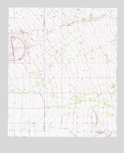
Desert Well, AZ USGS Topographic Map
Click on map above to begin viewing in our Map Viewer.

This topographic map contains these locations and features:
Feature Name Type Latitude Longitude GNIS ID View Map
Anderson RanchLocaleN33.3501°W111.6096°640View Map
Apache Junction LandfillLocaleN33.3673°W111.5310°2671954View Map
Apache Junction Wastewater Treatment PlantLocaleN33.3619°W111.5580°2669602View Map
Apache Sun Golf ClubLocaleN33.2608°W111.5570°2670110View Map
Benjamin Franklin Charter School - Queen CreekSchoolN33.2597°W111.6167°2517499View Map
Cimmaron Trails Mobile Home ParkPopulated PlaceN33.2761°W111.5609°2670192View Map
Combs High SchoolSchoolN33.2768°W111.5396°2544928View Map
Desert Proving GroundsLocaleN33.3356°W111.6201°14404View Map
Desert Ridge High SchoolSchoolN33.3701°W111.6173°2517742View Map
Desert Ridge Junior High SchoolSchoolN33.3705°W111.6126°2517743View Map
Desert WellWellN33.3517°W111.6090°3874View Map
Hawk RockPillarN33.3664°W111.5743°5630View Map
Jack Barnes Elementary SchoolSchoolN33.2611°W111.6234°2517783View Map
Los Hermanos Mobile Home ParkPopulated PlaceN33.2728°W111.5585°2670396View Map
Meridian Elementary SchoolSchoolN33.3435°W111.5932°2517751View Map
Mesa Fire Department Station 219BuildingN33.3534°W111.6004°2775461View Map
Pleasant Valley Mobile Home ParkPopulated PlaceN33.2762°W111.5579°2669831View Map
Powerline DamDamN33.3650°W111.5490°23782View Map
Ranch Elementary SchoolSchoolN33.2743°W111.5448°2544919View Map
Rittenhouse DamDamN33.2717°W111.5007°23791View Map
Siphon DrawValleyN33.3520°W111.5743°34467View Map
The Church of Jesus Christ of Latter Day SaintsChurchN33.3540°W111.6019°2671889View Map
Vineyard Road DamDamN33.3217°W111.5290°23839View Map
Weekes WashStreamN33.3617°W111.5485°35944View Map
Womack Airport (historical)AirportN33.3695°W111.5704°45300View Map
Womack Airstrip (historical)AirportN33.3700°W111.5701°23847View Map

Note: Coordinates in the location and feature list above are referenced to NAD83 datum.


Copyright (C) 2008-2025 Ryan Niemi / Sunset Dynamics ... All Rights Reserved