TopoQuest Logo
Do you find TopoQuest useful?
Help keep TopoQuest running and adding new maps/features by donating!
Bitcoin:  19c7KJd3qBynnjoSw5npx9KScwjBe4ifkT
Litecoin:  LXs6TkuXGGXo1vDsWCkWVdjQX94eUKd6ui
Home View Maps Find Maps Find Places Resources & Links


Devil Mountain, Colorado Topographic Map

USGS Map Title: Devil Mountain, CO
USGS Map MRC: 37107C3
DRG (GeoTIFF) Download: o37107c3.tif


Neighboring USGS Topographic Map Quads:


  Granite Peak, CO  
37107D4
 

  Bear Mountain, CO  
37107D3
 

  Oakbrush Ridge, CO  
37107D2
 

  Baldy Mountain, CO  
37107C4
 

  Devil Mountain, CO  
37107C3
 

  Chris Mountain, CO  
37107C2
 

  Pargin Mountain, CO  
37107B4
 

  Chimney Rock, CO  
37107B3
 

  Lonetree Canyon, CO  
37107B2


Map MRC Location:

N38°
W108°
N38°
W107°
H8 H7 H6 H5 H4 H3 H2 H1
G8 G7 G6 G5 G4 G3 G2 G1
F8 F7 F6 F5 F4 F3 F2 F1
E8 E7 E6 E5 E4 E3 E2 E1
D8 D7 D6 D5 D4 D3 D2 D1
C8 C7 C6 C5 C4 C3 C2 C1
B8 B7 B6 B5 B4 B3 B2 B1
A8 A7 A6 A5 A4 A3 A2 A1
N37°
W108°
N37°
W107°

Devil Mountain, CO USGS 1:24K Topographic Map Preview:
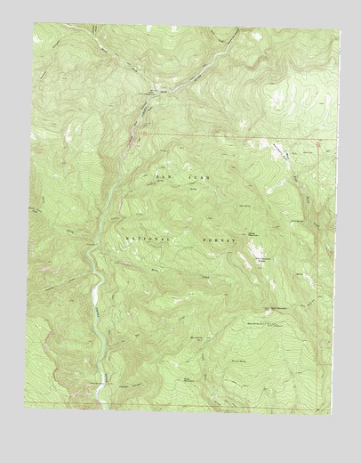
Devil Mountain, CO USGS Topographic Map
Click on map above to begin viewing in our Map Viewer.

This topographic map contains these locations and features:
Feature Name Type Latitude Longitude GNIS ID View Map
Coffee CreekStreamN37.3119°W107.3448°184289View Map
Coldwater CreekStreamN37.3706°W107.3503°184039View Map
Cooper CanyonValleyN37.2536°W107.3430°184287View Map
Davis CreekStreamN37.3700°W107.2950°184071View Map
Death Valley CreekStreamN37.3128°W107.3692°184226View Map
Devil MountainSummitN37.2842°W107.2762°184302View Map
Devil Mountain TrailTrailN37.3139°W107.2834°202994View Map
Dudley CreekStreamN37.3208°W107.3414°184290View Map
Elk CreekStreamN37.2708°W107.3431°184286View Map
Farrow SpringSpringN37.2669°W107.2913°184295View Map
First Box CanyonValleyN37.3309°W107.3387°184291View Map
First Fork Hunter campgroundLocaleN37.3561°W107.3267°196989View Map
First Fork Piedra RiverStreamN37.3536°W107.3248°184042View Map
First Fork TrailheadLocaleN37.3539°W107.3253°196995View Map
Ford SpringSpringN37.3125°W107.2687°184299View Map
Horse CreekStreamN37.3028°W107.3470°184285View Map
Horse MountainSummitN37.3083°W107.2867°184298View Map
Horse Mountain SpringsSpringN37.3008°W107.2812°184297View Map
Indian CreekStreamN37.2950°W107.3478°184227View Map
Johnny CanyonValleyN37.3728°W107.3540°184224View Map
Mesa Spring Hunter CampgroundLocaleN37.2797°W107.2778°184301View Map
Mesa Spring Number 1SpringN37.2739°W107.3033°184294View Map
Mesa Spring Number 2SpringN37.2798°W107.2789°184296View Map
Monument ParkFlatN37.3353°W107.2742°184303View Map
Mule MountainSummitN37.2597°W107.3117°184292View Map
Piedra Hunter CampgroundLocaleN37.3522°W107.3253°196990View Map
Piedra River Hot SpringsSpringN37.3119°W107.3553°1735256View Map
Second Box CanyonValleyN37.3694°W107.2948°184070View Map
Sheep CreekStreamN37.3050°W107.3475°184225View Map
Tres Piedras RanchLocaleN37.2583°W107.3428°184293View Map

Note: Coordinates in the location and feature list above are referenced to NAD83 datum.


Copyright (C) 2008-2025 Ryan Niemi / Sunset Dynamics ... All Rights Reserved