TopoQuest Logo
Do you find TopoQuest useful?
Help keep TopoQuest running and adding new maps/features by donating!
Bitcoin:  19c7KJd3qBynnjoSw5npx9KScwjBe4ifkT
Litecoin:  LXs6TkuXGGXo1vDsWCkWVdjQX94eUKd6ui
Home View Maps Find Maps Find Places Resources & Links


Diamond S Ranch, Texas Topographic Map

USGS Map Title: Diamond S Ranch, TX
USGS Map MRC: 29099H4
DRG (GeoTIFF) Download: o29099h4.tif


Neighboring USGS Topographic Map Quads:


  Boneyard Draw, TX  
30099A5
 

  Bee Caves Creek, TX  
30099A4
 

  Hunt, TX  
30099A3
 

  Well Hollow, TX  
29099H5
 

  Diamond S Ranch, TX  
29099H4
 

  Echo Hill Ranch, TX  
29099H3
 

  Sabinal Canyon, TX  
29099G5
 

  Love Creek, TX  
29099G4
 

  A Bar A Ranch, TX  
29099G3


Map MRC Location:

N30°
W100°
N30°
W99°
H8 H7 H6 H5 H4 H3 H2 H1
G8 G7 G6 G5 G4 G3 G2 G1
F8 F7 F6 F5 F4 F3 F2 F1
E8 E7 E6 E5 E4 E3 E2 E1
D8 D7 D6 D5 D4 D3 D2 D1
C8 C7 C6 C5 C4 C3 C2 C1
B8 B7 B6 B5 B4 B3 B2 B1
A8 A7 A6 A5 A4 A3 A2 A1
N29°
W100°
N29°
W99°

Diamond S Ranch, TX USGS 1:24K Topographic Map Preview:
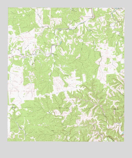
Diamond S Ranch, TX USGS Topographic Map
Click on map above to begin viewing in our Map Viewer.

This topographic map contains these locations and features:
Feature Name Type Latitude Longitude GNIS ID View Map
Bee BluffCliffN29.9488°W99.4723°1330298View Map
Buffalo CreekStreamN29.9991°W99.3834°1331558View Map
Coal CreekStreamN29.8763°W99.3925°1333024View Map
Diamond S RanchLocaleN29.9560°W99.4520°1334333View Map
Fisher RanchLocaleN29.9408°W99.3803°1335833View Map
Frank Baker CreekStreamN29.9838°W99.4184°1336147View Map
Green SpringSpringN29.9371°W99.4398°1336941View Map
Little Brewington CreekStreamN29.9038°W99.3753°1340029View Map
Lynhaven LodgeLocaleN29.9794°W99.4434°1340758View Map
Lynx Haven SpringsSpringN29.9919°W99.4587°1998497View Map
Mullen CreekStreamN29.9577°W99.4537°1342263View Map
Reed RanchLocaleN29.8919°W99.3817°1344999View Map
South Fork RanchLocaleN29.9560°W99.4837°1347457View Map
Spur BranchStreamN29.9877°W99.4173°1347767View Map
Sycamore DrawValleyN29.9805°W99.4478°1348173View Map
Whitworth RanchLocaleN29.9569°W99.4745°1350033View Map

Note: Coordinates in the location and feature list above are referenced to NAD83 datum.


Copyright (C) 2008-2025 Ryan Niemi / Sunset Dynamics ... All Rights Reserved