TopoQuest Logo
Do you find TopoQuest useful?
Help keep TopoQuest running and adding new maps/features by donating!
Bitcoin:  19c7KJd3qBynnjoSw5npx9KScwjBe4ifkT
Litecoin:  LXs6TkuXGGXo1vDsWCkWVdjQX94eUKd6ui
Home View Maps Find Maps Find Places Resources & Links


Dighton, Kansas Topographic Map

USGS Map Title: Dighton, KS
USGS Map MRC: 38100D4
DRG (GeoTIFF) Download: o38100d4.tif


Neighboring USGS Topographic Map Quads:


  Healy, KS  
38100E5
 

  Shields, KS  
38100E4
 

  Shields SE, KS  
38100E3
 

  Amy, KS  
38100D5
 

  Dighton, KS  
38100D4
 

  Alamota, KS  
38100D3
 

  Amy SE, KS  
38100C5
 

  Dighton SW, KS  
38100C4
 

  Dighton SE, KS  
38100C3


Map MRC Location:

N39°
W101°
N39°
W100°
H8 H7 H6 H5 H4 H3 H2 H1
G8 G7 G6 G5 G4 G3 G2 G1
F8 F7 F6 F5 F4 F3 F2 F1
E8 E7 E6 E5 E4 E3 E2 E1
D8 D7 D6 D5 D4 D3 D2 D1
C8 C7 C6 C5 C4 C3 C2 C1
B8 B7 B6 B5 B4 B3 B2 B1
A8 A7 A6 A5 A4 A3 A2 A1
N38°
W101°
N38°
W100°

Dighton, KS USGS 1:24K Topographic Map Preview:
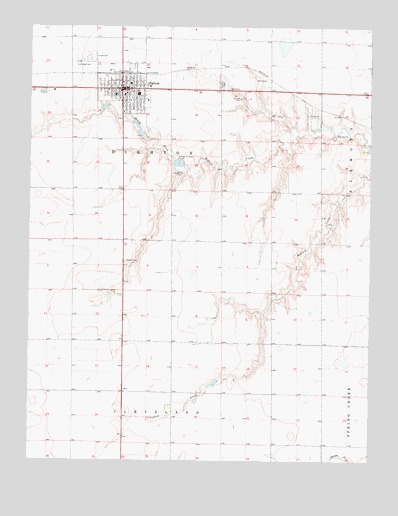
Dighton, KS USGS Topographic Map
Click on map above to begin viewing in our Map Viewer.

This topographic map contains these locations and features:
Feature Name Type Latitude Longitude GNIS ID View Map
Bible Fellowship ChurchChurchN38.4886°W100.4663°2688827View Map
City of DightonCivilN38.4811°W100.4664°2394534View Map
DightonPopulated PlaceN38.4820°W100.4671°471515View Map
Dighton AirportAirportN38.4898°W100.4808°481422View Map
Dighton CemeteryCemeteryN38.4834°W100.4301°471516View Map
Dighton City HallBuildingN38.4822°W100.4657°2693122View Map
Dighton City Police DepartmentBuildingN38.4813°W100.4652°2754334View Map
Dighton Elementary SchoolSchoolN38.4836°W100.4639°480726View Map
Dighton Fire Station Number 1BuildingN38.4823°W100.4685°2111261View Map
Dighton Junior / Senior High SchoolSchoolN38.4806°W100.4608°480728View Map
Dighton Post OfficePost OfficeN38.4808°W100.4658°2693691View Map
Dighton United Methodist ChurchChurchN38.4802°W100.4658°2689393View Map
Dighton Wastewater Treatment FacilityLocaleN38.4606°W100.4461°2691925View Map
First Baptist ChurchChurchN38.4844°W100.4679°2688953View Map
First Christian ChurchChurchN38.4808°W100.4649°2688988View Map
Lane CountyCivilN38.4813°W100.4664°485015View Map
Lane County Country ClubLocaleN38.4846°W100.4165°2694579View Map
Lane County CourthouseBuildingN38.4813°W100.4652°2625133View Map
Lane County Emergency Medical ServicesBuildingN38.4817°W100.4718°2696474View Map
Lane County FairgroundsLocaleN38.4914°W100.4783°2692962View Map
Lane County Health DepartmentBuildingN38.4823°W100.4676°2695026View Map
Lane County Historical MuseumBuildingN38.4850°W100.4672°2694937View Map
Lane County HospitalHospitalN38.4804°W100.4691°2499125View Map
Lane County JailBuildingN38.4813°W100.4652°2504314View Map
Lane County LibraryBuildingN38.4813°W100.4654°2694657View Map
Lane County Public WorksBuildingN38.4927°W100.4796°2693303View Map
Lane County Rural Fire Department 1BuildingN38.4823°W100.4686°2111504View Map
Lane County Sheriff's OfficeBuildingN38.4813°W100.4652°2503816View Map
Lincoln Grade SchoolSchoolN38.4787°W100.4578°480727View Map
Saint Theresa Catholic ChurchChurchN38.4793°W100.4677°2689198View Map

Note: Coordinates in the location and feature list above are referenced to NAD83 datum.


Copyright (C) 2008-2024 Ryan Niemi / Sunset Dynamics ... All Rights Reserved