TopoQuest Logo
Do you find TopoQuest useful?
Help keep TopoQuest running and adding new maps/features by donating!
Bitcoin:  19c7KJd3qBynnjoSw5npx9KScwjBe4ifkT
Litecoin:  LXs6TkuXGGXo1vDsWCkWVdjQX94eUKd6ui
Home View Maps Find Maps Find Places Resources & Links


Dillon Mountain, California Topographic Map

USGS Map Title: Dillon Mountain, CA
USGS Map MRC: 41123E5
DRG (GeoTIFF) Download: o41123e5.tif


Neighboring USGS Topographic Map Quads:


  Prescott Mountain, CA  
41123F6
 

  Bear Peak, CA  
41123F5
 

  Clear Creek, CA  
41123F4
 

  Chimney Rock, CA  
41123E6
 

  Dillon Mountain, CA  
41123E5
 

  Ukonom Mountain, CA  
41123E4
 

  Lonesome Ridge, CA  
41123D6
 

  Bark Shanty Gulch, CA  
41123D5
 

  Somes Bar, CA  
41123D4


Map MRC Location:

N42°
W124°
N42°
W123°
H8 H7 H6 H5 H4 H3 H2 H1
G8 G7 G6 G5 G4 G3 G2 G1
F8 F7 F6 F5 F4 F3 F2 F1
E8 E7 E6 E5 E4 E3 E2 E1
D8 D7 D6 D5 D4 D3 D2 D1
C8 C7 C6 C5 C4 C3 C2 C1
B8 B7 B6 B5 B4 B3 B2 B1
A8 A7 A6 A5 A4 A3 A2 A1
N41°
W124°
N41°
W123°

Dillon Mountain, CA USGS 1:24K Topographic Map Preview:
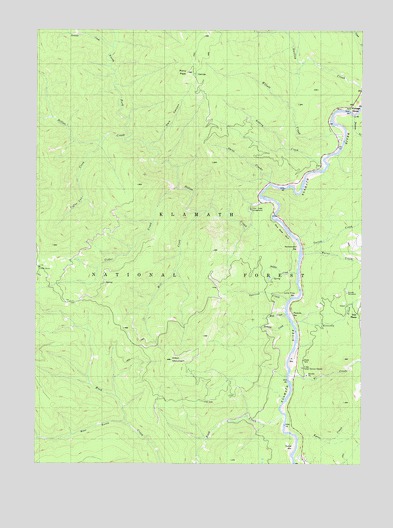
Dillon Mountain, CA USGS Topographic Map
Click on map above to begin viewing in our Map Viewer.

This topographic map contains these locations and features:
Feature Name Type Latitude Longitude GNIS ID View Map
Aubrey CreekStreamN41.5865°W123.5159°256373View Map
Bear GulchValleyN41.5118°W123.5920°277217View Map
Blue Nose BluffCliffN41.5673°W123.5323°257268View Map
Blue Nose MineMineN41.5657°W123.5239°257269View Map
Burns CreekStreamN41.5601°W123.5245°257716View Map
Carter CreekStreamN41.5621°W123.5245°258014View Map
Cedar CreekStreamN41.5793°W123.5726°220765View Map
Coffee Can CreekStreamN41.5923°W123.6028°258509View Map
Cottage GrovePopulated PlaceN41.6026°W123.5056°1655928View Map
Dark CanyonValleyN41.5923°W123.5823°259055View Map
Dillion Creek CampgroundLocaleN41.5735°W123.5431°277193View Map
Dillon CreekStreamN41.5765°W123.5381°259372View Map
Dillon MountainSummitN41.5301°W123.5745°259374View Map
Dobbins CreekStreamN41.5398°W123.5278°259416View Map
Elliott CreekStreamN41.5976°W123.5120°259872View Map
Eyese BarBarN41.5051°W123.5267°260015View Map
Eyese Bar (historical)Populated PlaceN41.5040°W123.5287°1682300View Map
Eyese CreekStreamN41.5073°W123.5256°277196View Map
Iron PhoneLocaleN41.5423°W123.5042°277194View Map
Jackass CreekStreamN41.6198°W123.5984°261858View Map
Kennedy CreekStreamN41.5410°W123.5278°262132View Map
Kennedy HomesteadLocaleN41.5496°W123.5073°262133View Map
Lone Pine BarBarN41.5490°W123.5253°262799View Map
Mill CreekStreamN41.5726°W123.5615°263590View Map
Mud CreekStreamN41.5432°W123.5309°263922View Map
North Fork Dillon CreekStreamN41.5929°W123.5928°264156View Map
Patsiluvra (historical)Populated PlaceN41.5451°W123.5287°1670697View Map
Persido BarBarN41.5435°W123.5295°264659View Map
Pony PeakSummitN41.6126°W123.5692°264937View Map
Rattlesnake BarBarN41.5615°W123.5259°265194View Map
Rock CreekStreamN41.5120°W123.5306°265495View Map
Soldier CreekStreamN41.5546°W123.5262°267380View Map
Squirrel CreekStreamN41.5473°W123.5295°267645View Map
Swillup CreekStreamN41.6090°W123.5012°235907View Map
Thomas CreekStreamN41.6004°W123.5045°268228View Map
Three CreeksStreamN41.5807°W123.5364°268251View Map
Ti BarBarN41.5296°W123.5287°268268View Map
Ti Bar Forest Service StationLocaleN41.5276°W123.5245°277195View Map
Ti Bar SchoolSchoolN41.5240°W123.5284°268269View Map
Ti CreekStreamN41.5254°W123.5289°268270View Map

Note: Coordinates in the location and feature list above are referenced to NAD83 datum.


Copyright (C) 2008-2024 Ryan Niemi / Sunset Dynamics ... All Rights Reserved