TopoQuest Logo
Do you find TopoQuest useful?
Help keep TopoQuest running and adding new maps/features by donating!
Bitcoin:  19c7KJd3qBynnjoSw5npx9KScwjBe4ifkT
Litecoin:  LXs6TkuXGGXo1vDsWCkWVdjQX94eUKd6ui
Home View Maps Find Maps Find Places Resources & Links


Dilworth, Minnesota Topographic Map

USGS Map Title: Dilworth, MN
USGS Map MRC: 46096H6
DRG (GeoTIFF) Download: o46096h6.tif


Neighboring USGS Topographic Map Quads:


  Georgetown, MN  
47096A7
 

  Felton SW, MN  
47096A6
 

  Felton, MN  
47096A5
 

  Fargo North, ND  
46096H7
 

  Dilworth, MN  
46096H6
 

  Glyndon North, MN  
46096H5
 

  Fargo South, ND  
46096G7
 

  Sabin, MN  
46096G6
 

  Glyndon South, MN  
46096G5


Map MRC Location:

N47°
W97°
N47°
W96°
H8 H7 H6 H5 H4 H3 H2 H1
G8 G7 G6 G5 G4 G3 G2 G1
F8 F7 F6 F5 F4 F3 F2 F1
E8 E7 E6 E5 E4 E3 E2 E1
D8 D7 D6 D5 D4 D3 D2 D1
C8 C7 C6 C5 C4 C3 C2 C1
B8 B7 B6 B5 B4 B3 B2 B1
A8 A7 A6 A5 A4 A3 A2 A1
N46°
W97°
N46°
W96°

Dilworth, MN USGS 1:24K Topographic Map Preview:
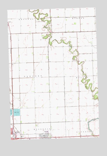
Dilworth, MN USGS Topographic Map
Click on map above to begin viewing in our Map Viewer.

This topographic map contains these locations and features:
Feature Name Type Latitude Longitude GNIS ID View Map
Apostolic Bible ChurchChurchN46.8808°W96.7497°2080816View Map
Arrowhead ParkParkN46.8817°W96.7394°2080983View Map
Believer's Fellowship ChurchChurchN46.8800°W96.7450°2080824View Map
Belmont Baptist ChurchChurchN46.8808°W96.7433°2080825View Map
Birch Tree ParkParkN46.8797°W96.7108°2081063View Map
Bulane ParkParkN46.8892°W96.7497°2080990View Map
Centennial ParkParkN46.8917°W96.7431°2080987View Map
City of DilworthCivilN46.8795°W96.6985°2394536View Map
Concordia ChurchChurchN46.9627°W96.6601°641436View Map
Constitution ParkParkN46.8772°W96.7139°2081059View Map
County Ditch Number FiftyCanalN46.8800°W96.7201°642166View Map
County Ditch Number FortyoneCanalN46.8805°W96.7373°642081View Map
County Ditch Number ThirtyfiveCanalN46.9202°W96.6726°641993View Map
County Ditch Number ThirtyfiveCanalN46.9533°W96.6937°641994View Map
DilworthPopulated PlaceN46.8766°W96.7034°642816View Map
Dilworth City DepotBuildingN46.8769°W96.6956°2081055View Map
Dilworth City HallBuildingN46.8761°W96.7028°2081051View Map
Dilworth Community HallBuildingN46.8781°W96.7136°2081048View Map
Dilworth Fire DepartmentBuildingN46.8779°W96.7136°2081052View Map
Dilworth Glyndon Felton SchoolsSchoolN46.8781°W96.7033°2081060View Map
Dilworth Lutheran ChurchChurchN46.8806°W96.7003°2081058View Map
Dilworth Police DepartmentBuildingN46.8760°W96.7100°2081050View Map
Dilworth Post OfficePost OfficeN46.8756°W96.7028°2081049View Map
Dilworth Presbyterian ChurchChurchN46.8761°W96.7058°2081057View Map
Dilworth Trailer ParkPopulated PlaceN46.8792°W96.6944°2081053View Map
Easten MallLocaleN46.8778°W96.7167°2081061View Map
Faith Mennonite ChurchChurchN46.9317°W96.7497°2080814View Map
Jerger's FieldAirportN46.9209°W96.7165°660303View Map
Moorhead Health Care CenterHospitalN46.8778°W96.7347°2080834View Map
Moorhead Softball DiamondsParkN46.8889°W96.7375°2080986View Map
Northeast ParkParkN46.8833°W96.7497°2080989View Map
Park Lane Mobile Home ParkPopulated PlaceN46.8786°W96.6944°2081054View Map
Saint Elizabeth ChurchChurchN46.8789°W96.7022°2081056View Map
Township of OakportCivilN46.9416°W96.7251°665193View Map
Walnut ParkParkN46.8817°W96.7108°2081062View Map
Whistle Stop ParkParkN46.8767°W96.6969°2081064View Map

Note: Coordinates in the location and feature list above are referenced to NAD83 datum.


Copyright (C) 2008-2024 Ryan Niemi / Sunset Dynamics ... All Rights Reserved