TopoQuest Logo
Do you find TopoQuest useful?
Help keep TopoQuest running and adding new maps/features by donating!
Bitcoin:  19c7KJd3qBynnjoSw5npx9KScwjBe4ifkT
Litecoin:  LXs6TkuXGGXo1vDsWCkWVdjQX94eUKd6ui
Home View Maps Find Maps Find Places Resources & Links


Dobson, North Carolina Topographic Map

USGS Map Title: Dobson, NC
USGS Map MRC: 36080D6
DRG (GeoTIFF) Download: o36080d6.tif


Neighboring USGS Topographic Map Quads:


  Lambsburg, VA  
36080E7
 

  Cana, VA  
36080E6
 

  Mount Airy North, NC  
36080E5
 

  Bottom, NC  
36080D7
 

  Dobson, NC  
36080D6
 

  Mount Airy South, NC  
36080D5
 

  Elkin North, NC  
36080C7
 

  Copeland, NC  
36080C6
 

  Siloam, NC  
36080C5


Map MRC Location:

N37°
W81°
N37°
W80°
H8 H7 H6 H5 H4 H3 H2 H1
G8 G7 G6 G5 G4 G3 G2 G1
F8 F7 F6 F5 F4 F3 F2 F1
E8 E7 E6 E5 E4 E3 E2 E1
D8 D7 D6 D5 D4 D3 D2 D1
C8 C7 C6 C5 C4 C3 C2 C1
B8 B7 B6 B5 B4 B3 B2 B1
A8 A7 A6 A5 A4 A3 A2 A1
N36°
W81°
N36°
W80°

Dobson, NC USGS 1:24K Topographic Map Preview:
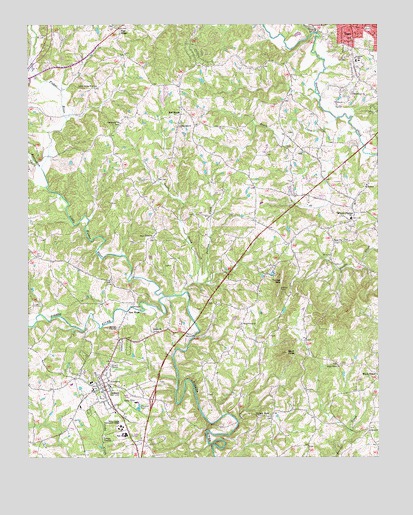
Dobson, NC USGS Topographic Map
Click on map above to begin viewing in our Map Viewer.

This topographic map contains these locations and features:
Feature Name Type Latitude Longitude GNIS ID View Map
Beaverdam CreekStreamN36.4587°W80.7448°980855View Map
Beech CreekStreamN36.4732°W80.6395°980902View Map
Black Water ChurchChurchN36.4015°W80.6395°981549View Map
Blues Grove Baptist ChurchChurchN36.4385°W80.7053°981639View Map
Blues Grove CemeteryCemeteryN36.4382°W80.7053°1731529View Map
Bunker HomesiteParkN36.4532°W80.6290°1001972View Map
Burkes CreekStreamN36.4651°W80.6303°1731542View Map
Central Surry Volunteer Fire Department Station 77 HeadquartersBuildingN36.3860°W80.7153°2639083View Map
Community ChurchChurchN36.4718°W80.7253°1024798View Map
Community ChurchChurchN36.4715°W80.7167°1731550View Map
Cooks CreekStreamN36.4226°W80.6948°983476View Map
DobsonPopulated PlaceN36.3957°W80.7226°984238View Map
Dobson CemeteryCemeteryN36.4115°W80.7045°1731554View Map
Dobson CemeteryCemeteryN36.3985°W80.7251°1731555View Map
Dobson ChurchChurchN36.4118°W80.7051°984239View Map
Dobson Elementary SchoolSchoolN36.3949°W80.7262°1001975View Map
Dobson Fire DepartmentBuildingN36.3970°W80.7241°2638056View Map
Dobson High School (historical)SchoolN36.3951°W80.7259°1731556View Map
Dobson Police DepartmentBuildingN36.3981°W80.7243°2769587View Map
Dobson Post OfficePost OfficeN36.3962°W80.7249°2774186View Map
Dobson Rescue SquadBuildingN36.3788°W80.7080°2720534View Map
Doggett LakeReservoirN36.4972°W80.6534°1000688View Map
Doggett Lake DamDamN36.4968°W80.6531°1000687View Map
Dover ChurchChurchN36.4376°W80.6378°984320View Map
Emmanuel ChurchChurchN36.4801°W80.6337°984777View Map
Fishers River Primitive Baptist Church (historical)ChurchN36.4318°W80.6978°1731565View Map
FranklinPopulated PlaceN36.4893°W80.6337°1731571View Map
Franklin Elementary SchoolSchoolN36.4899°W80.6312°1024825View Map
Hawks LakeReservoirN36.4282°W80.6626°1000619View Map
Hawks Lake DamDamN36.4285°W80.6631°1000618View Map
Holly View Forest-Highland ParkPopulated PlaceN36.4646°W80.6465°1001983View Map
Horns CreekStreamN36.3854°W80.6748°1731585View Map
Jackson CreekStreamN36.4257°W80.6895°987492View Map
Laurel Springs Primitive Baptist ChurchChurchN36.4824°W80.7267°988209View Map
Little Fisher RiverStreamN36.4218°W80.7012°988640View Map
New HopePopulated PlaceN36.4199°W80.7117°1021630View Map
Pickshin Nature CenterBuildingN36.3854°W80.7212°1001995View Map
Pine RidgePopulated PlaceN36.4990°W80.7173°992281View Map
Piney Grove Baptist ChurchChurchN36.4137°W80.6740°992367View Map
Red BrushPopulated PlaceN36.4762°W80.6948°993103View Map
Reeves-Freeman HouseParkN36.3971°W80.7226°1002000View Map
Ring CreekStreamN36.4879°W80.7487°993363View Map
Ross CreekStreamN36.4437°W80.7278°1731650View Map
Stott KnobSummitN36.4054°W80.6578°995591View Map
Surry Central High SchoolSchoolN36.3812°W80.7206°1002004View Map
Surry CountyCivilN36.4148°W80.6881°1008587View Map
Surry County Community CollegeSchoolN36.3840°W80.7167°995721View Map
Surry County CourthouseBuildingN36.3960°W80.7234°1731672View Map
Surry County Emergency Services Station 5BuildingN36.3802°W80.7076°2720392View Map
Surry County Sheriff's OfficeBuildingN36.3975°W80.7229°2769566View Map
Toast Census Designated PlaceCensusN36.4967°W80.6347°2402936View Map
Town of DobsonCivilN36.3921°W80.7254°2406382View Map
Township of DobsonCivilN36.3969°W80.7247°1027211View Map
Turkey FordPopulated PlaceN36.3876°W80.6628°996333View Map
Turkey Ford Baptist ChurchChurchN36.3868°W80.6631°1731675View Map
Turner MountainSummitN36.4237°W80.6601°1023014View Map
Turners CreekStreamN36.4782°W80.6456°1731676View Map
Union CemeteryCemeteryN36.3824°W80.6284°1731677View Map
Union Hill ChurchChurchN36.4712°W80.6956°996503View Map
Union Primitive Baptist ChurchChurchN36.3829°W80.6281°996467View Map
White PlainsPopulated PlaceN36.4457°W80.6334°997194View Map
White Plains Baptist ChurchChurchN36.4537°W80.6290°1731688View Map
White Plains CemeteryCemeteryN36.4537°W80.6298°1731689View Map
White Plains CemeteryCemeteryN36.4479°W80.6326°1731690View Map
White Plains Census Designated PlaceCensusN36.4452°W80.6351°2403023View Map
White Plains Christian AcademySchoolN36.4471°W80.6351°1002011View Map
White Plains Elementary SchoolSchoolN36.4554°W80.6712°1002012View Map
White Plains Friends Meeting HouseChurchN36.4482°W80.6331°1731691View Map
White Plains High School (historical)SchoolN36.4440°W80.6345°1731692View Map
White Plains Post OfficePost OfficeN36.4454°W80.6330°2773962View Map
White Plains Volunteer Fire DepartmentBuildingN36.4449°W80.6344°2639410View Map
WYZD-AM (Dobson)TowerN36.3935°W80.7345°1018565View Map

Note: Coordinates in the location and feature list above are referenced to NAD83 datum.


Copyright (C) 2008-2024 Ryan Niemi / Sunset Dynamics ... All Rights Reserved