TopoQuest Logo
Do you find TopoQuest useful?
Help keep TopoQuest running and adding new maps/features by donating!
Bitcoin:  19c7KJd3qBynnjoSw5npx9KScwjBe4ifkT
Litecoin:  LXs6TkuXGGXo1vDsWCkWVdjQX94eUKd6ui
Home View Maps Find Maps Find Places Resources & Links


Doddridge SE, Arkansas Topographic Map

USGS Map Title: Doddridge SE, AR
USGS Map MRC: 33093A7
DRG (GeoTIFF) Download: o33093a7.tif


Neighboring USGS Topographic Map Quads:


  Doddridge NW, AR  
33093B8
 

  Doddridge NE, AR  
33093B7
 

  Canfield, AR  
33093B6
 

  Doddridge, AR  
33093A8
 

  Doddridge SE, AR  
33093A7
 

  Bradley, AR  
33093A6
 

  Vivian North, LA  
32093H8
 

  Wardview, LA  
32093H7
 

  Plain Dealing, LA  
32093H6


Map MRC Location:

N34°
W94°
N34°
W93°
H8 H7 H6 H5 H4 H3 H2 H1
G8 G7 G6 G5 G4 G3 G2 G1
F8 F7 F6 F5 F4 F3 F2 F1
E8 E7 E6 E5 E4 E3 E2 E1
D8 D7 D6 D5 D4 D3 D2 D1
C8 C7 C6 C5 C4 C3 C2 C1
B8 B7 B6 B5 B4 B3 B2 B1
A8 A7 A6 A5 A4 A3 A2 A1
N33°
W94°
N33°
W93°

Doddridge SE, AR USGS 1:24K Topographic Map Preview:
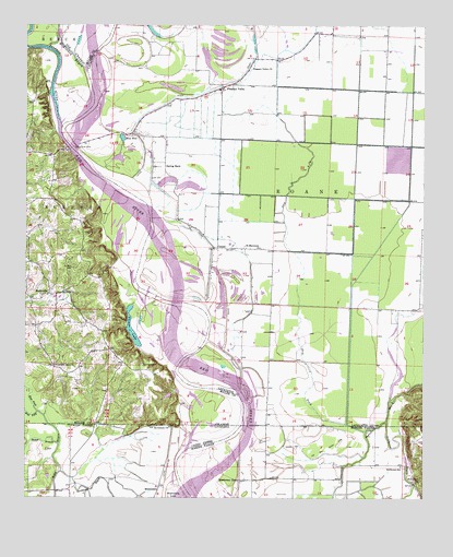
Doddridge SE, AR USGS Topographic Map
Click on map above to begin viewing in our Map Viewer.

This topographic map contains these locations and features:
Feature Name Type Latitude Longitude GNIS ID View Map
Bardstown BayouStreamN33.0071°W93.8635°532313View Map
Bethlehem ChurchChurchN33.0187°W93.8296°532997View Map
Blanton CemeteryCemeteryN33.0357°W93.8382°46714View Map
Blue HoleLakeN33.0954°W93.8449°74679View Map
CanalePopulated PlaceN33.0668°W93.8141°57499View Map
Dry ForkStreamN33.0178°W93.7685°48654View Map
East Fork Kelly BayouStreamN33.0221°W93.8685°48763View Map
Kiblah Oil and Gas FieldOilfieldN33.0432°W93.7957°62481View Map
MissionaryPopulated PlaceN33.0032°W93.8327°1629906View Map
Missionary FerryLocaleN33.0049°W93.8071°537161View Map
Missionary LakeLakeN33.0004°W93.8300°555336View Map
Nance BranchStreamN33.0143°W93.8643°537516View Map
New Hope ChurchChurchN33.0543°W93.8652°52667View Map
New Light ChurchChurchN33.0043°W93.7521°537606View Map
Old Bed Rotten LakeFlatN33.0132°W93.7799°537821View Map
Old Channel McKinney BayouStreamN33.0993°W93.8638°52993View Map
Palmer LakeLakeN33.0425°W93.8408°75067View Map
Pleasant ValleyPopulated PlaceN33.1087°W93.8127°57160View Map
Pleasant Valley ChurchChurchN33.1132°W93.8046°53608View Map
Promised Land ChurchChurchN33.0351°W93.8655°53812View Map
Saint Matthews ChurchChurchN33.0665°W93.8013°54427View Map
SmithvillePopulated PlaceN33.0540°W93.8677°58645View Map
Spring BankLocaleN33.0890°W93.8310°55076View Map
Spring Bank (historical)Populated PlaceN33.0910°W93.8663°63125View Map
Spring Bank FerryLocaleN33.0932°W93.8602°55077View Map
Stillhouse BayouStreamN33.0202°W93.7614°55224View Map
Stillhouse SchoolSchoolN33.0085°W93.7568°539671View Map
Sulphur RiverStreamN33.0935°W93.8616°78492View Map
West Fork Kelly BayouStreamN33.0229°W93.8707°56183View Map

Note: Coordinates in the location and feature list above are referenced to NAD83 datum.


Copyright (C) 2008-2025 Ryan Niemi / Sunset Dynamics ... All Rights Reserved