TopoQuest Logo
Do you find TopoQuest useful?
Help keep TopoQuest running and adding new maps/features by donating!
Bitcoin:  19c7KJd3qBynnjoSw5npx9KScwjBe4ifkT
Litecoin:  LXs6TkuXGGXo1vDsWCkWVdjQX94eUKd6ui
Home View Maps Find Maps Find Places Resources & Links


Dollar Settlement, Michigan Topographic Map

USGS Map Title: Dollar Settlement, MI
USGS Map MRC: 46084D6
DRG (GeoTIFF) Download: o46084d6.tif


Neighboring USGS Topographic Map Quads:


  Pendills Lake, MI  
46084D7
 

  Dollar Settlement, MI  
46084D6
 

  Brimley, MI  
46084D5
 

  Sullivan Creek, MI  
46084C7
 

  Raco, MI  
46084C6
 

  Kinross, MI  
46084C5


Map MRC Location:

N47°
W85°
N47°
W84°
H8 H7 H6 H5 H4 H3 H2 H1
G8 G7 G6 G5 G4 G3 G2 G1
F8 F7 F6 F5 F4 F3 F2 F1
E8 E7 E6 E5 E4 E3 E2 E1
D8 D7 D6 D5 D4 D3 D2 D1
C8 C7 C6 C5 C4 C3 C2 C1
B8 B7 B6 B5 B4 B3 B2 B1
A8 A7 A6 A5 A4 A3 A2 A1
N46°
W85°
N46°
W84°

Dollar Settlement, MI USGS 1:24K Topographic Map Preview:
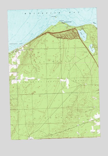
Dollar Settlement, MI USGS Topographic Map
Click on map above to begin viewing in our Map Viewer.

This topographic map contains these locations and features:
Feature Name Type Latitude Longitude GNIS ID View Map
Bay Mills Township Emergency Services FacilityBuildingN46.4853°W84.6713°2627105View Map
Dollar SettlementPopulated PlaceN46.4617°W84.7392°1619735View Map
Dollar Settlement CemeteryCemeteryN46.4333°W84.7398°624769View Map
Hillcrest CemeteryCemeteryN46.3765°W84.6833°2356435View Map
Iroquois IslandIslandN46.4917°W84.6826°629088View Map
Iroquois Mountain Ski AreaLocaleN46.4775°W84.6862°1625102View Map
Iroquois Post Office (historical)Post OfficeN46.4617°W84.7436°2354363View Map
Lake Shore Ski ClubLocaleN46.4797°W84.6428°1623477View Map
Mission HillSummitN46.4720°W84.6767°632502View Map
Mission Hill CemeteryCemeteryN46.4570°W84.6401°1620863View Map
Monocle LakeLakeN46.4742°W84.6456°632570View Map
Monocle Lake CampgroundLocaleN46.4750°W84.6381°1622653View Map
Nadoway PointCapeN46.4875°W84.6787°1621018View Map
Point IroquoisCapeN46.4842°W84.6312°1621270View Map
RacoPopulated PlaceN46.3756°W84.7228°1621333View Map
Spectacle LakeLakeN46.4585°W84.6334°638488View Map
Township of SuperiorCivilN46.3769°W84.6817°1627140View Map
United States Department of Agriculture Iroquois Light HouseLocaleN46.4833°W84.6311°2356398View Map
Wellsburg Post Office (historical)Post OfficeN46.3756°W84.6667°2354310View Map
Westons Iroquois BeachPopulated PlaceN46.4859°W84.6726°1622120View Map

Note: Coordinates in the location and feature list above are referenced to NAD83 datum.


Copyright (C) 2008-2024 Ryan Niemi / Sunset Dynamics ... All Rights Reserved