TopoQuest Logo
Do you find TopoQuest useful?
Help keep TopoQuest running and adding new maps/features by donating!
Bitcoin:  19c7KJd3qBynnjoSw5npx9KScwjBe4ifkT
Litecoin:  LXs6TkuXGGXo1vDsWCkWVdjQX94eUKd6ui
Home View Maps Find Maps Find Places Resources & Links


Dome Lake, Wyoming Topographic Map

USGS Map Title: Dome Lake, WY
USGS Map MRC: 44107E3
DRG (GeoTIFF) Download: o44107e3.tif


Neighboring USGS Topographic Map Quads:


  Woodrock, WY  
44107F4
 

  Walker Mountain, WY  
44107F3
 

  Beckton, WY  
44107F2
 

  Shell Reservoir, WY  
44107E4
 

  Dome Lake, WY  
44107E3
 

  Park Reservoir, WY  
44107E2
 

  Spanish Point, WY  
44107D4
 

  Shell Lake, WY  
44107D3
 

  Cloud Peak, WY  
44107D2


Map MRC Location:

N45°
W108°
N45°
W107°
H8 H7 H6 H5 H4 H3 H2 H1
G8 G7 G6 G5 G4 G3 G2 G1
F8 F7 F6 F5 F4 F3 F2 F1
E8 E7 E6 E5 E4 E3 E2 E1
D8 D7 D6 D5 D4 D3 D2 D1
C8 C7 C6 C5 C4 C3 C2 C1
B8 B7 B6 B5 B4 B3 B2 B1
A8 A7 A6 A5 A4 A3 A2 A1
N44°
W108°
N44°
W107°

Dome Lake, WY USGS 1:24K Topographic Map Preview:
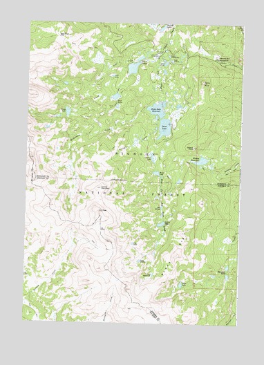
Dome Lake, WY USGS Topographic Map
Click on map above to begin viewing in our Map Viewer.

This topographic map contains these locations and features:
Feature Name Type Latitude Longitude GNIS ID View Map
Bighorn MountainsRangeN44.5002°W107.2509°1597104View Map
Bighorn National ForestForestN44.5454°W107.3631°1604600View Map
Black RibSummitN44.5283°W107.2859°1585608View Map
Coney CreekStreamN44.6089°W107.3131°1586929View Map
Coney LakeLakeN44.5878°W107.3517°1586930View Map
Crescent LakeLakeN44.5689°W107.3016°1587210View Map
Dome LakeLakeN44.5818°W107.2951°1587704View Map
Dome Lake Number 1ReservoirN44.6064°W107.3142°1606767View Map
Dome Lake Number 1 DamDamN44.6066°W107.3123°1606766View Map
Dome Lake ReservoirReservoirN44.5892°W107.2999°1587705View Map
Dome RockPillarN44.6005°W107.2729°1587706View Map
Duck PondLakeN44.6084°W107.2950°1587894View Map
Edelman CreekStreamN44.5066°W107.2501°1599535View Map
Elk PassGapN44.5389°W107.3312°1588243View Map
Elk PeakSummitN44.5464°W107.3326°1588244View Map
Geddes LakeLakeN44.5416°W107.2957°1588849View Map
Grubstake Syndicate MineMineN44.5080°W107.3673°1726298View Map
Heart LakeLakeN44.5628°W107.2992°1589455View Map
Hope LakeLakeN44.5164°W107.2837°1589669View Map
Lake AlibiLakeN44.5333°W107.3121°1584738View Map
Lake BuffaloLakeN44.5261°W107.3082°1586077View Map
Lake DunchiLakeN44.6094°W107.2916°1587918View Map
Lake FontanalisLakeN44.6115°W107.2933°1588604View Map
Lake MirageLakeN44.5483°W107.2958°1591647View Map
Lake ShamrockLakeN44.5205°W107.3002°1594154View Map
Lost LakeLakeN44.6032°W107.3254°1591046View Map
Porcupine CreekStreamN44.5875°W107.3001°1592959View Map
Preacher RockPillarN44.6108°W107.2640°1597567View Map
Rinehart LakesLakeN44.5222°W107.2573°1593414View Map
Rock Chuck PassGapN44.6189°W107.3573°1593554View Map
Saddle MountainSummitN44.5564°W107.3317°1593738View Map
Sawmill DamDamN44.6250°W107.3040°1606820View Map
Sawmill LakesLakeN44.6241°W107.2970°1604708View Map
Snail CreekStreamN44.6111°W107.3012°1594502View Map
Stull LakesLakeN44.5922°W107.3234°1595133View Map
Twin LakesReservoirN44.6105°W107.3098°1606763View Map
Twin Lakes CampgroundLocaleN44.6105°W107.3031°1595802View Map
Twin Lakes Number 1 DamDamN44.6100°W107.3106°1606762View Map
Twin Lakes Number 2ReservoirN44.6116°W107.3073°1606813View Map
Twin Lakes Number 2 DamDamN44.6116°W107.3073°1606812View Map
Twin Lakes Picnic AreaLocaleN44.6111°W107.3012°1604862View Map
Weston DamDamN44.5700°W107.2723°1606750View Map
Weston PointCliffN44.5733°W107.2781°1596264View Map
Weston ReservoirReservoirN44.5681°W107.2731°1596266View Map
Wilderness CreekStreamN44.5891°W107.3059°1596394View Map

Note: Coordinates in the location and feature list above are referenced to NAD83 datum.


Copyright (C) 2008-2024 Ryan Niemi / Sunset Dynamics ... All Rights Reserved