TopoQuest Logo
Do you find TopoQuest useful?
Help keep TopoQuest running and adding new maps/features by donating!
Bitcoin:  19c7KJd3qBynnjoSw5npx9KScwjBe4ifkT
Litecoin:  LXs6TkuXGGXo1vDsWCkWVdjQX94eUKd6ui
Home View Maps Find Maps Find Places Resources & Links


Donnybrook, North Dakota Topographic Map

USGS Map Title: Donnybrook, ND
USGS Map MRC: 48101E8
DRG (GeoTIFF) Download: o48101e8.tif


Neighboring USGS Topographic Map Quads:


  Kenmare, ND  
48102F1
 

  Norma, ND  
48101F8
 

  Tolley, ND  
48101F7
 

  Coulee, ND  
48102E1
 

  Donnybrook, ND  
48101E8
 

  Tolley SE, ND  
48101E7
 

  Palermo NE, ND  
48102D1
 

  Aurelia, ND  
48101D8
 

  Hartland, ND  
48101D7


Map MRC Location:

N49°
W102°
N49°
W101°
H8 H7 H6 H5 H4 H3 H2 H1
G8 G7 G6 G5 G4 G3 G2 G1
F8 F7 F6 F5 F4 F3 F2 F1
E8 E7 E6 E5 E4 E3 E2 E1
D8 D7 D6 D5 D4 D3 D2 D1
C8 C7 C6 C5 C4 C3 C2 C1
B8 B7 B6 B5 B4 B3 B2 B1
A8 A7 A6 A5 A4 A3 A2 A1
N48°
W102°
N48°
W101°

Donnybrook, ND USGS 1:24K Topographic Map Preview:
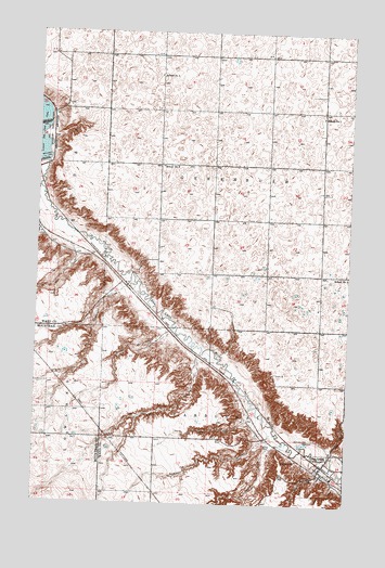
Donnybrook, ND USGS Topographic Map
Click on map above to begin viewing in our Map Viewer.

This topographic map contains these locations and features:
Feature Name Type Latitude Longitude GNIS ID View Map
Aennis CouleeValleyN48.5256°W101.9135°1027657View Map
Berg CouleeValleyN48.5375°W101.9349°1027896View Map
Bowman CouleeValleyN48.5172°W101.9082°1028101View Map
Church HillSummitN48.5078°W101.8921°1028373View Map
City of DonnybrookCivilN48.5078°W101.8874°1035995View Map
Dam Number 8DamN48.5906°W101.9968°1028601View Map
DonnybrookPopulated PlaceN48.5095°W101.8852°1028703View Map
Donnybrook Fire Protection DistrictBuildingN48.5098°W101.8855°2637689View Map
Donnybrook Post OfficePost OfficeN48.5097°W101.8855°2741970View Map
Holbrook CemeteryCemeteryN48.5119°W101.8948°1029494View Map
Jack Power CouleeValleyN48.5081°W101.8849°1029641View Map
Killian CouleeValleyN48.5056°W101.8799°1029742View Map
Lower Des Lacs LakeReservoirN48.5958°W101.9999°1030030View Map
Marble PointCapeN48.5150°W101.9085°1030098View Map
McIntosh CouleeValleyN48.5453°W101.9460°1030149View Map
Mike King HillSummitN48.5184°W101.8771°1030223View Map
Mott CouleeValleyN48.5700°W101.9868°1030300View Map
School Number 1SchoolN48.6028°W101.8871°1031533View Map
School Number 2SchoolN48.5614°W101.8763°1031708View Map
School Number 3SchoolN48.5897°W101.9516°1031852View Map
School Number 4SchoolN48.6134°W101.9524°1031947View Map
Shipton CouleeValleyN48.5156°W101.9041°1032066View Map
Spencer CouleeValleyN48.5567°W101.9657°1032214View Map
Township of CarbondaleCivilN48.5028°W101.9084°1033987View Map
Township of GreenbushCivilN48.5900°W101.9079°1759680View Map

Note: Coordinates in the location and feature list above are referenced to NAD83 datum.


Copyright (C) 2008-2025 Ryan Niemi / Sunset Dynamics ... All Rights Reserved