TopoQuest Logo
Do you find TopoQuest useful?
Help keep TopoQuest running and adding new maps/features by donating!
Bitcoin:  19c7KJd3qBynnjoSw5npx9KScwjBe4ifkT
Litecoin:  LXs6TkuXGGXo1vDsWCkWVdjQX94eUKd6ui
Home View Maps Find Maps Find Places Resources & Links


Dora NW, New Mexico Topographic Map

USGS Map Title: Dora NW, NM
USGS Map MRC: 33103H4
DRG (GeoTIFF) Download: o33103h4.tif


Neighboring USGS Topographic Map Quads:


  Floyd SE, NM  
34103A5
 

  Delphos, NM  
34103A4
 

  Portales SE, NM  
34103A3
 

  Badger Lake, NM  
33103H5
 

  Dora NW, NM  
33103H4
 

  Dora, NM  
33103H3
 

  Elida SE, NM  
33103G5
 

  Dora SW, NM  
33103G4
 

  Pep, NM  
33103G3


Map MRC Location:

N34°
W104°
N34°
W103°
H8 H7 H6 H5 H4 H3 H2 H1
G8 G7 G6 G5 G4 G3 G2 G1
F8 F7 F6 F5 F4 F3 F2 F1
E8 E7 E6 E5 E4 E3 E2 E1
D8 D7 D6 D5 D4 D3 D2 D1
C8 C7 C6 C5 C4 C3 C2 C1
B8 B7 B6 B5 B4 B3 B2 B1
A8 A7 A6 A5 A4 A3 A2 A1
N33°
W104°
N33°
W103°

Dora NW, NM USGS 1:24K Topographic Map Preview:
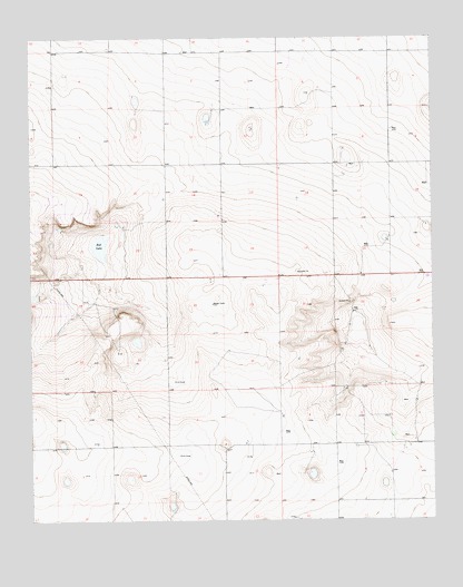
Dora NW, NM USGS Topographic Map
Click on map above to begin viewing in our Map Viewer.

This topographic map contains these locations and features:
Feature Name Type Latitude Longitude GNIS ID View Map
06085 Water WellWellN33.9790°W103.4402°935225View Map
06086 Water WellWellN33.9312°W103.4780°934943View Map
06087 Water WellWellN33.9387°W103.3925°934940View Map
06138 Water WellWellN33.9020°W103.4566°934953View Map
06139 Water WellWellN33.8951°W103.4766°935027View Map
06142 Water WellWellN33.8784°W103.4513°935017View Map
06144 Water WellWellN33.8784°W103.4697°935018View Map
11067 Water WellWellN33.9784°W103.4313°935227View Map
11068 Water WellWellN33.9787°W103.4427°934911View Map
11073 Water WellWellN33.9820°W103.4127°934912View Map
11074 Water WellWellN33.9640°W103.3958°934928View Map
11080 Water WellWellN33.9434°W103.3888°935051View Map
11081 Water WellWellN33.9356°W103.4047°935046View Map
11082 Water WellWellN33.9348°W103.3794°935043View Map
11095 Water WellWellN33.9218°W103.4011°934950View Map
11097 Water WellWellN33.9059°W103.3786°934956View Map
11198 Water WellWellN33.8831°W103.4233°934970View Map
11202 Water WellWellN33.8926°W103.3827°934964View Map
11203 Water WellWellN33.8979°W103.3972°935028View Map
11204 Water WellWellN33.8937°W103.4216°935026View Map
11205 Water WellWellN33.8837°W103.3883°935020View Map
11206 Water WellWellN33.8904°W103.3825°935023View Map
Red LakeLakeN33.9460°W103.4788°893756View Map
Red Lake (historical)Populated PlaceN33.9379°W103.4405°933154View Map

Note: Coordinates in the location and feature list above are referenced to NAD83 datum.


Copyright (C) 2008-2025 Ryan Niemi / Sunset Dynamics ... All Rights Reserved