TopoQuest Logo
Do you find TopoQuest useful?
Help keep TopoQuest running and adding new maps/features by donating!
Bitcoin:  19c7KJd3qBynnjoSw5npx9KScwjBe4ifkT
Litecoin:  LXs6TkuXGGXo1vDsWCkWVdjQX94eUKd6ui
Home View Maps Find Maps Find Places Resources & Links


Dore, North Dakota Topographic Map

USGS Map Title: Dore, ND
USGS Map MRC: 47104H1
DRG (GeoTIFF) Download: o47104h1.tif


Neighboring USGS Topographic Map Quads:


  Bainville SW, MT  
48104A2
 

  Bainville SE, MT  
48104A1
 

  Trenton SW, ND  
48103A8
 

  Fairview NW, MT  
47104H2
 

  Dore, ND  
47104H1
 

  Buford, ND  
47103H8
 

  Fairview SW, MT  
47104G2
 

  Fairview, MT  
47104G1
 

  Cartwright, ND  
47103G8


Map MRC Location:

N48°
W105°
N48°
W104°
H8 H7 H6 H5 H4 H3 H2 H1
G8 G7 G6 G5 G4 G3 G2 G1
F8 F7 F6 F5 F4 F3 F2 F1
E8 E7 E6 E5 E4 E3 E2 E1
D8 D7 D6 D5 D4 D3 D2 D1
C8 C7 C6 C5 C4 C3 C2 C1
B8 B7 B6 B5 B4 B3 B2 B1
A8 A7 A6 A5 A4 A3 A2 A1
N47°
W105°
N47°
W104°

Dore, ND USGS 1:24K Topographic Map Preview:
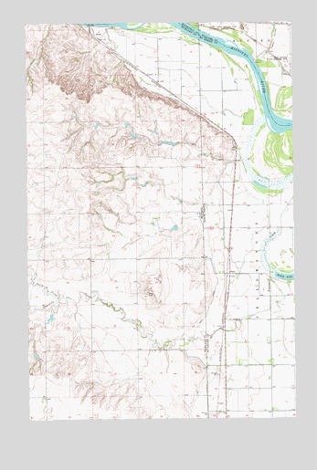
Dore, ND USGS Topographic Map
Click on map above to begin viewing in our Map Viewer.

This topographic map contains these locations and features:
Feature Name Type Latitude Longitude GNIS ID View Map
25N59E24CCDC01 WellWellN47.8970°W104.0488°825173View Map
26N59E11BADB01 WellWellN47.9381°W104.0652°825232View Map
26N59E22AD__01 WellWellN47.9914°W104.0763°825392View Map
26N59E22DBDD01 WellWellN47.9872°W104.0797°825365View Map
26N59E23ABCA01 WellWellN47.9956°W104.0616°825408View Map
26N59E23BBDA01 WellWellN47.9956°W104.0688°825409View Map
26N59E26CADC01 WellWellN47.9728°W104.0658°825314View Map
Candee DamDamN47.8950°W104.1222°797711View Map
DorePopulated PlaceN47.9206°W104.0310°1028704View Map
Fairview CemeteryCemeteryN47.8764°W104.0402°1028931View Map
Figley CouleeValleyN47.9909°W104.0122°1028955View Map
Flecher Reservoir DamDamN47.9634°W104.0738°795538View Map
Fort Buford (historical)MilitaryN47.9864°W104.0014°1940261View Map
Fort Buford State Historic SiteParkN47.9878°W104.0010°1029009View Map
Fort Union (historical)MilitaryN47.9992°W104.0425°1940260View Map
Garden CouleeValleyN47.9964°W104.0238°1029079View Map
Java Post Office (historical)Post OfficeN47.9895°W104.0519°1714977View Map
La Bonte DamDamN47.9050°W104.1155°797777View Map
Lars Borg DamDamN47.9084°W104.0838°798795View Map
Main CanalCanalN47.9164°W104.0377°1030068View Map
Nohle (historical)LocaleN47.9956°W104.0922°1714964View Map
NohlyPopulated PlaceN47.9956°W104.0919°774661View Map
Nohly LakeLakeN47.9201°W104.0020°1030420View Map
Nohly Post Office (historical)Post OfficeN47.9956°W104.0922°1714965View Map
Nohly School (historical)SchoolN47.9956°W104.0919°1715037View Map
North Fork Fourmile CreekStreamN47.9131°W104.1116°768076View Map
Simon SpringSpringN47.8856°W104.0983°1715252View Map
Township of YellowstoneCivilN47.8972°W104.0050°1759523View Map

Note: Coordinates in the location and feature list above are referenced to NAD83 datum.


Copyright (C) 2008-2025 Ryan Niemi / Sunset Dynamics ... All Rights Reserved