TopoQuest Logo
Do you find TopoQuest useful?
Help keep TopoQuest running and adding new maps/features by donating!
Bitcoin:  19c7KJd3qBynnjoSw5npx9KScwjBe4ifkT
Litecoin:  LXs6TkuXGGXo1vDsWCkWVdjQX94eUKd6ui
Home View Maps Find Maps Find Places Resources & Links


Dorsey, Nebraska Topographic Map

USGS Map Title: Dorsey, NE
USGS Map MRC: 42098F3
DRG (GeoTIFF) Download: o42098f3.tif


Neighboring USGS Topographic Map Quads:


  Lynch, NE  
42098G4
 

  Monowi, NE  
42098G3
 

  Verdel, NE  
42098G2
 

  Dorsey NW, NE  
42098F4
 

  Dorsey, NE  
42098F3
 

  Pishelville, NE  
42098F2
 

  Dorsey SW, NE  
42098E4
 

  Star, NE  
42098E3
 

  Walnut, NE  
42098E2


Map MRC Location:

N43°
W99°
N43°
W98°
H8 H7 H6 H5 H4 H3 H2 H1
G8 G7 G6 G5 G4 G3 G2 G1
F8 F7 F6 F5 F4 F3 F2 F1
E8 E7 E6 E5 E4 E3 E2 E1
D8 D7 D6 D5 D4 D3 D2 D1
C8 C7 C6 C5 C4 C3 C2 C1
B8 B7 B6 B5 B4 B3 B2 B1
A8 A7 A6 A5 A4 A3 A2 A1
N42°
W99°
N42°
W98°

Dorsey, NE USGS 1:24K Topographic Map Preview:
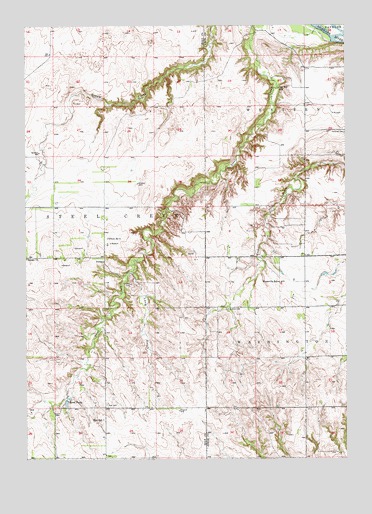
Dorsey, NE USGS Topographic Map
Click on map above to begin viewing in our Map Viewer.

This topographic map contains these locations and features:
Feature Name Type Latitude Longitude GNIS ID View Map
Bartos DamDamN42.6758°W98.2891°1769708View Map
Bartos Dam Number 2DamN42.6754°W98.2820°1770096View Map
Bartos ReservoirReservoirN42.6745°W98.2906°1769709View Map
Bartos Reservoir Number 2ReservoirN42.6742°W98.2806°1770097View Map
DorseyPopulated PlaceN42.6817°W98.3445°835288View Map
Dorsey CemeteryCemeteryN42.6755°W98.3342°828761View Map
Dorsey Post Office (historical)Post OfficeN42.6817°W98.3445°1847722View Map
KnoxvillePopulated PlaceN42.6686°W98.2965°835351View Map
Knoxville Post Office (historical)Post OfficeN42.6686°W98.2965°1884769View Map
Knoxville SchoolSchoolN42.6758°W98.2765°830541View Map
Long GulchValleyN42.6792°W98.3340°830858View Map
National CemeteryCemeteryN42.7192°W98.2503°831565View Map
Old Mill SchoolSchoolN42.7317°W98.2762°831856View Map
Revell DamDamN42.6417°W98.3587°1769072View Map
Revell PondsReservoirN42.6411°W98.3595°832530View Map
Revell ReservoirReservoirN42.6417°W98.3587°1769073View Map
School Number 4SchoolN42.6883°W98.3437°836681View Map
Star CemeteryCemeteryN42.6408°W98.3440°833776View Map
Star SchoolSchoolN42.6367°W98.3451°833780View Map
Township of Steel CreekCivilN42.6906°W98.3647°838272View Map

Note: Coordinates in the location and feature list above are referenced to NAD83 datum.


Copyright (C) 2008-2025 Ryan Niemi / Sunset Dynamics ... All Rights Reserved