TopoQuest Logo
Do you find TopoQuest useful?
Help keep TopoQuest running and adding new maps/features by donating!
Bitcoin:  19c7KJd3qBynnjoSw5npx9KScwjBe4ifkT
Litecoin:  LXs6TkuXGGXo1vDsWCkWVdjQX94eUKd6ui
Home View Maps Find Maps Find Places Resources & Links


Double L Ranch, Wyoming Topographic Map

USGS Map Title: Double L Ranch, WY
USGS Map MRC: 41104G8
DRG (GeoTIFF) Download: o41104g8.tif


Neighboring USGS Topographic Map Quads:


  Natwick, WY  
41105H1
 

  Ferguson Corner, WY  
41104H8
 

  Bordeaux, WY  
41104H7
 

  Richeau Hills, WY  
41105G1
 

  Double L Ranch, WY  
41104G8
 

  Chugwater, WY  
41104G7
 

  McDonald Ranch, WY  
41105F1
 

  Whitcomb Hill, WY  
41104F8
 

  Bristol Ridge NE, WY  
41104F7


Map MRC Location:

N42°
W105°
N42°
W104°
H8 H7 H6 H5 H4 H3 H2 H1
G8 G7 G6 G5 G4 G3 G2 G1
F8 F7 F6 F5 F4 F3 F2 F1
E8 E7 E6 E5 E4 E3 E2 E1
D8 D7 D6 D5 D4 D3 D2 D1
C8 C7 C6 C5 C4 C3 C2 C1
B8 B7 B6 B5 B4 B3 B2 B1
A8 A7 A6 A5 A4 A3 A2 A1
N41°
W105°
N41°
W104°

Double L Ranch, WY USGS 1:24K Topographic Map Preview:
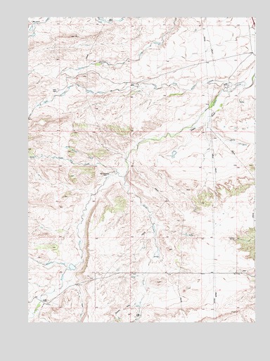
Double L Ranch, WY USGS Topographic Map
Click on map above to begin viewing in our Map Viewer.

This topographic map contains these locations and features:
Feature Name Type Latitude Longitude GNIS ID View Map
Allison RanchLocaleN41.8736°W104.9544°1584800View Map
Beacon Number 8LocaleN41.8708°W104.9119°1605168View Map
Chase RanchLocaleN41.8450°W104.9833°1586593View Map
Chugwater DivisionCivilN41.7912°W104.9469°1939699View Map
Double L DamDamN41.7866°W104.9722°1605853View Map
Double L RanchLocaleN41.7591°W104.9925°1587739View Map
Double L ReservoirReservoirN41.7866°W104.9722°1605854View Map
Grant DamDamN41.8450°W104.9589°1605654View Map
Grant RanchLocaleN41.8472°W104.9411°1589055View Map
Grant ReservoirReservoirN41.8442°W104.9602°1608842View Map
L L DrawValleyN41.7650°W104.9764°1590430View Map
Lewis RanchLocaleN41.8464°W104.8897°1590668View Map
Maxwell CreekStreamN41.7725°W104.9772°1591274View Map
Mylet RanchLocaleN41.8730°W104.9989°1591942View Map
North Richeau CreekStreamN41.8475°W104.8858°1592264View Map
Robert Grant DamDamN41.8400°W104.9939°1605656View Map
Robert Grant ReservoirReservoirN41.8391°W104.9937°1608844View Map
Ryff and Klassert DamDamN41.8550°W104.9905°1605674View Map
Ryff and Klassert ReservoirReservoirN41.8550°W104.9905°1608859View Map
Scotch CreekStreamN41.8152°W104.9594°1594049View Map
South Hunton CreekStreamN41.8750°W104.9189°1594703View Map
South Richeau CreekStreamN41.8100°W104.9458°1594726View Map
Stewart DrawValleyN41.7586°W104.9400°1595049View Map
Tepee Ring CreekStreamN41.8116°W104.9502°1595370View Map
Upper McDougal RanchLocaleN41.8097°W104.9569°1595866View Map
Voight RanchLocaleN41.7530°W104.9383°1595949View Map
Walker DrawValleyN41.8439°W104.8894°1595996View Map

Note: Coordinates in the location and feature list above are referenced to NAD83 datum.


Copyright (C) 2008-2025 Ryan Niemi / Sunset Dynamics ... All Rights Reserved