TopoQuest Logo
Do you find TopoQuest useful?
Help keep TopoQuest running and adding new maps/features by donating!
Bitcoin:  19c7KJd3qBynnjoSw5npx9KScwjBe4ifkT
Litecoin:  LXs6TkuXGGXo1vDsWCkWVdjQX94eUKd6ui
Home View Maps Find Maps Find Places Resources & Links


Ada Creek, Montana Topographic Map

USGS Map Title: Ada Creek, MT
USGS Map MRC: 47106C5
DRG (GeoTIFF) Download: o47106c5.tif


Neighboring USGS Topographic Map Quads:


  Bateman Coulee, MT  
47106D6
 

  Bateman Coulee NE, MT  
47106D5
 

  Hagen Gap, MT  
47106D4
 

  Black John Coulee, MT  
47106C6
 

  Ada Creek, MT  
47106C5
 

  Maxwell Coulee, MT  
47106C4
 

  York Reservoir, MT  
47106B6
 

  Cohagen NE, MT  
47106B5
 

  Hafla School, MT  
47106B4


Map MRC Location:

N48°
W107°
N48°
W106°
H8 H7 H6 H5 H4 H3 H2 H1
G8 G7 G6 G5 G4 G3 G2 G1
F8 F7 F6 F5 F4 F3 F2 F1
E8 E7 E6 E5 E4 E3 E2 E1
D8 D7 D6 D5 D4 D3 D2 D1
C8 C7 C6 C5 C4 C3 C2 C1
B8 B7 B6 B5 B4 B3 B2 B1
A8 A7 A6 A5 A4 A3 A2 A1
N47°
W107°
N47°
W106°

Ada Creek, MT USGS 1:24K Topographic Map Preview:
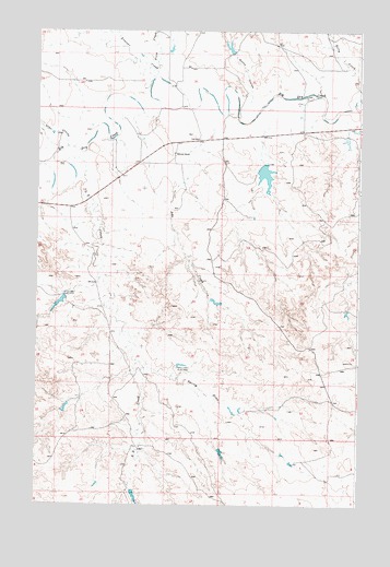
Ada Creek, MT USGS Topographic Map
Click on map above to begin viewing in our Map Viewer.

This topographic map contains these locations and features:
Feature Name Type Latitude Longitude GNIS ID View Map
17N41E06A___01 WellWellN47.2636°W106.5364°821791View Map
18N40E01B___01 WellWellN47.3475°W106.5664°822370View Map
18N40E01C___01 WellWellN47.3397°W106.5712°822311View Map
18N40E01C___02 WellWellN47.3428°W106.5714°822327View Map
18N40E01DBBB01 WellWellN47.3461°W106.5634°822358View Map
18N40E02B___01 WellWellN47.3467°W106.5923°822369View Map
18N41E29D___01 WellWellN47.2844°W106.5153°821942View Map
18N41E33C___01 WellWellN47.2686°W106.5073°821829View Map
19N41E31C___01 WellWellN47.3556°W106.5487°822418View Map
19N41E32C___01 WellWellN47.3572°W106.5262°822428View Map
Ada CreekStreamN47.3500°W106.5573°768117View Map
Allen CouleeValleyN47.3442°W106.6137°768202View Map
Dry Lake DamDamN47.2767°W106.6123°797229View Map
First CreekStreamN47.3656°W106.5834°771379View Map
Frazier CreekStreamN47.3617°W106.5820°771616View Map
Jim J Murion Number 1 DamDamN47.3467°W106.5056°796660View Map
Jim J Murion Number 2 DamDamN47.3483°W106.5006°796661View Map
Karen Number 2 DamDamN47.3050°W106.6156°797458View Map
Karen Number 3 DamDamN47.3267°W106.5823°797459View Map
Kelly CreekStreamN47.3578°W106.5003°772967View Map
Keplerville (historical)Populated PlaceN47.3458°W106.6006°1715979View Map
Keplerville Post Office (historical)Post OfficeN47.3458°W106.6006°1715981View Map
Keplerville School (historical)SchoolN47.3458°W106.6006°1715980View Map
L S CreekStreamN47.3400°W106.6148°773161View Map
Mahoney RanchLocaleN47.3425°W106.5723°773820View Map
Murnions DamDamN47.3383°W106.5373°796195View Map
Murnions ReservoirReservoirN47.3371°W106.5369°796196View Map
Sonny CouleeValleyN47.3569°W106.5431°776741View Map
Sonny Number 1 DamDamN47.3700°W106.5489°797241View Map
Spring DrawValleyN47.2856°W106.5798°777078View Map
Viall School (historical)SchoolN47.3464°W106.5631°778020View Map
Yellow Horse DamDamN47.3033°W106.5556°797230View Map

Note: Coordinates in the location and feature list above are referenced to NAD83 datum.


Copyright (C) 2008-2025 Ryan Niemi / Sunset Dynamics ... All Rights Reserved