TopoQuest Logo
Do you find TopoQuest useful?
Help keep TopoQuest running and adding new maps/features by donating!
Bitcoin:  19c7KJd3qBynnjoSw5npx9KScwjBe4ifkT
Litecoin:  LXs6TkuXGGXo1vDsWCkWVdjQX94eUKd6ui
Home View Maps Find Maps Find Places Resources & Links


Dowling Park, Florida Topographic Map

USGS Map Title: Dowling Park, FL
USGS Map MRC: 30083B2
DRG (GeoTIFF) Download: o30083b2.tif


Neighboring USGS Topographic Map Quads:


  Madison SE, FL  
30083C3
 

  Falmouth, FL  
30083C2
 

  Live Oak West, FL  
30083C1
 

  Day, FL  
30083B3
 

  Dowling Park, FL  
30083B2
 

  Mayo NE, FL  
30083B1
 

  Day SE, FL  
30083A3
 

  Mayo, FL  
30083A2
 

  Mayo SE, FL  
30083A1


Map MRC Location:

N31°
W84°
N31°
W83°
H8 H7 H6 H5 H4 H3 H2 H1
G8 G7 G6 G5 G4 G3 G2 G1
F8 F7 F6 F5 F4 F3 F2 F1
E8 E7 E6 E5 E4 E3 E2 E1
D8 D7 D6 D5 D4 D3 D2 D1
C8 C7 C6 C5 C4 C3 C2 C1
B8 B7 B6 B5 B4 B3 B2 B1
A8 A7 A6 A5 A4 A3 A2 A1
N30°
W84°
N30°
W83°

Dowling Park, FL USGS 1:24K Topographic Map Preview:
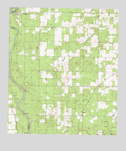
Dowling Park, FL USGS Topographic Map
Click on map above to begin viewing in our Map Viewer.

This topographic map contains these locations and features:
Feature Name Type Latitude Longitude GNIS ID View Map
Allen Mill PondLakeN30.1597°W83.2407°304966View Map
Allen Mill Pond SpringSpringN30.1627°W83.2425°2772485View Map
Baptizing SpringSpringN30.1339°W83.1342°278091View Map
Beulah ChurchChurchN30.1872°W83.2146°278588View Map
Beulah Community HallBuildingN30.1905°W83.2137°301616View Map
Blue SpringSpringN30.1262°W83.2261°279065View Map
Charles SpringSpringN30.1674°W83.2305°280314View Map
Clayland ChurchChurchN30.2424°W83.1482°301615View Map
Clayland SchoolSchoolN30.2419°W83.1496°280518View Map
DellPopulated PlaceN30.1366°W83.2399°295238View Map
Dowling ParkPopulated PlaceN30.2436°W83.2363°281738View Map
Dowling Park DivisionCivilN30.2235°W83.1511°1935747View Map
Dowling Park Post OfficePost OfficeN30.2475°W83.2415°2765666View Map
Head CemeteryCemeteryN30.1619°W83.2132°283845View Map
LancasterPopulated PlaceN30.2491°W83.2029°295401View Map
Mims CemeteryCemeteryN30.2427°W83.1318°286951View Map
New Harmony ChurchChurchN30.1594°W83.1632°287615View Map
New Harmony Methodist ChurchChurchN30.1592°W83.1635°2450554View Map
Oak Hill ChurchChurchN30.2172°W83.1471°287973View Map
Orange Grove SpringSpringN30.1272°W83.1310°288195View Map
Patmus ChurchChurchN30.1991°W83.2151°288570View Map
Peacock Springs State ParkParkN30.1269°W83.1354°304929View Map
Pine Level ChurchChurchN30.2311°W83.1982°288897View Map
Pump SpringSpringN30.1386°W83.1356°289359View Map
Thomas SpringSpringN30.1456°W83.2306°292215View Map
Walker SpringSpringN30.1334°W83.1303°292838View Map

Note: Coordinates in the location and feature list above are referenced to NAD83 datum.


Copyright (C) 2008-2025 Ryan Niemi / Sunset Dynamics ... All Rights Reserved