TopoQuest Logo
Do you find TopoQuest useful?
Help keep TopoQuest running and adding new maps/features by donating!
Bitcoin:  19c7KJd3qBynnjoSw5npx9KScwjBe4ifkT
Litecoin:  LXs6TkuXGGXo1vDsWCkWVdjQX94eUKd6ui
Home View Maps Find Maps Find Places Resources & Links


Dry Creek Reservoir, Wyoming Topographic Map

USGS Map Title: Dry Creek Reservoir, WY
USGS Map MRC: 43106G5
DRG (GeoTIFF) Download: o43106g5.tif


Neighboring USGS Topographic Map Quads:


  Schlicht Draw, WY  
43106H6
 

  Antelope Draw, WY  
43106H5
 

  Elaine Draw, WY  
43106H4
 

  Hibbard Draw, WY  
43106G6
 

  Dry Creek Reservoir, WY  
43106G5
 

  Fourmile Reservoir, WY  
43106G4
 

  Kaycee, WY  
43106F6
 

  Kaycee NE, WY  
43106F5
 

  Figure 8 Reservoir, WY  
43106F4


Map MRC Location:

N44°
W107°
N44°
W106°
H8 H7 H6 H5 H4 H3 H2 H1
G8 G7 G6 G5 G4 G3 G2 G1
F8 F7 F6 F5 F4 F3 F2 F1
E8 E7 E6 E5 E4 E3 E2 E1
D8 D7 D6 D5 D4 D3 D2 D1
C8 C7 C6 C5 C4 C3 C2 C1
B8 B7 B6 B5 B4 B3 B2 B1
A8 A7 A6 A5 A4 A3 A2 A1
N43°
W107°
N43°
W106°

Dry Creek Reservoir, WY USGS 1:24K Topographic Map Preview:
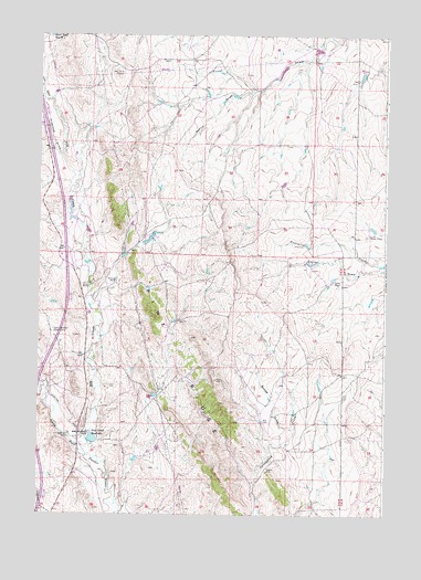
Dry Creek Reservoir, WY USGS Topographic Map
Click on map above to begin viewing in our Map Viewer.

This topographic map contains these locations and features:
Feature Name Type Latitude Longitude GNIS ID View Map
Affalter DitchCanalN43.7741°W106.6139°1584713View Map
Amerada DamDamN43.8683°W106.5356°1606582View Map
Amerada ReservoirReservoirN43.8683°W106.5356°1606583View Map
Antelope DrawValleyN43.8433°W106.6175°1584875View Map
Bybee DrawValleyN43.7728°W106.5350°1586227View Map
Chris LeDoux PointSummitN43.7779°W106.6112°2760656View Map
Denny DrawValleyN43.8600°W106.5498°1587538View Map
Dry CreekStreamN43.7664°W106.6095°1587806View Map
Dry Creek DamDamN43.7683°W106.6073°1606366View Map
Dry Creek ReservoirReservoirN43.7700°W106.6053°1587821View Map
Goyhenex RanchLocaleN43.7700°W106.6137°1589012View Map
Irigaray MineMineN43.7739°W106.5131°1746311View Map
Kaycee DivisionCivilN43.8119°W106.5578°1939717View Map
Lund Sheep CampLocaleN43.8228°W106.5067°1591124View Map
Melke Brothers RanchLocaleN43.7703°W106.6089°1591464View Map
Sippie MineMineN43.7611°W106.5423°1594382View Map
Stock Trail Reservoir Number 4ReservoirN43.8748°W106.6212°1605480View Map
Taylor Brothers Sheep CampLocaleN43.7980°W106.6198°1595315View Map
Taylor Number 1 DamDamN43.8133°W106.5273°1606428View Map
Taylor Number 1 ReservoirReservoirN43.8133°W106.5273°1606429View Map
Taylor RanchLocaleN43.8103°W106.5170°1595329View Map
Trail DrawValleyN43.8591°W106.6237°1595680View Map
Ullery Pit Number ThreeMineN43.8269°W106.6117°1746312View Map
Ullery RanchLocaleN43.8094°W106.6067°1595838View Map
Williams RanchLocaleN43.8108°W106.5970°1596421View Map

Note: Coordinates in the location and feature list above are referenced to NAD83 datum.


Copyright (C) 2008-2024 Ryan Niemi / Sunset Dynamics ... All Rights Reserved