TopoQuest Logo
Do you find TopoQuest useful?
Help keep TopoQuest running and adding new maps/features by donating!
Bitcoin:  19c7KJd3qBynnjoSw5npx9KScwjBe4ifkT
Litecoin:  LXs6TkuXGGXo1vDsWCkWVdjQX94eUKd6ui
Home View Maps Find Maps Find Places Resources & Links


Aquilla, Texas Topographic Map

USGS Map Title: Aquilla, TX
USGS Map MRC: 31097G2
DRG (GeoTIFF) Download: o31097g2.tif


Neighboring USGS Topographic Map Quads:


  Whitney, TX  
31097H3
 

  Peoria, TX  
31097H2
 

  Abbott, TX  
31097H1
 

  Smiths Bend, TX  
31097G3
 

  Aquilla, TX  
31097G2
 

  West, TX  
31097G1
 

  China Springs, TX  
31097F3
 

  Gholson, TX  
31097F2
 

  Elm Mott, TX  
31097F1


Map MRC Location:

N32°
W98°
N32°
W97°
H8 H7 H6 H5 H4 H3 H2 H1
G8 G7 G6 G5 G4 G3 G2 G1
F8 F7 F6 F5 F4 F3 F2 F1
E8 E7 E6 E5 E4 E3 E2 E1
D8 D7 D6 D5 D4 D3 D2 D1
C8 C7 C6 C5 C4 C3 C2 C1
B8 B7 B6 B5 B4 B3 B2 B1
A8 A7 A6 A5 A4 A3 A2 A1
N31°
W98°
N31°
W97°

Aquilla, TX USGS 1:24K Topographic Map Preview:
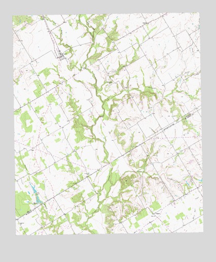
Aquilla, TX USGS Topographic Map
Click on map above to begin viewing in our Map Viewer.

This topographic map contains these locations and features:
Feature Name Type Latitude Longitude GNIS ID View Map
Alligator CreekStreamN31.8252°W97.1906°1329417View Map
AquillaPopulated PlaceN31.8515°W97.2181°1329645View Map
Aquilla Post OfficePost OfficeN31.8509°W97.2192°2732212View Map
Aquilla Volunteer Fire DepartmentBuildingN31.8516°W97.2190°2552261View Map
Bold Springs CemeteryCemeteryN31.7791°W97.1339°1331023View Map
City of AquillaCivilN31.8548°W97.2200°2409720View Map
Cobb CreekStreamN31.8599°W97.1967°1333035View Map
Coffelt Lake Number 1ReservoirN31.7752°W97.2370°1855092View Map
Coffelt Lake Number 1 DamDamN31.7752°W97.2370°1855091View Map
Coffelt Lake Number 2ReservoirN31.7685°W97.2320°1855094View Map
Coffelt Lake Number 2 DamDamN31.7685°W97.2320°1855093View Map
County Line GinLocaleN31.7841°W97.2008°1333517View Map
Dead Horse CreekStreamN31.8479°W97.2028°1334137View Map
Holiness ChurchChurchN31.7566°W97.2478°1337939View Map
KJNE-FM (Hillsboro)TowerN31.8249°W97.1594°1387990View Map
MenlowPopulated PlaceN31.8696°W97.1606°1378664View Map
Patten LakeReservoirN31.7760°W97.2376°1343672View Map
Prairie Grove CemeteryCemeteryN31.7852°W97.2370°1344503View Map
Scotts Chapel CemeteryCemeteryN31.8357°W97.1850°1346824View Map
Snake CreekStreamN31.7677°W97.1939°1347321View Map
Square K AirportAirportN31.7713°W97.1330°1386364View Map
TokioPopulated PlaceN31.7585°W97.1558°2034659View Map
Tokio ChurchChurchN31.7599°W97.1575°1348614View Map
TysonPopulated PlaceN31.7988°W97.2395°1379187View Map
Vrbas LakeReservoirN31.7935°W97.1269°1864120View Map
Vrbas Lake DamDamN31.7935°W97.1269°1864119View Map
West DivisionCivilN31.7638°W97.1355°1939310View Map
WigginsPopulated PlaceN31.7613°W97.1581°1379274View Map

Note: Coordinates in the location and feature list above are referenced to NAD83 datum.


Copyright (C) 2008-2024 Ryan Niemi / Sunset Dynamics ... All Rights Reserved