TopoQuest Logo
Do you find TopoQuest useful?
Help keep TopoQuest running and adding new maps/features by donating!
Bitcoin:  19c7KJd3qBynnjoSw5npx9KScwjBe4ifkT
Litecoin:  LXs6TkuXGGXo1vDsWCkWVdjQX94eUKd6ui
Home View Maps Find Maps Find Places Resources & Links


Duart, North Carolina Topographic Map

USGS Map Title: Duart, NC
USGS Map MRC: 34078G7
DRG (GeoTIFF) Download: o34078g7.tif


Neighboring USGS Topographic Map Quads:


  Hope Mills, NC  
34078H8
 

  Cedar Creek, NC  
34078H7
 

  Autryville, NC  
34078H6
 

  Saint Pauls, NC  
34078G8
 

  Duart, NC  
34078G7
 

  Jerome, NC  
34078G6
 

  Northeast Lumberton, NC  
34078F8
 

  Tar Heel, NC  
34078F7
 

  Dublin, NC  
34078F6


Map MRC Location:

N35°
W79°
N35°
W78°
H8 H7 H6 H5 H4 H3 H2 H1
G8 G7 G6 G5 G4 G3 G2 G1
F8 F7 F6 F5 F4 F3 F2 F1
E8 E7 E6 E5 E4 E3 E2 E1
D8 D7 D6 D5 D4 D3 D2 D1
C8 C7 C6 C5 C4 C3 C2 C1
B8 B7 B6 B5 B4 B3 B2 B1
A8 A7 A6 A5 A4 A3 A2 A1
N34°
W79°
N34°
W78°

Duart, NC USGS 1:24K Topographic Map Preview:
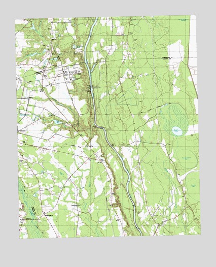
Duart, NC USGS Topographic Map
Click on map above to begin viewing in our Map Viewer.

This topographic map contains these locations and features:
Feature Name Type Latitude Longitude GNIS ID View Map
Bakers LakeLakeN34.8094°W78.7645°1018911View Map
Big Marsh SwampStreamN34.7760°W78.8720°1025151View Map
Bladen Union ChurchChurchN34.8302°W78.8667°981573View Map
Boone CemeteryCemeteryN34.7943°W78.8734°1004314View Map
Boone CemeteryCemeteryN34.7943°W78.8731°981735View Map
Brisson BaySwampN34.7849°W78.8434°981915View Map
Burrell BayBasinN34.8385°W78.8595°1025206View Map
Cedar Creek Fish FarmLocaleN34.8594°W78.8094°2650337View Map
Chapel Grove ChurchChurchN34.8729°W78.7947°983009View Map
Cogdell CemeteryCemeteryN34.8613°W78.7934°1004316View Map
DuartPopulated PlaceN34.7935°W78.8178°1006184View Map
EleasePopulated PlaceN34.8652°W78.7964°1006196View Map
Ellis CemeteryCemeteryN34.8068°W78.7553°1004315View Map
Gallberry SwampStreamN34.7774°W78.8714°1025331View Map
Georgia BranchStreamN34.8146°W78.8214°985636View Map
Kirks Mill CreekStreamN34.8588°W78.8506°988025View Map
Little Alligator SwampSwampN34.8704°W78.7528°988529View Map
Longs BranchStreamN34.8668°W78.8567°989015View Map
Marsh Wood LakeReservoirN34.8586°W78.8341°998164View Map
Marsh Wood Lake DamDamN34.8568°W78.8347°998165View Map
Millars ChapelChurchN34.8007°W78.8559°1026203View Map
Miller Chapel (historical)ChurchN34.8029°W78.8525°1025544View Map
Mines CreekStreamN34.8143°W78.8328°1025547View Map
NewlightPopulated PlaceN34.7635°W78.7834°1004313View Map
Newlight SchoolSchoolN34.7624°W78.7839°991129View Map
Pages LakeReservoirN34.8160°W78.8469°998133View Map
Pages Lake DamDamN34.8152°W78.8447°998132View Map
Prospect Hall LandingLocaleN34.8132°W78.8192°1025629View Map
Saint Rest ChurchChurchN34.7568°W78.7770°1004312View Map
Second Newlight ChurchChurchN34.7635°W78.8575°994471View Map
Spring Branch ChurchChurchN34.7682°W78.8342°1004311View Map
Swans CreekStreamN34.8588°W78.8506°1025736View Map
Thoroughfare BaySwampN34.7913°W78.7578°996075View Map
Tolar LandingPopulated PlaceN34.8357°W78.8225°1022959View Map
TolarsvillePopulated PlaceN34.7613°W78.8722°1025753View Map
Township of HollowCivilN34.7644°W78.8241°1026431View Map
Verdery PondReservoirN34.8618°W78.8697°998168View Map
Verdery Pond DamDamN34.8618°W78.8697°998169View Map
William O Huske Lock and Dam Number 3DamN34.8346°W78.8231°1025489View Map
Willis CreekStreamN34.8513°W78.8272°1025804View Map
Willis Creek CemeteryCemeteryN34.8468°W78.8472°1026202View Map
Willis Creek ChurchChurchN34.8638°W78.8486°1026161View Map
Willis Creek Church (historical)ChurchN34.8474°W78.8467°1025805View Map

Note: Coordinates in the location and feature list above are referenced to NAD83 datum.


Copyright (C) 2008-2024 Ryan Niemi / Sunset Dynamics ... All Rights Reserved