TopoQuest Logo
Do you find TopoQuest useful?
Help keep TopoQuest running and adding new maps/features by donating!
Bitcoin:  19c7KJd3qBynnjoSw5npx9KScwjBe4ifkT
Litecoin:  LXs6TkuXGGXo1vDsWCkWVdjQX94eUKd6ui
Home View Maps Find Maps Find Places Resources & Links


Dumont, Texas Topographic Map

USGS Map Title: Dumont, TX
USGS Map MRC: 33100G5
DRG (GeoTIFF) Download: o33100g5.tif


Neighboring USGS Topographic Map Quads:


  Russellville, TX  
33100H6
 

  China Canyon, TX  
33100H5
 

  Grow NW, TX  
33100H4
 

  Sanders Hollow, TX  
33100G6
 

  Dumont, TX  
33100G5
 

  Buffalo Creek, TX  
33100G4
 

  East Afton, TX  
33100F6
 

  East Afton NE, TX  
33100F5
 

  Guthrie NW, TX  
33100F4


Map MRC Location:

N34°
W101°
N34°
W100°
H8 H7 H6 H5 H4 H3 H2 H1
G8 G7 G6 G5 G4 G3 G2 G1
F8 F7 F6 F5 F4 F3 F2 F1
E8 E7 E6 E5 E4 E3 E2 E1
D8 D7 D6 D5 D4 D3 D2 D1
C8 C7 C6 C5 C4 C3 C2 C1
B8 B7 B6 B5 B4 B3 B2 B1
A8 A7 A6 A5 A4 A3 A2 A1
N33°
W101°
N33°
W100°

Dumont, TX USGS 1:24K Topographic Map Preview:
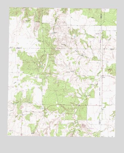
Dumont, TX USGS Topographic Map
Click on map above to begin viewing in our Map Viewer.

This topographic map contains these locations and features:
Feature Name Type Latitude Longitude GNIS ID View Map
Deep WellWellN33.8423°W100.5910°1355833View Map
Dillar WindmillLocaleN33.8659°W100.5271°1356020View Map
DumontPopulated PlaceN33.8098°W100.5162°1356437View Map
Dumont CemeteryCemeteryN33.7770°W100.5165°1356438View Map
Dumont Horse Pasture WindmillLocaleN33.8006°W100.5260°1356439View Map
Eighteen CreekStreamN33.8234°W100.5123°1356845View Map
Eighteen Creek WindmillLocaleN33.8295°W100.5410°1356846View Map
Headquarters WindmillLocaleN33.8070°W100.5910°1358976View Map
McDuff WindmillLocaleN33.7898°W100.5351°1362435View Map
Middle CreekStreamN33.8062°W100.5240°1362711View Map
Middle Creek WindmillLocaleN33.8137°W100.5490°1362713View Map
Sandy WellWellN33.8359°W100.6240°1367729View Map
Section Seven WindmillLocaleN33.8501°W100.5215°1367924View Map
Shinnery DrawValleyN33.7776°W100.5462°1368188View Map
Shinnery SpringsSpringN33.7531°W100.5942°1368192View Map
South East Thief Hollow WindmillLocaleN33.8392°W100.5596°1368673View Map
South River WindmillLocaleN33.8620°W100.6029°1368754View Map
Southeast River WindmillLocaleN33.8615°W100.5893°1368832View Map
Thief Hollow WindmillLocaleN33.8506°W100.5740°1369828View Map
Threeway WindmillLocaleN33.8298°W100.5798°1369909View Map
Wildcat DrawValleyN33.7578°W100.5437°1371520View Map

Note: Coordinates in the location and feature list above are referenced to NAD83 datum.


Copyright (C) 2008-2024 Ryan Niemi / Sunset Dynamics ... All Rights Reserved